Boreholes
Type of resources
Available actions
Topics
Keywords
Contact for the resource
Provided by
Years
Formats
Representation types
Update frequencies
Service types
Scale
Resolution
-
Site investigation and geotechnical data received by BGS from 3rd party organisations in AGS file format. When received by BGS the data is validated against predefined rules, processed and stored in the BGS AGS agnostic store. This data is delivered as received e.g. no interpretative values or observations are added to the data by the BGS. For more details about the Association of Geotechnical & Geoenvironmental Specialists (AGS) see: https://www.ags.org.uk For more details on depositing AGS data with BGS see: http://www.bgs.ac.uk/data/ags To access AGS data held by BGS: http://mapapps2.bgs.ac.uk/geoindex/home.html?layer=AGSBoreholes
-
The Single Onshore Borehole Index (SOBI) is an index of over 1 million boreholes, shafts and wells and references collections of digital and analogue records from all forms of drilling and site investigation work held by the BGS. The index covers onshore and near shore boreholes from Great Britain dating back to at least 1790 and ranging from one to several thousand metres deep. Some 50,000 new boreholes are added each year. The majority of the records contain written descriptions of the ground encountered. The SOBI index database originated in 1988 from a number of existing tables and from data input from a variety of coding forms. Therefore not all fields in the database are populated and data that should be in some fields may currently form part of the entries in another. The index is available on the BGS website via the Geoindex
-
The Geotechnical Database contains information about site investigation reports, boreholes and samples. It contains geotechnical measurements taken over borehole intervals and on samples. Some of the data is obtained digitally from AGS files (Association of Geotechnical and Geoenvironmental Specialists - File Transfer Format), some is obtained manually from Site Investigation Reports stored in the National Geoscience Data Centre. The database currently contains geotechnical data from over 450 000 laboratory test samples and core descriptions, borehole observations and in situ tests from over 96 000 boreholes extracted from over 4800 site investigation reports. The database underpins BGS Geo-engineering properties and processes research and is an important information resource for answering enquiries and providing for the data needs of external customers.
-
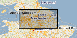
The dataset is a subset of the BGS borehole material database, created on August 1st 2015 covering only the Bowland-Hodder geological unit (as defined and mapped by Andrews et al., 2013). It shows all boreholes (name, location and registration details) for which BGS hold borehole material (drillcore, cuttings, samples and their depth ranges). This data will add value to existing NERC (Natural Environment Research Council) data by allowing a simple route for users to identify borehole material from the Bowland-Hodder interval.
-
Reports of site investigations produced by external organisations carried out for all forms of site investigation The reports date back to the 1950s and may contain information on boreholes, trial pits, laboratory tests and chemical analyses etc. The collection covers the whole of Great Britain with concentrations in urban areas and transportation routes. The interpreative parts of the reports are not available to public.
-
This database stores down-hole stratigraphic data to complement the seismic surface picks stored in the Seismic Locations And Sections Database (LOCSEC). Because these surfaces are chosen for their visibility on seismic data, they may not be directly equivalent to established BGS lithostratigraphic and/or choronstratigraphic divisions. However, the local coding system is based on and can relate to the BGS stratigraphic LEXICON. Stratigraphic picks are stored in terms of depth and seismic one-way travel time. Local borehole summary information (location, elevation, etc.) is used because both onshore and offshore boreholes are stored in this database. These data can be related to the BGS onshore borehole database by borehole registration, and to the offshore well database by DTI well-id. Additional tables (under development) provide information on hydrocarbon tests and their results. Almost all data are within the UK Onshore area; although there are some UK near-shore and offshore (North Sea, Irish Sea).
-
Site investigation and geotechnical data received by the Geological Survey of Northern Ireland (GSNI) from 3rd party organisations in AGS file format. This data has been collected under the Northern Ireland Pan Government Collaborative Framework Agreement (www.bgs.ac.uk/gsni/ags/). Once received by GSNI, the data is validated against predefined rules, processed and stored in the AGS agnostic database store. This data is then delivered as received e.g. no interpretative values or observations are added to the data by the GSNI. For more details about the Association of Geotechnical & Geoenvironmental Specialists (AGS) see: https://www.ags.org.uk
-
Index to borehole material held chiefly as continuous drillcore, bulk samples, unwashed cuttings and processed material from onshore UK.
-
Index to reports of site investigations produced by external organisations carried out for all forms of site investigation. The Oracle index was setup in 1988 and covers the whole of Great Britain, all site investigation reports are indexed but the level of detail in the index for each record may vary. The reports date back to the 1950's and may contain information on boreholes, trial pits, laboratory tests and chemical analyses etc.
-
The Borehole Geology database holds downhole lithological / lithostratigraphical data (with unit-bound lithological properties where appropriate) for boreholes identified within the Single Onshore Borehole Index (SOBI), which covers onshore and nearshore Great Britain. The database can store multiple interpretations for each borehole and properties assigned to each coded lithological unit. Available borehole geology properties include porosity, Munsell colour, grainsize, water struck, etc, and other valid property-types can be included when/if required.
 NERC Data Catalogue Service