2015
Type of resources
Available actions
Topics
Keywords
Contact for the resource
Provided by
Years
Formats
Representation types
Update frequencies
Service types
Scale
Resolution
-

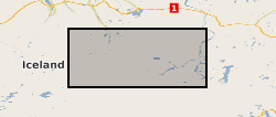
This is continuous raw data from 3-component broad-band (30 sec to 100 Hz) Guralp 6TD seismometer deployments around Askja in the central region of Iceland.
-

The datasets contain FIB-SEM and X-ray micro-tomographic images of a wettability-altered carbonate rock sample before and after dissolution with reactive CO2-saturated brine at reservoir pressure and temperature conditions. The data were acquired with the aim of investigating CO2 storage in depleted oil fields that have oil-wet or mixed-wet conditions. Our novel procedure of injecting oil after reactive transport has revealed previously unidentified (ghost) regions of partially-dissolved rock grains that were difficult to identify in X-ray tomographic images after dissolution from single fluid phase experiments. The details of image files and imaging parameters are described in readme file.
-

The spreadsheet gathers the data collected during two experiments conducted on a synthetic sandstone core sample to assess geophysical monitoring techniques, storage capacity evaluation and the geomechanical integrity of shallow CO2 storage reservoirs. The tests were conducted in the rock physics laboratory at the National Oceanography Centre, Southampton, during 2016, as part of the DiSECCS project with funding from the United Kingdom's Engineering and Physical Sciences Research Council (EPSRC grant EP/K035878/1) and the Natural Environment Research Council (NERC). One experiment was a steady state brine-CO2 flow-through test (so called BTFT in the spreadsheet) to simultaneously evaluate storage capacity and identify pore fluid distribution and mechanical indicators during CO2 geosequestration. The confining and pore pressure conditions were similar to those estimated for shallow North Sea - like storage reservoirs, but simulating inflation/depletion cyclic scenarios for increasing brine:CO2 fractional flow rates. The second experiment focused on the assessment of geomechanical changes (the so called GAT in the spreadsheet) during and after CO2 storage activities under the same stress conditions. The data include ultrasonic P- and S-wave velocities and their respective attenuation factors and axial and radial strains in both tests, and electrical resistivity in the case of the flow-through test.
-

Physical properties of four serpentinite and four gabbro samples acquired respectively at the Southern Wall (IODP leg 357) and at the Central Dome (IODP leg 304-305) of the Atlantis Massif have been measured and analysed in the frame of a NERC UK-IODP moratorium research. The physical property measurements included simultaneous ultra-sonic wave velocities (compressional and shear wave velocities), attenuation, electrical resistivity and permeability under increasing and decreasing effective pressure ranging between 5 and 45 Mpa. Measurements were carried out using the experimental physical property measurement rig of the rock Physics laboratory of the National Oceanography Centre, Southampton, UK. The porosity and the density of the samples were estimated using their wet dry weight difference and the volume of the samples, under atmospheric pressure and room temperature. The aim of this research project was to learn about the physical properties of oceanic lower crustal and upper-mantle rocks and to find a geophysical method that would allow to distinguish between these rocks, remotely. The dataset has been acquired and interpreted by a science party including researchers from the University of Southampton and the National Oceanography Centre. The ultrasonic wave velocities, attenuation and the electrical resistivity for each sample and for each effective pressure (increasing from 5 to 45 with an interval of 10 MPa and decreasing from 45 to 5 with an interval of 20 MPa) are reported in this dataset. Permeability measurements could have been carried out only on 6 samples for which the permeability was high enough to be measured with the experimental rig.
-

The HiRES-1 project acquired airborne geophysical data during 1998. Coverage included the Central Midlands of England and into the associated Welsh Borderland. Survey flying for the collaborative BGS and World Geoscience Corporation Ltd (WGC) high resolution geophysical and environmental survey was completed in early September 1998. The data comprise multi-channel gamma ray spectrometer, magnetometer and dual frequency VLF-EM. Flight line spacing was 400 m with tie lines at 1200 m and the total area surveyed is some 14 000 km2. Flight-line orientations are W–E over the western survey area, SW–NE over the eastern area. Ground clearance was maintained at 90 m in rural areas, increasing to about 240 m in built-up zones. The project and data descriptions are provided in an internal BGS report: R J Peart, R J Cuss, D Beamish and D G Jones, 2003. The High Resolution Airborne Resource and Environmental Survey- Phase 1 (HiRES-1): background, data processing and dissemination and future prospects. British Geological Survey Internal Report, IR/03/112. 28pp.
-

Thermochronological data from IODP Bengal Fan site 354. Grant abstract: The Himalayas are a type example of continent-continent collision, and resultant mountain building processes. Geologists can look at the rocks in the mountain belt itself to determine its evolution, but sometimes the evidence in the rocks in the mountain belt itself is obscured by later increases in the temperature and pressure that the rocks were subjected to, which overprints the evidence. Sediments eroded off the evolving Himalaya are deposited in the Bengal Fan, and these can provide an archive of the erosion of the history of the mountain belt through time which has not been obscured my later metamorphism, as the material was eroded and removed from the mountain belt prior to these later overprinting events. This project will analyse minerals that cooled as they were exhumed from deoth towards the surface in the mountain belt. The project will date the minerals to determine the time they cooled, and this will provide information on when the rocks were exhumed and how fast they exhumed, thus providing information on when and how fast the mountain belt grew.
-
Airborne atmospheric measurements from core and non-core instrument suites data on board the FAAM BAE-146 aircraft collected for UTLS-Ozone: CIRRUS project.
-
Airborne atmospheric measurements from core and non-core instrument suites data on board the FAAM BAE-146 aircraft collected for Ice and Precipitation Initiation in Cumulus (ICEPIC) project.
-
The ESA Ocean Colour CCI project has produced global level 3 binned multi-sensor time-series of satellite ocean-colour data with a particular focus for use in climate studies. This dataset contains the Version 1.0 Remote Sensing Reflectance product on a sinusoidal projection at approximately 4 km spatial resolution and at a daily time resolution. Values for remote sensing reflectance at the sea surface are provided for the standard SeaWiFS wavelengths (412, 443, 490, 510, 555, 670nm) with pixel-by-pixel uncertainty estimates for each wavelength. These are merged products based on SeaWiFS, MERIS and Aqua-MODIS data. Note, this dataset is also contained within the 'All Products' dataset. This data product is on a sinusoidal equal-area grid projection, matching the NASA standard level 3 binned projection. The default number of latitude rows is 4320, which results in a vertical bin cell size of approximately 4 km. The number of longitude columns varies according to the latitude, which permits the equal area property. Unlike the NASA format, where the bin cells that do not contain any data are omitted, the CCI format retains all cells and simply marks empty cells with a NetCDF fill value. (A separate dataset is also available for data on a geographic projection).
-
Airborne atmospheric measurements from core instrument suite data on board the FAAM BAE-146 aircraft collected for NCAS general FAAM flying (SeptEx, Winter 2010) (Oil and Gas) project.
 NERC Data Catalogue Service