2011
Type of resources
Available actions
Topics
Keywords
Contact for the resource
Provided by
Years
Formats
Representation types
Update frequencies
Service types
Scale
Resolution
-
The Marine Hard Substrate dataset maps areas of rock or hard substrate outcropping or within 0.5m of the sea-bed. For the purpose of this dataset, Hard Substrate was defined as the presence of either rock or clasts >64 mm (boulders or cobbles) within 0.5 m of the seabed. This definition includes sediment veneer overlying hard substrate in some areas. This is used in order to include both infaunal and epifaunal communities and is considered beneficial for habitat mappers. The interpretation was based on a variety of data sourced from within the British Geological Survey and externally. Data consulted includes archive sample and seismic records, side scan sonar, multibeam bathymetry and Olex datasets. The distribution of hard substrate at the seabed, or within 0.5 m of the seabed, is important in dictating the benthic assemblages found in certain areas. Therefore, an understanding of the distribution of these substrates is of primary importance in marine planning and designation of Marine Conservation Zones (MCZs) under the Marine and Coastal Access Act, 2009. In addition, a number of other users will value these data, including marine renewable companies, aggregate companies, the fishing and oil and gas industries. In order to address this issue it was necessary to update British Geological Survey sea-bed mapping to delineate areas where rock, boulders or cobbles are present at, or within 0.5 m of the sea-bed surface. A polygon shape file showing areas of rock or hard substrate at, or within 0.5m of the sea-bed has been developed. The dataset has been created as vector polygons and are available in a range of GIS formats, including ESRI shapefile (.shp) and OGC GeoPackage (.gpkg). More specialised formats may be available but may incur additional processing costs. This dataset has been developed in collaboration with external partners and the methodology used is detailed in the report MB0103 for DEFRA: Developing the necessary data layers for Marine Conservation Zone selection - Distribution of rock/hard substrate on the UK Continental Shelf MB0103 (Gafeira et al., 2010). This dataset was produced for use at 1:250 000 scale. However, in many cases, the detail of the mapping is far greater than expected for this scale as hard substrate delineation was done based on the best available data. This data should not be relied on for local or site-specific geology. Contact BGS Digital Data (digitaldata@bgs.ac.uk) for more information on this dataset.
-
The BGS Seabed Sediments 250k dataset is vector data which reflects the distribution of seabed substrate types of the UK and some of its adjacent waters (the UK Exclusive Economic Zone, EEZ) at 1:250,000 scale. This comprehensive dataset provides a digital compilation of the paper maps published by BGS at the same scale, as well as additional re-interpretations from regional geological studies. The seabed is commonly covered by sediments that form a veneer or thicker superficial layer of unconsolidated material above the bedrock. These sediments are classified based on their grain size, which reflects the environment in which they were deposited. This information is important to a range of stakeholders, including marine habitat mappers, marine spatial planners and offshore industries (in particular, the dredging and aggregate industries). This dataset was primarily based on seabed grab samples of the top 0.1 m, combined with cores, dredge samples and sidescan sonar acquired during mapping surveys since the early 1970s. Variations in data density are reflected in the detail of the mapping. The sediment divisions on the map are primarily based on particle size analysis (PSA) of both surface sediment samples and the uppermost sediments taken from shallow cores. Sediments are classified according to the modified Folk triangle classification (Folk, 1954, Journal of Geology, Vol. 62, pp 344–359). The modified Folk diagram and classification used by BGS differs from that created by Folk (1954) in that the boundary between 'no gravel' and 'slightly gravelly' is changed from trace (0.05%) to 1% weight of particles coarser than -1Ø (2mm), shown below. The boundaries between sediment classifications or types are delineated using sample station particle size analyses and descriptions, seafloor topography derived from shallow geophysical and, where available, multibeam bathymetry, backscatter and side-scan sonar profiles. This dataset was produced for use at 1:250 000 scale. These data should not be relied on for local or site-specific geology.
-
This data compilation contains uranium isotopes (234U/235U/238U) and concentration data on a suite of terrestrial and extra-terrestrial samples for understanding the uranium isotope cycling on Earth. Sample list includes meteorites (ordinary chondrites, eucrites), mantle-derived basalts (Ocean Island Basalts, Mid-Ocean Ridge Basalts), arc volcanics, altered oceanic crust (ODP 801), volcanici-clastic sediments, seawater, fossil corals and organic-rich sediments (From the Black Sea and Cariaco Basin).
-
The dataset describes the relative vulnerability of groundwater to contamination across Scotland, by means of five relative classes ranging from 1 (lowest vulnerability) to 5 (highest vulnerability). The dataset is a screening tool that can be used to show the relative threat to groundwater quality from contamination across Scotland. It can provide guidance on the vulnerability of groundwater at a regional scale, highlighting areas at comparatively higher risk of groundwater contamination, and can help indicate the degree of specific site investigation required for a new development or activity. It is designed to be used at a scale of 1:100,000 and should be regarded as a tool to aid groundwater risk assessment rather than a complete solution. Latest version: Groundwater Vulnerability Scotland version 2
-
This mineral resource data was produced as part of the Mineral Resource Map of Northern Ireland via a commission from the Northern Ireland Department of the Environment. The work resulted in a series of 21 data layers which were used to generate a series of six digitally generated maps. This work was completed in 2012 with one map for each of the six counties (including county boroughs) of Northern Ireland at a scale of 1:100 000. This data and the accompanying maps are intended to assist strategic decision making in respect of mineral extraction and the protection of important mineral resources against sterilisation. They bring together a wide range of information, much of which is scattered and not always available in a convenient form. The data has been produced by the collation and interpretation of mineral resource data principally held by the Geological Survey of Northern Ireland and was funded via a commission from the Northern Ireland Department of the Environment. These layers display the spatial data of the mineral resources of Northern Ireland. There are a series of layers which consist of: Bedrock: Clay, Bauxitic clay, Coal & Lignite, Coal – lignite proven, Conglomerate, Dolomite, Igneous and meta-igneous rock, Limestone, a 100m buffer layer on the Ulster White Limestone, Meta-sedimentary rocks, Perlite, Salt, Sandstone and Silica Sand. Superficial (unconsolidated recent sediments) : Sand & gravel and Peat. The data except for the salt and proven lignite resource layers was derived from the 1:50 00 and 1:250 000 scale DigMap NI dataset. This version of the data retains the internal geological boundaries which are dissolved out in the accompanying dissolved version. A user guide 'The Mineral Resources of Northern Ireland digital dataset (version 1)' OR/12/039 describing the creation and use of the data is available.
-
The BGS-HPA UK OneGeology Radon Potential Web map service provides access to the BGS-HPA UK OneGeology Radon Potential dataset. This service provides access to the BGS-HPA UK OneGeology Radon Potential data at scales smaller than 1:250,000.
-
Linear features (shown as polylines) represent seven classes of geological structural features e.g. faults, folds or landforms e.g. buried channels, glacial drainage channels at the ground or bedrock surface (beneath superficial deposits). The scale of the data is 1:10 000 scale. Onshore coverage is partial with approximately 30% of England, Scotland and Wales available in the version 2 data release. BGS intend to continue developing coverage at this scale; current focus is to include all large priority urban areas, along with road and rail transport corridors. Linear features are associated most closely with the bedrock theme either as an intrinsic part of it for example marine bands or affecting it in the case of faults. However landform elements are associated with both bedrock and superficial deposits. The linear features are organised into seven main categories: Alteration area indicating zones of change to the pre-existing rocks due to the application of heat and pressure can occur round structural features such as faults and dykes. Fault where a body of bedrock has been fractured and displaced by a large scale process affecting the earth's crust. Fold where strata are bent or deformed resulting from changes or movement of the earth's surface creating heat and pressure to reshape and transform the original horizontal strata. Folds appear on all scales, in all rock types and from a variety of causes. Fossil horizons where prolific fossil assemblages occur and can be used to help establishing the order in which deposits were laid down (stratigraphy). These horizons allow correlation where sediments of the same age look completely different due to variations in depositional environment. Mineral vein where concentrations of crystallised mineral occur within a rock, they are closely associated with faulting but may occur independently. Landforms define the landscape by its surface form; these include glacial features such as drumlins, eskers and ice margins. Rock identifies key (marker) beds, recognised as showing distinct physical characteristics or fossil content. Examples include coal seams, gypsum beds and marine bands. The data are available in vector format (containing the geometry of each feature linked to a database record describing their attributes) as ESRI shapefiles and are available under BGS data licence.
-

This vector contour dataset represents the distribution of the theoretical potential calculated 'identified resources' (in GJ/m2 or PJ/km2) for the Carboniferous Fell Sandstone Formation (Mid Border Group) in the Northumberland-Solway Basin. The theoretical potential for 'identified resources' represents the estimated proportion of the geothermal resource that is available for development. For consistency with other legacy estimations, additional columns have been added to the original layers to include the converted value of 'identified resource' to 'recoverable heat' in MW/km2, for equivalence to the method used by D J.R. Jones, T. Randles, T. Kearsey, T.C. Pharaoh, A. Newell (2023). https://doi.org/10.1016/j.geothermics.2023.102649 and Kearsey, T.I., Receveur, M. and Monaghan, A.A., 2024. Modelled hot sedimentary aquifer geothermal potential of Upper Devonian strata in the Midland Valley of Scotland.
-
The London Earth data are part of the Geochemical Baseline Survey of the Environment (G-BASE) dataset, a nation-wide project to determine the distribution of chemical elements in the surface environment. London Earth focuses on the soil of the capital city, the limits of the survey being defined by the Greater London Authority (GLA) administrative boundary. Chemical elements have been determined by X-ray fluorescence spectrometry (XRFS) at the laboratories of the British Geological Survey (BGS) in Keyworth, Nottingham. These results are presented as a Microsoft Excel file.
-
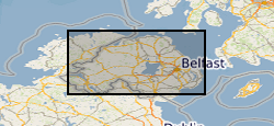
This mineral resource data was produced as part of the Mineral Resource Map of Northern Ireland via a commission from the Northern Ireland Department of the Environment. The work resulted in a series of 21 data layers which were used to generate a series of six digitally generated maps. This work was completed in 2012 with one map for each of the six counties (including county boroughs) of Northern Ireland at a scale of 1:100 000. This data and the accompanying maps are intended to assist strategic decision making in respect of mineral extraction and the protection of important mineral resources against sterilisation. They bring together a wide range of information, much of which is scattered and not always available in a convenient form. The data has been produced by the collation and interpretation of mineral resource data principally held by the Geological Survey of Northern Ireland and was funded via a commission from the Northern Ireland Department of the Environment. These layers display the spatial data of the mineral resources of Northern Ireland. There are a series of layers which consist of: Bedrock: Clay, Coal & Lignite, Coal – lignite proven, Conglomerate, Dolomite, Igneous and meta-igneous rock, Limestone, a 100m buffer layer on the Ulster White Limestone, Meta-sedimentary rocks, Perlite, Salt, sandstone and Silica Sand. Superficial (unconsolidated recent sediments) : Sand & gravel and Peat. The data except for the salt and proven lignite resource layers was derived from the 1:50 00 and 1:250 000 scale DigMap NI dataset. A user guide 'The Mineral Resources of Northern Ireland digital dataset (version 1)' OR/12/039 describing the creation and use of the data is available. A companion set of data with the internal boundaries retained is also available.
 NERC Data Catalogue Service