
1998
Type of resources
Available actions
Topics
Keywords
Contact for the resource
Provided by
Years
Formats
Representation types
Update frequencies
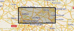
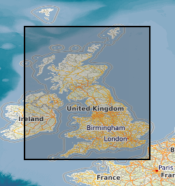
Scale
-
This dataset consists of results of chemical analyses of single water chemistry samples, taken from headwater streams during a survey in 1998. Water samples were analysed at the Centre for Ecology & Hydrology for chemical analysis of alkalinity (at pH 8.3) and soluble reactive phosphorus. Conductivity and pH were measured in the field using a regularly calibrated field meter. Data were collected under the Countryside Survey long term monitoring project managed by the Centre for Ecology & Hydrology. The Countryside Survey is a unique study or 'audit' of the natural resources of the UK's countryside. The sample sites are chosen from a stratified random sample, based on a 15 by 15 km grid of GB. Headwater stream surveys have been carried out in 1990, 1998 and 2007 with repeated visits to the majority of sites. The countryside is sampled and surveyed using rigorous scientific methods, allowing us to compare new results with those from previous surveys. In this way we can detect the gradual and subtle changes that occur in the UK's countryside over time. In addition to headwater stream data, soil data, habitat areas, vegetation species data and linear habitat data are also gathered by Countryside Survey. Full details about this dataset can be found at https://doi.org/10.5285/b8052165-c6c5-427e-a90c-c536ff46aec8
-
This dataset consists of macrophyte species records, sampled from headwater streams during a survey in 1998. Stream macrophytes in Countryside Survey are surveyed using the standard MTR (Mean Trophic Rank) protocol, which records the presence and extent (on a categorical scale) of macrophytes in a 100m reach. Data were collected under the Countryside Survey long term monitoring project managed by the Centre for Ecology & Hydrology. The Countryside Survey is a unique study or 'audit' of the natural resources of the UK's countryside. The sample sites are chosen from a stratified random sample, based on a 15 by 15 km grid of GB. Headwater stream surveys have been carried out in 1990, 1998 and 2007 with repeated visits to the majority of sites. The countryside is sampled and surveyed using rigorous scientific methods, allowing us to compare new results with those from previous surveys. In this way we can detect the gradual and subtle changes that occur in the UK's countryside over time. In addition to headwater stream data, soil data, habitat areas, vegetation species data and linear habitat data are also gathered by Countryside Survey. Full details about this dataset can be found at https://doi.org/10.5285/e0b638d5-8271-4442-97ef-cf46ea220f5d
-

Data relating to project specific sites of investigation into fluid processes in landfills and mine sites.
-
The full title of this project is" Studies into metal speciation and bioavailability to assist risk assessment and remediation of brownfield sites in urban areas" and is funded by NERC under the URGENT thematic programme form 1998-2001. The project is being undertaken by a consortium of workers from the Imperial College, University of Nottingham, and the British Geological Survey. Innovative collaborative and multi-disciplinary research will be applied to the interpretation of urban geochemical maps and associated meta-datasets to assist decision making by local authorities in the redevelopment of brownfield sites. Source apportionment, speciation and bioavailability of potentially toxic heavy metals will be studied at representative conurbations in the UK Midlands region. Scanning electron microscopy, chemical extractions and soil solution and vegetable analysis, will be integrated with high precision isotopic analyses of Pb and other potential toxic metals in this study. The results will be available as maps in GIS format to provide a generic decision support system for quantitative health risk assessment.
-

PROJECT DETAILS ONLY - NO DATA. The processes by which frost shatters rock are subject to controversy. The main objective of the proposed research is to develop a new methodology for experimentally testing a model of ice segregation in permafrost. Using specialist cold-room facilities in the CRNS Centre de Geomorphologie, Caen (France), the methodology will simulate the bedrock thermal and hydrological regime at the top of cold permafrost in order to determine whether growth of segregated ice within the simulated permafrost shatters a large block of frost susceptible rock (chalk). Verification of the ice-segregation hypothesis by the proposed experiment would have international significance to the fields of permafrost science, engineering and rock weathering because it would emphasise the unified nature and consequences of ground-ice development in fine-grained soils and rocks.
-
This dataset consists of invertebrate species records, sampled from headwater streams during a survey in 1998. Macro-invertebrates were sampled using standard protocols. The sample area in each stream was a single area of stream-bed whose major habitat types can be sampled within the recommended sampling period of three minutes of active sampling, supplemented by a one minute hand search. The length of river surveyed would normally vary from 5 to 15m. Samples were collected using a standard 1mm mesh pond net and returned to the Centre for Ecology & Hydrology (formerly Institute of Freshwater Ecology) for later sorting and identification. Supplemental physical measurements (width, depth, substrate composition) required to run RIVPACS (River Invertebrate Prediction and Classification System) were taken. Data were collected under the Countryside Survey long term monitoring project managed by the Centre for Ecology & Hydrology. The Countryside Survey is a unique study or 'audit' of the natural resources of the UK's countryside. The sample sites are chosen from a stratified random sample, based on a 15 by 15 km grid of GB. Headwater stream surveys have been carried out in 1990, 1998 and 2007 with repeated visits to the majority of sites. The countryside is sampled and surveyed using rigorous scientific methods, allowing us to compare new results with those from previous surveys. In this way we can detect the gradual and subtle changes that occur in the UK's countryside over time. In addition to headwater stream data, soil data, habitat areas, vegetation species data and linear habitat data are also gathered by Countryside Survey. Full details about this dataset can be found at https://doi.org/10.5285/fd0ce233-3b4d-4a5e-abcb-c0a26dd71c95
-

PROJECT DETAILS ONLY - NO DATA. Understanding of the fundamental dynamic controls of eruptive behaviour of andesite volcanoes using Montserrat as a case study. Quantitative petrology and geochemistry; thermodynamic models on changes in magma during degassing; experiments to constrain kinetic laws of crystallisation of degassing magmas; mathematical models on the dynamics of lava extrusion and explosive eruption.
-
The BGS collection of downhole CCTV (Closed Circuit Television) recordings and backup tapes for worldwide SKYLAB satellite imagery. CCTV recordings carried out down boreholes, mainly drilled for water, were undertaken by BGS for specific commercial contracts in Great Britain, and may also have associated geophysical data. The collection started in 1997, and the present holdings are 138 videos, with infrequent additions. Video recordings on other topics may be added.
-

PROJECT DETAILS ONLY - NO DATA. Knowing the age of diamonds is critical to understanding their formation and likely distribution in the mantle. Re-Os isotope analyses of synergetic sulphide inclusions allows dating of individual diamonds by isochron and model age methods. This method will be applied to a suite of well-characterised Siberian diamond inclusions from several different kimberlite pipes. We will aim to determine the ages of eclogite-suite and periodite-suite diamonds, which may provide clues as to their different modes of origin. Shrimp ii Pb-Pb isotope and S-isotopic measurements will further constrain the age and origin of the sulphides and hence the diamonds. N-aggregation studies on the host diamonds will independently assess mantle residence times. We will examine absolute age differences between cores and rims of diamonds by laser cutting fragments of diamonds with multiple inclusions.
-

Index to the BGS collection of downhole CCTV recordings and also backup tapes for SKYLAB satellite imagery. The Oracle index was setup in 1997 and covers the whole of Great Britain, all received videos are indexed but the level of detail in the index may vary between entries.