
10000
Type of resources
Available actions
Topics
Keywords
Contact for the resource
Provided by
Years
Formats
Representation types
Update frequencies
Scale
Resolution
-

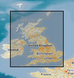
The aim of the Landslides Project is to define, describe and catalogue the landslides and mass movements of Great Britain and interpret them in terms of the hazard that they engender so that they may be avoided, or mitigated. A central part of this project is the operation of the National Landslide Database. The National Landslide Database forms the primary record of landslide information in Great Britain. It records information gathered by the Landslide Project and projects elsewhere in the BGS on landslide events and landforms throughout Great Britain. It incorporates information from other databases, including regional landslide databases held within BGS which includes the National Landslide Database created for the DOE in 1994. The database records the name and location of all landslides known to the project and wherever possible also records information on classification, dimensions, physical characteristics, geology, history, causal factors and impacts of each landslide as well as references to other data sources.
-

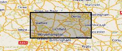
Magnetics Tellus Survey 2005 - 2006 Geophysical data were collected in 2005 and 2006 by the Joint Airborne-geoscience Capability (JAC), a joint venture between the Finnish Geological Survey (GTK) and the British Geological Survey (BGS). Magnetic, electromagnetic and terrestrial gamma-radiation (radiometric) data were recorded. Data were acquired for 80,458 line km of survey. Flight lines were spaced 200 m apart in the direction 165-345 degrees. The survey was flown with a nominal ground clearance of 56 m in rural areas and 240 m in urban areas, with sample intervals of 7 m (magnetics), 17.5 m (electromagnetics) and 70 m (gamma radiation).
-

This dataset is an taxonomic listing (various phyla and families) of Quaternary, Upper Tertiary and Carboniferous fossils relevant to the palaeontology of Scotland and Northern England. Species authors and some dates are given. The MS Access database MTD_TAXALIST presently contains 1169 records. It has provision for environmental interpretation, and publications in which the fossils are illustrated.
-
The full title of this project is" Studies into metal speciation and bioavailability to assist risk assessment and remediation of brownfield sites in urban areas" and is funded by NERC under the URGENT thematic programme form 1998-2001. The project is being undertaken by a consortium of workers from the Imperial College, University of Nottingham, and the British Geological Survey. Innovative collaborative and multi-disciplinary research will be applied to the interpretation of urban geochemical maps and associated meta-datasets to assist decision making by local authorities in the redevelopment of brownfield sites. Source apportionment, speciation and bioavailability of potentially toxic heavy metals will be studied at representative conurbations in the UK Midlands region. Scanning electron microscopy, chemical extractions and soil solution and vegetable analysis, will be integrated with high precision isotopic analyses of Pb and other potential toxic metals in this study. The results will be available as maps in GIS format to provide a generic decision support system for quantitative health risk assessment.
-

Records of all onshore Northern Ireland boreholes, trial pits, shafts and wells held in the Geological Survey of Northern Ireland archives. The records range from simple single page lithological logs through to hydrocarbon completion reports. They are approximately 24,000 records dating back over 200 years and ranging between one and several thousand metres deep. New records are being added to the collection each year. A small percentage of the borehole records are held commercial-in-confidence for various reasons, and cannot be released without the written permission of the originator. GSNI staff will release the data where this is possible or provide you with the information needed to contact the originator.
-
As an integral part of the investigations carried out at Sellafield, and to a lesser extent for the Dounreay boreholes, the cores from the boreholes were systematically examined by geologists and samples selected for detailed petrographic analysis. Thin sections were prepared from many of these samples. Some of the samples were then prepared for analysis using X-ray fluorescence, X-ray diffraction or scanning electron microscopy. Samples containing fluid inclusions were prepared as doubly polished fluid inclusion wafers. Thin sections were prepared from soil materials obtained from the investigations of the Quaternary deposits. Particular attention was given to samples of the mineralisation that was identified in the formations at Sellafield. In addition to the samples from the boreholes, there are also some samples obtained from surface exposures that were examined during the regional surveys. The samples and sections have been catalogued and incorporated into the national collection by the British Geological Survey. The ownership of NIREX (Nuclear Industry Radioactive Waste Executive) was transferred from the nuclear industry to the UK Government departments DEFRA and DTI in April 2005, and then to the UK's Nuclear Decommissioning Authority (NDA) in November 2006.
-

**Nothing Known About This**Grain size analysis and statistics of Jurassic-Cretaceous and Tertiary sands from East Dorset, the Hampshire Basin and Shaftesbury area. Analysis taken from selected sites therefore not complete cover of the area.
-
[This metadata record has been superseded, see http://data.bgs.ac.uk/id/dataHolding/13480403]. Index to reports of site investigations produced by external organisations carried out for all forms of site investigation. The Oracle index was setup in 1988 and covers the whole of Great Britain, all site investigation reports are indexed but the level of detail in the index for each record may vary. The reports date back to the 1950's and may contain information on boreholes, trial pits, laboratory tests and chemical analyses etc.
-

[This metadata record has been superseded, see http://data.bgs.ac.uk/id/dataHolding/13480158] The Geophysical Borehole Log index provides details of all digital geophysical logs available to BGS. The database provides the borehole metadata related to logging and metadata for the logging itself and log data stored in a proprietary hierarchical database system (PETRIS RECALL). Contains most digital geophysically logged bores known to BGS National Geological Records Centre. Scattered distribution of boreholes, locally dense coverage, relatively few logs from Scotland & Central Wales, increasing data density on UK continental Shelf.
-

The commercial GeoReports project, under the National Geoscience Information Service sector of the Information Systems and Management directorate, produces around 8000 GeoReports a year, giving an annual turnover of over 600,000 pounds currently. The site specific reports are aimed at anyone who is investigating ground conditions in Great Britain (geology, hydrogeology and any related geohazards, including radon). Georeports reference: http://www.bgs.ac.uk/georeports