
notEntered
Type of resources
Available actions
Topics
Keywords
Contact for the resource
Provided by
Years
Formats
Representation types
Update frequencies
Scale
-

A digital elevation model of the base of the Holocene for the Mersey estuary. The model was created as part of the Estuaries Research Programme (EMPHASYS).
-

A digital elevation model for the Holocene surface around the area known as Southampton Water. The model was created as part of the Estuaries Reasearch Programme (EMPHASYS)
-

An additional core scanning dataset from the TH0424 drill core that was drilled onshore at Thornton Science Park, Cheshire, UK as part of the UK Geoenergy Observatories (UKGEOS) Cheshire ground investigation funded by UKRI/NERC. The approximately 100 m long core succession comprises the Sherwood Sandstone Group. This additional core scanning dataset pack contains high-resolution optical images and X-ray fluorescence (XRF) downcore point measurements obtained using a Geotek Core Workstation (MSCL-XYZ) at the Core Scanning Facility (CSF) at the British Geological Survey (BGS).
-
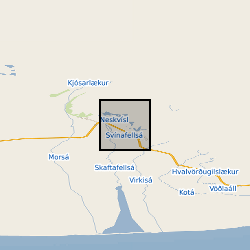
Stable isotope and inorganic chemistry data for samples of groundwater from boreholes and springs in the sandur aquifer; glacial meltwater and river water; and glacier ice, from Virkisjokull glacier observatory. Selected water chemistry and stable isotope data are reported in Ó Dochartaigh, B. É., et al. 2019. Groundwater?- glacier?meltwater interaction in proglacial aquifers, Hydrol. Earth Syst. Sci. https://doi.org/10.5194/hess-2019-120
-

This is a series of maps, in GIS shapefile format, for each of 48 countries in Africa, that show hydrogeology (aquifer type and productivity) and geology (with particular relevance to hydrogeology) at 1:5 million scale. The maps have two hydrogeological themes: -geology with geological categories that reflect significant hydrogeological units; and -hydrogeology, combining classifications of aquifer type and productivity. The maps were produced as part of the Africa Groundwater Atlas project.
-

A digital elevation model for the Holocene surface around the area known as the Humber Estuary. The model was created as part of the Estuaries Reasearch Programme (EMPHASYS).
-
Groundwater level and groundwater temperature data measured in 9 boreholes between August 2012 and August 2018. Groundwater conductivity data measured in 1 of these boreholes from September 2012 to August 2014. Eight of the boreholes are drilled into a sandur (glacial outwash floodplain) aquifer in front of Virkisjokull glacier, SE Iceland, and are between 8.2 and 14.9 m deep. The remaining borehole is drilled into a volcanic rock aquifer between the sandur and glacier and is 5.1 m deep. Selected groundwater monitoring data are reported in Ó Dochartaigh, B. É., et al. 2019. Groundwater?- glacier?meltwater interaction in proglacial aquifers, Hydrol. Earth Syst. Sci. https://doi.org/10.5194/hess-2019-120. Further information on borehole installations and geology can be found in Ó Dochartaigh et al. 2012. Groundwater investigations at Virkisjokull, Iceland: data report 2012. British Geological Survey Open Report OR/12/088, http://nora.nerc.ac.uk/id/eprint/500570/
-

This Offshore Quaternary dataset shows the distribution of interpreted lithostratigraphic units within the shallow subsurface. Large areas of the UK offshore are covered, at a scale of 1:250 000. This dataset was originally published between 1984 and 1992, as a series of paper map sheets. This is the first time that the Quaternary Geology 1:250 000 maps have been made available in digital format. Information from the original map sheets have been included in the attribute fields in this dataset, including a lithological description for each formation. Additional data has also been provided where it was deemed to add value. The BGS lexicon code for each formation has been supplied, so users can research any formation of interest. The maximum and minimum age of each formation, in a variety of formats, has also been added. This key information was sourced from Stoker et al (2011). Our understanding of the Quaternary lithostratigraphy is evolving due to the increased data collection associated with renewable energy development. However, no formal update of the regional lithostratigraphic framework has been completed at time of release. This dataset therefore reflects the understanding at the time of original publication. Inaccuracies in the dataset may have since been resolved and the level of uncertainty regarding the age or character of a formation may have changed. Nonetheless, this dataset contains valuable information, and this digital version will help facilitate access to this for users.
-
The dataset is a subset of the BGS borehole material database, created on August 1st 2015 covering only the Bowland-Hodder geological unit (as defined and mapped by Andrews et al., 2013). It shows all boreholes (name, location and registration details) for which BGS hold borehole material (drillcore, cuttings, samples and their depth ranges). This data will add value to existing NERC (Natural Environment Research Council) data by allowing a simple route for users to identify borehole material from the Bowland-Hodder interval.
-

An additional core scanning dataset from the TH0424 drill core that was drilled onshore at Thornton Science Park, Cheshire, UK as part of the UK Geoenergy Observatories (UKGEOS) Cheshire ground investigation funded by UKRI/NERC. The approximately 100 m long core succession comprises the Sherwood Sandstone Group. This additional core scanning dataset pack contains high-resolution optical images and X-ray fluorescence (XRF) downcore point measurements obtained using a Geotek Core Workstation (MSCL-XYZ) at the Core Scanning Facility (CSF) at the British Geological Survey (BGS).