
Groundwater
Type of resources
Available actions
Topics
Keywords
Contact for the resource
Provided by
Years
Formats
Representation types
Update frequencies
Scale
-
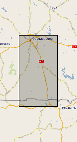
Monthly time-series data of GRACE (Gravity Recovery and Climate Experiment) total terrestrial water storage (TWS), GLDAS (Global Land Data Assimilation System) soil moisture, surface water (surface runoff), snow water storage, and basin-aggregated observations from piezometric data for the Makutapora Basin (Tanzania) and Limpopo Basin (South Africa).
-
In this study data were collected from viruses in groundwater from urban poor settlements in Arusha, Tanzania, Dodowa (Accra), Ghana, and Kampala, Uganda. The published Open Access paper can be viewed here https://pubs.acs.org/doi/10.1021/acsestwater.0c00306
-
The BGS groundwater levels dataset is a gridded interpolation of depth to groundwater. The dataset is a raster grid, with 50 × 50 metre pixels holding values that represent the probable maximum depth, in metres, to the phreatic water table. This represents the likely lowest water level, under natural conditions, in an open well or borehole drilled into the uppermost parts of a rock unit. The dataset has been modelled from topography and hydrology, assuming that surface water and groundwater are hydraulically connected. It has not used observations of groundwater level in wells or boreholes directly, but they have been used to validate its performance.
-

The file contain groundwater level/depth (WL), Groundwater and Surface Water Quality data (EC (micro-siemens per centimetre or µS/cm), Temperature (degrees C) and pH) for 49 points under fortnightly monitoring relevant to Gro for GooD research project in Kwale County, Kenya. Blank - Data not available. Note this is same dataset as NGDC record number 118189 with extended time series. Gro for GooD: Groundwater Risk Management for Growth and Development
-

This dataset classifies bedrock and superficial geologic units according to their aquifer designation - Principal Aquifers, Secondary Aquifers (Secondary A, Secondary B, and Secondary undifferentiated), and Unproductive Strata. The Environment Agency (EA) and Natural Resources Wales (NRW) help to protect groundwater by identifying different types of aquifers ‐ underground layers of water‐bearing, permeable rock or drift deposits from which groundwater can be extracted. The groundwater protection policies for the EA and Natural Resources Wales use aquifer designations that are consistent with the Water Framework Directive. These designations reflect the importance of aquifers in terms of groundwater as a resource (such as a drinking water supply) but also their role in supporting surface water flows and wetland ecosystems. The aquifer designation dataset is jointly owned by the British Geological Survey (BGS) and the Environment Agency (EA). The dataset covers geologic units mapped in England and is derived from BGS Geology 50k (DiGMapGB-50).
-
Groundwater temperature data from a shallow urban aquifer in Cardiff, Wales, UK between 2014-2018. Monitoring was undertaken as part of the ‘Cardiff Urban Geo-Observatory’ project . Boreholes are located within the urban area of the City of Cardiff, Wales, UK. The majority of temperature sensors were installed within boreholes that monitor a shallow Quaternary aged sand and gravel aquifer, however the made ground and the Triassic Mercia Mudstone also represented. Temperature sensors installed in 53 boreholes, between depths of 1.5m and 12- m below ground, with measurements every 30 minutes. The dataset comprises of just over 3.5 million temperature measurements. Monitoring was undertaken by the British Geological Survey and was designed to address knowledge gaps of subsurface urban heat island and it use for heat recovery and storage. Metadata Report http://nora.nerc.ac.uk/id/eprint/525332/
-

Collection of reports and general hydrogeological/geological information held in box files by country, almost exclusely by Jeff Davies.
-
The datasets consist of soil moisture (hourly-weekly), river stage (1 min), and groundwater level (hourly) collected as part of the BRAVE project (NE/M008827/1 and NE/M008983/1) to understand the resilience of boreholes in low-yielding aquifers in the River Volta Basin to climate. The data were collected from physical observatories in Sanon (Burkina Faso) and Aniabisi (Ghana). Soil moisture data were logged hourly beneath contrasting land uses and roaming soil moisture surveys were also undertaken across a wider access tube array. River stage was monitored at the catchment outlet in Sanon and groundwater levels were measured in both catchments.
-
This dataset contains a summary of the weekly volumetric output of pumps monitored using Smart Handpump sensors for 2014 and 2015. Grants that permitted the data collection include: Groundwater Risk Management for Growth and Development project (NE/M008894/1) funded by NERC/ESRC/DFID’s UPGro programme; New mobile citizens and waterpoint sustainability in rural Africa (ES/J018120/1) ESRC-DFID; Groundwater Risks and Institutional Responses for Poverty Reduction in Rural Africa (NE/L001950/1) funded by NERC/ESRC/DFID’s UPGro programme Notes: 1. The accuracy of these volume figures should be considered to be +/- 20%. 2. The dataset has gaps due to variable signal, and some attrition due to damage and vandalism. 3. Not all pumps in the study area were under monitoring. References: [1] P. Thomson, R. Hope, and T. Foster, “GSM-enabled remote monitoring of rural handpumps: a proof-of-concept study,” Journal of Hydroinformatics, vol. 14, no. 4, pp. 829–839, 05 2012. [Online]. Available: https://doi.org/10.2166/hydro.2012.183 [2] Behar, J., Guazzi, A., Jorge, J., Laranjeira, S., Maraci, M.A., Papastylianou, T., Thomson, P., Clifford, G.D. and Hope, R.A., 2013. Software architecture to monitor handpump performance in rural Kenya. In Proceedings of the 12th International Conference on Social Implications of Computers in Developing Countries, Ochos Rios, Jamaica. pp. 978 (Vol. 991).
-

This dataset provides a detailed physical science dataset to the groundwater resource and engineering properties of 150 handpumped borehole supplies (HPBs) across Ethiopia, Malawi and Uganda, surveyed in 2017. The dataset includes measurements of aquifer resource potential, groundwater quality, downhole construction and condition of handpump components, and borehole construction. Detailed social science data were also collected as part of the second survey phases of the Hidden Crisis project. However, these data are reported as a separate (associated) dataset to the physical science Survey 2 dataset – and are available from Economic and Social Research Council (ESRC) UK Data Service (UKDS). The Hidden Crisis project (2015-20) was an international research project aimed at developing a robust evidence base and understanding of the complex and multi-faceted causes which underlie the current high failure rates of many new groundwater supplies in Africa. The project was jointly funded by: DFID, NERC and ESRC as part of the UPGro programme. The project carried out the research work in three countries - Ethiopia, Malawi and Uganda – to examine functionality and performance of groundwater supplies in a range of hydrogeological, climatic and social, institutional and governance environments in East Africa. The work focused specifically on examining the functionality of HPBs – these being the main form of improved community water supply across rural Africa. The Survey 2 dataset, is major dataset developed by the project.