
Hydrogeology
Type of resources
Available actions
Topics
Keywords
Contact for the resource
Provided by
Years
Formats
Representation types
Update frequencies
Service types
Scale
Resolution
-

The Africa Groundwater Atlas is an online resource developed by the BGS, in collaboration with hydrogeologists across Africa. This service presents layers showing the hydrogeology (aquifer type and productivity) and geology (with particular reference to hydrogeology) of 38 African countries.
-

Collection of raw hydrogeological data obtained during various projects in different countries.
-

Card index of hydrogeological references, including "Whitaker" bibliography and material up to 1950s.
-

Collection of reports and general hydrogeological/geological information held in box files by country, almost exclusely by Jeff Davies.
-

Card index with abstraction data for licensed water wells in England and Wales 1948-1963.
-

This is a series of maps, in GIS shapefile format, for each of 48 countries in Africa, that show hydrogeology (aquifer type and productivity) and geology (with particular relevance to hydrogeology) at 1:5 million scale. The maps have two hydrogeological themes: -geology with geological categories that reflect significant hydrogeological units; and -hydrogeology, combining classifications of aquifer type and productivity. The maps were produced as part of the Africa Groundwater Atlas project.
-

Spatial data for Bishket urban pollution project data on groundwater pollution
-

Data on borehole/wellstats and design summaries for Bishket, Kyrghystan.
-

Database of inorganic water quality analyses from research projects both in the UK and overseas.
-
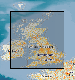
The data comprises GIS layers representing the permeability of mass movement deposits for Great Britain. The permeability data has been derived from DiGMap-GB (Digital Geological Map Data of Great Britain), and therefore reflects the scale of DiGMap-GB. For the majority of the Great Britain, the scale is 1:50,000,. The data is updated annually, or after a major new release of DiGMap-GB. The permeability data describes the fresh water flow through mass movement deposits and the ability of a unit to transmit water. Maximum and minimum permeability indices are given for each geological unit to indicate the range in permeability likely to be encountered and the predominant flow mechanism (fracture or intergranular). Neither of the assigned values takes into account the thickness of either the unsaturated or saturated part of the lithostratigraphical unit. The data can be used freely internally, but is licensed for commercial use. It is best displayed using a desktop GIS, and is available in vector format as ESRI shapefiles and MapInfo TAB files.