.csv
Type of resources
Topics
Keywords
Contact for the resource
Provided by
Years
Formats
Representation types
Update frequencies
-
This dataset presents the amount of different magnesium carbonates under different conditions. Here, using batch reactor experiments and mineralogical characterization, we explored magnesite precipitation kinetics in chemically complex fluids whereby the impact of fluid acidity and alkalinity, NaCl, and MgO nanoparticles was investigated. The dataset was created within SECURe project (Subsurface Evaluation of CCS and Unconventional Risks) - https://www.securegeoenergy.eu/. This project has received funding from the European Union’s Horizon 2020 research and innovation programme under grant agreement No 764531
-
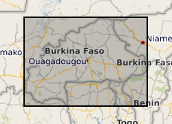
This dataset consists of reconstructions of daily groundwater levels for eight boreholes in Burkina Faso. Data for each borehole is provided in an individual csv file, with reconstructed groundwater level time series reported in metres above sea level (GWL, mASL). The groundwater level reconstructions were derived in 2019 as a part of the BRAVE project (NE/M008827/1 and NE/M008983/1) to develop an improved understanding of temporal variability in groundwater levels in sub-Saharan Africa. The reconstructions were derived using the lumped conceptual groundwater model AquiMod. Observed groundwater level time series for the eight boreholes were modelled using AquiMod, and the calibrated models were used with historic precipitation and potential evapotranspiration data to derive the reconstructions. The length of the time series of reconstructed groundwater levels varies between the boreholes due to differences in the length of the precipitation time series used to derive the reconstructions. Full details of this dataset are reported by Ascott et al. (2020). Ascott, M.J., Macdonald, D.M.J., Black, E., Verhoef, A., Nakohoun, P., Tirogo, J., Sandwidi, W.J.P., Bliefernicht, J., Sorensen, J.P.R., Bossa, A.Y., 2020. In Situ Observations and Lumped Parameter Model Reconstructions Reveal Intra-Annual to Multidecadal Variability in Groundwater Levels in Sub-Saharan Africa. Water Resour. Res., 56(12): e2020WR028056. DOI:https://doi.org/10.1029/2020WR028056
-
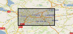
The data represent ground motion results obtained from Interferometric Synthetic Aperture Radar (InSAR) for the UKGEOS – Glasgow site. The InSAR techniques used is called Interferometric Point Target Analysis (IPTA) and the BGS processing is based on Sentinel-1 radar satellite data for the period August 2015 - June 2017. The results include time series of displacement (in mm) during this interval and average velocity across the whole period (in mm/yr) along the satellite Line of Sight (Hanssen, 2001). InSAR has provided information on the baseline conditions of ground stability ahead of any underground activity planned in at the Glasgow Geothermal Energy Research Field Site (GGERFS) as described in Bateson and Novellino (2019). References: Bateson, L.; Novellino, A.. 2019 Glasgow Geothermal Energy Research Field Site : ground motion survey report. Nottingham, UK, British Geological Survey, 35pp. (OR/18/054) (Unpublished). Available at http://nora.nerc.ac.uk/id/eprint/524555/ Hanssen, R., 2001. Radar Interferometry: Dordrecht Kluwer Academic Publishers, The Netherlands (2001) (308 pp.)
-

This dataset comprises palynological counts on sediments from IODP Expedition 374 Site U1521 to the Ross Sea, collected on the RV JOIDES Resolution. Marine palynomorphs are counted in 23 samples, and 7 samples were counted for terrestrial palynomorphs (pollen and spores). Shipboard biostratigraphy and magnetostratigraphy suggests the samples are early Miocene in age (McKay et al., 2019, Proceedings of the International Ocean Discovery Program).
-
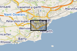
Groundwater temperature data from a shallow urban aquifer in Cardiff, Wales, UK between 2014-2018. Monitoring was undertaken as part of the ‘Cardiff Urban Geo-Observatory’ project . Boreholes are located within the urban area of the City of Cardiff, Wales, UK. The majority of temperature sensors were installed within boreholes that monitor a shallow Quaternary aged sand and gravel aquifer, however the made ground and the Triassic Mercia Mudstone also represented. Temperature sensors installed in 53 boreholes, between depths of 1.5m and 12- m below ground, with measurements every 30 minutes. The dataset comprises of just over 3.5 million temperature measurements. Monitoring was undertaken by the British Geological Survey and was designed to address knowledge gaps of subsurface urban heat island and it use for heat recovery and storage. Metadata Report http://nora.nerc.ac.uk/id/eprint/525332/
-
The dataset consists of data for the UK for the Sustainable Development Goal 6.6.1: groundwater sub-indicator for the period 1990 to 2019. The dataset reports for the UK against Sub-Indicator 5 of Goal 6.6.1, following the recommended procedures in the UNEP report on monitoring methodologies for that sub-indicator. The sub-indicator is defined as the change in mean groundwater levels, averaged over a five-year period, from a mean in levels over a previous five-year reference period. Groundwater level data was obtained from BGS’ WellMaster database. 192 groundwater level monitoring stations were processed and, following quality control, 154 were used to provide estimates of regional variation in groundwater levels for 19 of the 34 HydroBASINS at Level 6 in Great Britain and Northern Ireland. As required by the guidance in the monitoring methodology, the sites chosen are representative of local and regional groundwater systems and are observation and monitoring boreholes where groundwater levels are not systematically affected by abstraction. All sites chosen have average monitoring frequencies of greater than one observation a month. The dataset is provided as a .csv file with the following headers: Column A: HYBAS_ID, HydroBASIN unique identification number. Column B: reference period (1990 to 1994). Columns C to AA: reporting periods (five-year periods starting in 1991) with data reported as percentage change (relative to reference period) in running mean five-year groundwater level by HydroBasin.
-
The dataset describes the results of high pressure experimental measurements of three contrasting 'tight' rocks; a Bowland Shale, a Haynesville shale and Pennant sandstone. The results are tabulated as a csv file, listing experimental parameters, confining pressure, argon gas pore pressure and permeability. complementary measurements of key petrophysical data are provided - bulk modulus of compressibility, porosity TOC and density.
-

Binary presence/absence of ichnotaxa and lamination from the Pliensbachian of the Llanbedr (Mochras Farm) borehole, Wales, together with a summary of runs tests from the same dataset. Used as basis for cyclostratigraphic analysis. Data are at an even 10 cm resolution from 865.0 m depth to 1284.0 m depth in the borehole. Ichnotaxa included are Phycosiphon, Thalassinoides, and Schaubcylindrichnus. Data may be useful for cyclostratigraphic reanalysis. Dataset comprises supplementary files from Pienkowski, G., Uchman, A., Ninard, K., Hesselbo, S.P. 2021. Ichnology, sedimentology, and orbital cycles in the hemipelagic Early Jurassic Laurasian Seaway (Pliensbachian, Cardigan Bay Basin, UK). Global and Planetary Change, publ. date 1st Dec 2021
-
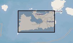
This dataset provides an overview of hydrothermal alteration samples from the island of Milos, Greece, that were analysed using a portable infrared mineral analyser (PIMA) or AgriSpec spectrometer. During data acquisition, spectrums were input into The Spectral Geologist (TSG) to provide an instant and estimated mineral identification using the shortwave infrared (SWIR) part of the electromagnetic spectrum. The samples were acquired during field visits between 2017 - 2019 by the British Geological Survey and the GW4+ Doctorial Training Partnership (NE/L002434/1). This data was primarily used to aid sample collection for further hydrothermal alteration analyses to improve our understanding of regional and local paleo-hydrothermal activity across the island. Identification by the TSG provides an estimation only, and the raw data files in .txt, .fos and .csv formats, are supplied for each analysis in the attached zipped file. This may be useful within the metallic and industrial mineral mining sector and associated researchers. The data includes grid references (± 5 m), TSG interpretations, and field/sample observations noted during data acquisition. GW4+ Doctoral Training Partnership (NE/L002434/1) is supported by grant award GA/09F/139 – RMS E3557, and the British Geological Survey’s University Funding Initiative (BUFI S345).
-
This dataset contains the acquired distributed acoustic sensing (DAS) and hydrophone datasets from a project investigating the usage DAS at the UK Geoenergy Observatory (UKGEOS) research facility in Glasgow, funded by the UK Unconventional Hydrocarbons (UKUH) small project grant. The UKGEOS site in Glasgow has repurposed an abandoned coal mine to investigate its potential as a heat source and heat sink, and its borehole infrastructure includes pre-installed fibre-optic cables. DAS is a novel seismic monitoring technique that utilizes fibre-optic cables to measure small acoustic and seismic vibrations. Comparable to a very densely spaced hydrophone or geophone array, DAS provides unparalleled data resolution and insights into the subsurface. This dataset provides both active source and passive measurements of DAS at the UKGEOS Site 2 prior to the heat pump installation, providing geophysical baseline measurements of the mine. Alongside the acquired DAS data, data from a hydrophone array co-located to the fibre-optic cable was collected during the active source survey to provide a means of comparison to the DAS. NERC and ESRC jointly funded Unconventional Hydrocarbons in the UK Energy System Programme grant - Baseline seismic monitoring survey for UKGEOS Glasgow geothermal production using Distributed Acoustic Sensing (DAS)
 NERC Data Catalogue Service