 NERC Data Catalogue Service
InSAR
Type of resources
Available actions
Topics
Keywords
Contact for the resource
Provided by
Years
Formats
Representation types
Update frequencies
Resolution
-
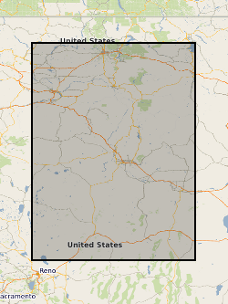
Processed SAR interferograms for the Wells, Nevada earthquake. Grant abstract: How do earthquakes happen? Understanding the nature of earthquakes is a key fundamental question in Geociences that holds many implications for society. Earthquakes are typically associated with a sudden release of energy that has slowly accumulated over hundreds to thousands of years, being strongly controlled by friction in faults buried several kilometers beneath our feet under quite extreme conditions. For example, the amount of heat produced in just a few seconds is such that it can dramatically change the nature of the fault zone near the sliding surface. Moreover, there is abundant evidence of substantial frictional weakening of faults (i.e., fault strength weakens with increasing slip or slip rate) during earthquakes. However, there are still many open questions related to earthquake source processes: How similar are earthquakes in different temperature-pressure conditions? What is the earthquake's energy budget, which controls the intensity of ground motions? What are the physical mechanisms responsible for fault weakening? Recent progress in seismological imaging methods, theoretical fracture mechanics and rupture dynamics simulations can help solve these questions. Huge volumes of freely available seismic and geodetic data from around the world now allow the routine calculation of earthquake models where earthquakes are typically described as single space-time points. Time is now ripe for systematically building robust, more detailed seismic models bearing information on earthquake's physics by using recently developed sophisticated modelling tools along with high-quality images of the 3-D Earth's interior structure enabled by high performance computing facilities. Moreover, it is now possible to model ruptures theoretically in detail using both analytical fracture mechanics calculations and numerical rupture dynamics simulations, and, for example, estimate the fault temperature during the rupture process, which is the most direct way to quantify friction. However, systematic quantitative links between these calculations and seismological observations are still lacking. This project addresses these issues through a coordinated effort involving seismology and rock mechanics aiming at estimating fault temperature rise during earthquakes from new macroscopic seismic source models. We will use advanced seismic source imaging methods to build a new set of robust kinematic, static and dynamic earthquake source parameters for a large selected set of global earthquakes (e.g., average fault length, width, rupture speed and time history, stress drop, radiated and fracture energy). These solutions will then be used as input parameters to estimate fault temperature using analytical and numerical rupture dynamics calculations. This will lead to an improved understanding of how local fault processes occurring at scales from few microns to tens of centimetres translate into macroscopic seismological properties, how energy is partitioned during earthquakes and which are the mechanisms responsible for fault weakening. Ultimately this project will shed new light on many basic questions in earthquake science such as the similarity of earthquakes in different P-T conditions and the potential geological record left by ruptures (e.g., melt). More broadly, this project will benefit hazard models and any studies relying on accurate earthquake source parameters such as studies in seismic tomography, active tectonics and microseismicity (e.g., associated with hydraulic fracturing).
-
This dataset contains a map of ground movements covering the Afar Rift Zone in Ethiopia, Eritrea, and Djibouti for the time period between October 2014 and August 2019. The Afar region is located where three tectonic plates are pulling apart, creating rift segments which are 50-100 km long. Surface deformation on these segments is not constant in time, with episodes of rifting occurring periodically and magma intrusions causing sudden ground movements. We use frequent Sentinel-1 satellite Interferometric Synthetic Aperture Radar (InSAR) observations to measure surface displacements through time across the whole region. We relate these to ground based Global Navigation Satellite Systems (GNSS) observations and combine data from different satellite tracks to produce maps of the average surface velocity in three directions (perpendicular to the rift zone, parallel to the rift zone, and vertical). The continued observation of these time-varying ground movements is important for understanding how continents break up, with data here providing evidence of how tightly focussed extension is around the rift segments and of the subsurface magma movement at several volcanic centres.
-
The datasets contain Interferometric Synthetic Aperture Radar (InSAR) measurements carried out over Caithness and Sutherland in order to measure peatland surface motion over the Flow Country using the Advanced Pixel System Intermittent Small Baseline Subset InSAR technique (APSIS InSAR). The data covers surface motion across all landcover types within the survey area. It includes timeseries of peat surface height and long term mean motion over the survey period. Data was collected on a 6-12 day basis from 12/3/2015-7/7/2019. Missing pixels are associated with low coherence and are excluded. Missing survey dates are associated with processing issues or poor coherence. Data processing was carried out by Terra Motion Ltd. Full details about this dataset can be found at https://doi.org/10.5285/7c2778bf-b498-4ba2-b8cb-60a2081e5ba7
-
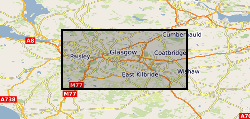
The data represent ground motion results obtained from Interferometric Synthetic Aperture Radar (InSAR) for the UKGEOS – Glasgow site. The InSAR techniques used is called Interferometric Point Target Analysis (IPTA) and the BGS processing is based on Sentinel-1 radar satellite data for the period August 2015 - June 2017. The results include time series of displacement (in mm) during this interval and average velocity across the whole period (in mm/yr) along the satellite Line of Sight (Hanssen, 2001). InSAR has provided information on the baseline conditions of ground stability ahead of any underground activity planned in at the Glasgow Geothermal Energy Research Field Site (GGERFS) as described in Bateson and Novellino (2019). References: Bateson, L.; Novellino, A.. 2019 Glasgow Geothermal Energy Research Field Site : ground motion survey report. Nottingham, UK, British Geological Survey, 35pp. (OR/18/054) (Unpublished). Available at http://nora.nerc.ac.uk/id/eprint/524555/ Hanssen, R., 2001. Radar Interferometry: Dordrecht Kluwer Academic Publishers, The Netherlands (2001) (308 pp.)
-
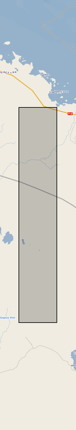
This dataset contains 204 ascending and 300 descending Sentinel-1 geocoded unwrapped interferograms and coherence, and 70 ascending and 102 descending Re-sampled Single Look Complex (RSLC) images for each acquisition date. This data set also includes the original size Digital Elevation Model (DEM) used during InSAR processing. Data used by: Moore et al, 2019, “The 2017 Eruption of Erta 'Ale Volcano, Ethiopia: Insights into the Shallow Axial Plumbing System of an Incipient Mid-Ocean Ridge”.