Abrasion
Type of resources
Available actions
Topics
Keywords
Contact for the resource
Provided by
Years
Formats
Representation types
Update frequencies
Service types
-

IDA272269 Methane and CO2 gas concentrations and stable isotope analyses of cutting samples from GGA05 and GGA08 boreholes of the Glasgow UKGEOS facility. Cutting samples were collected approximately every 3m depth in gas tight isojars by the BGS. Geochemical gas analyses was carried out at the Scottish Universities Environmental Research Centre (SUERC) and consisted of bulk concentration analysis using gas chromatography; followed by δ13CCH4, δ13CCO2, and δD stable isotope analyses on a methane combustion line (full methods attached). This data was collected to investigate the variability of gas fingerprints with depth within the Glasgow coal mine workings, and unmined Carboniferous coal measures. Samples and data are derived from the UK Geoenergy Observatories Programme funded by the UKRI Natural Environment Research Council and delivered by the British Geological Survey.
-

A core scanning dataset from the BHA-101 drill core that was drilled onshore at the Ince Marshes site near the village of Elton, Cheshire, UK as part of the UK Geoenergy Observatories (UKGEOS) Cheshire ground investigation funded by UKRI/NERC. This core scanning dataset pack contains high-resolution optical and radiographic images, X-ray fluorescence (XRF) and physical property downcore point measurements on core from 71.12 m to 121.1 m (Sherwood Sandstone Group) obtained at the Core Scanning Facility (CSF) at the British Geological Survey (BGS).
-

Stress-Dependent permeability data for samples of the Glasgow Main coal and the overlying mudstone and sandstone from the UKGEOS research borehole GGC01. Associated XRD mineralogy, Helium Porosity, bulk and matrix densities are also included. Samples and data are derived from the UK Geoenergy Observatories Programme funded by the UKRI Natural Environment Research Council and delivered by the British Geological Survey.
-

A comprehensive core scanning dataset from the Prees-2C borehole. This borehole was drilled onshore in the Cheshire Basin, Shropshire, UK, in November and December 2020 as part of the JET project (Integrated understanding of Early Jurassic Earth system and timescale - https://gtr.ukri.org/projects?ref=NE 2FN018508 2F1) and principally funded by the ICDP, NERC, and DFG. The approximately 620 m-long Early Jurassic core succession (>99% recovery) mainly comprises mudstone, limestone, and siltstone. The core scanning dataset contains optical images, radiographic images, geophysical and geochemical property data obtained using a Geotek rotating X-ray computed tomography core scanner (RXCT), a Geotek multi-sensor core logger (MSCL-S) and a Cox Analytical Systems XRF core scanner (Itrax MC) at the Core Scanning Facility (CSF) at the British Geological Survey (BGS).
-

Loan IDA number - IDA271576. No data was obtained for microbial cultivation experiments with core samples SSK111460 and SSK111461 from UKGEOS Glasgow Observatory, borehole GGC01. Samples and data are derived from the UK Geoenergy Observatories Programme funded by the UKRI Natural Environment Research Council and delivered by the British Geological Survey. Attached document described methodology of enriching sandstone core (SSK111461) in different media types and shale core (SSK111460) in synthetic groundwater. No microbial growth was seen after 7 months.
-

Porosity of core samples SSK111464 (sandstone) and SSK111465 (shale) calculated using backscatter electron SEM images of carbon coated thin sections processed in ImageJ Fiji software. 85 images of SSK111464 (sandstone) used and 74 images of SSK111465 (shale) at various magnifications. Core samples from UKGEOS Glasgow Observatory, borehole GGC01. Samples and data are derived from the UK Geoenergy Observatories Programme funded by the UKRI Natural Environment Research Council and delivered by the British Geological Survey.
-
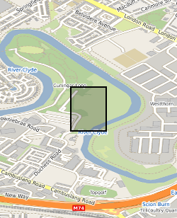
The data release includes groundwater chemistry data from 15 samples collected during the borehole test pumping phase at the UK Geoenergy Observatories (UKGEOS) Glasgow facility. This release from the British Geological Survey (BGS) covers groundwater samples collected between 14 January 2020 and 21 February 2020 and then analysed for the concentrations of selected parameters at BGS and other laboratories. It contains a report and 2 data sheets. Further details can be found in the accompanying report http://nora.nerc.ac.uk/id/eprint/531098/.
-

The borehole information pack from borehole GGC01, site 10 of the UK Geoenergy Observatories (UKGEOS) Glasgow facility. This initial data release pack from BGS contains composite and digital wireline logs; drillers summary logs and prognosis; sample recovery information spreadsheets; and daily driller's borehole records. The cored, seismic monitoring borehole was drilled between 19 November and 12 December 2018 to 199m producing a core of 102 mm diameter. The borehole was wireline logged in December 2018 and a string of 5 seismometers were installed in February 2019. A range of fluid, water and core samples were taken during the drilling process.
-
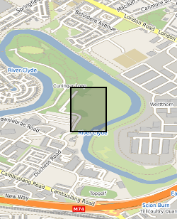
This summary borehole information release is for ‘as-built’ mine water and environmental baseline monitoring boreholes of the UK Geoenergy Observatories (UKGEOS) Glasgow facility at Cuningar Loop. The information pack from BGS contains a brief report with summary tables of locations, drilled depths, screened intervals and illustrative interpretations, and is accompanied with a spreadsheet and shapefile of the borehole locations and drilled depths. The purpose is to give potential users of the Glasgow Observatory an outline of the as-built infrastructure including condition of the target mine workings, as a summary of the more detailed information packs for each borehole. This dataset was updated in June 2020. Further details can be found in the accompanying report http://nora.nerc.ac.uk/id/eprint/526889
-

The borehole information pack from borehole TH0410 at the UK GeoEnergy Observatories (UKGEOS) Cheshire facility. This release from the British Geological Survey (BGS) contains a borehole schematic, borehole metadata, a report from the drilling contractors, geophysical wireline logs, and an index to samples collected from the borehole, which are archived in the National Geological Repository at BGS Keyworth. No core scanning data is available for this borehole and the core has been disposed of.
 NERC Data Catalogue Service