2022
Type of resources
Topics
Keywords
Contact for the resource
Provided by
Years
Formats
Representation types
Update frequencies
Service types
Scale
Resolution
-

This dataset contains VASP runs performed on several supercomputing services (Monsoon and ARCHER, and their successors Monsoon2 and ARCHER2) to calculate the chemical potentials of potassium in liquid iron mixtures and in liquid and solid silicate mixtures, and their distribution in the Earth’s core using density functional theory. Data are available for the chemical potentials of potassium and various other elements in iron and silicate liquid mixtures. These data were used to calculate chemical equilibrium between liquid iron alloys and Earth’s mantle materials. The present grant also supported work regarding the Si composition and thermal history of Earth’s liquid core. Results from VASP runs are also included in the uploaded dataset.
-

An initial core scanning dataset from the TH0424 borehole that was drilled onshore at Thornton Science Park, Cheshire, UK as part of the UK Geoenergy Observatories (UKGEOS) Cheshire ground investigation funded by UKRI/NERC. The approximately 100 m long core succession comprises the Sherwood Sandstone Group. The core scanning dataset contains X-ray radiographic images and geophysical property data obtained using a Geotek rotating X-ray computed tomography (RXCT) core scanner and a Geotek multi-sensor core logger (MSCL-S) at the Core Scanning Facility (CSF) at the British Geological Survey (BGS).
-
X-ray CT scan dataset of Darley Dale sandstone sample tts6. This sample was deformed in a true triaxial apparatus, and is fully described in the PhD thesis of Stuart (1992, UCL). The sample is a cube, measuring approximately 50 mm on a side. The sample experienced two sets of true triaxial deformation (test DDSS0009 and DDSS0010), with different applied stresses in the 1, 2 and 3 directions. This deformation produced distinct families of brittle microcracks, which were detected using acoustic emissions and seismic velocity analysis. This X-ray CT scan dataset was collected in 2019 at the University of Aberdeen by Dr Stewart Chalmers and Dr Dave Healy.
-
This data set contains seismic source parameters (magnitudes, corner frequencies, stress drops and their associated uncertainty) for 94 microseismic events linked to fault reactivation during hydro-fracturing operations in the Horn River Basin (British Columbia). The data presented here were derived from proprietary third party seismic data recorded on 2 arrays of 35 - 15 Hz GEO-OMNI-2400 borehole geophones each. These data were first reported in Adam G Klinger, Maximilian J Werner, Stress drops of hydraulic fracturing induced microseismicity in the Horn River basin: challenges at high frequencies recorded by borehole geophones, Geophysical Journal International, Volume 228, Issue 3, March 2022, Pages 2018–2037, https://doi.org/10.1093/gji/ggab458
-

The initial borehole information pack from the TH0424 Ground Investigation Borehole drilled as part of the UK Geoenergy Observatories (UKGEOS) Cheshire facility. TH0424 was drilled to TD of 101 m between the 08-Nov-2021 and 30-Nov-2021. Drill core was collected from 2 m – 101 mm with 100 mm diameter. This initial data release pack from BGS contains composite and digital wireline logs alongside daily driller's borehole records. This information pack also contains the Initial Core Scan dataset from the BGS Core Scanning Facility (https://doi.org/10.5285/b06d44e6-324d-4e19-bf78-a4520b9b87c8).
-
A compilation of mineral and glass compositions erupted at Villarrica volcano, Chile, measured by electron microprobe. Data are sourced from published articles, theses and unpublished works. Minerals and glasses are from deposits erupted over the last 100ka. This is supporting data for the manuscript entitled 'Insights into Magma Storage Beneath a Frequently Erupting Arc Volcano (Villarrica, Chile) from Unsupervised Machine Learning Analysis of Mineral Compositions' by F. O. Boschetty, D. J. Ferguson, J. A Cortés, E. Morgado, S. K. Ebmeier, D. J. Morgan, J. E. Romero and C. Silva Parejas.
-
Chemical composition of bioleaching experiments on three Turkish karst bauxites using three approaches and equivalent uninoculated controls. Bioleaching methods consist of organic acid bioleaching (Aspergillus), reductive bioleaching (Acidithiobacillus ferrooxidans) and oxidative bioleaching (A. ferrooxidans). Bioleaching experiments were conducted at the British Geological Survey to assess the potential for bauxite to recover rare earth elements from bauxite. Details of experimental design and interpretation is published elsewhere (http://dx.doi.org/10.3390/min10080649)
-
Porosity of core samples SSK111464 (sandstone) and SSK111465 (shale) calculated using backscatter electron SEM images of carbon coated thin sections processed in ImageJ Fiji software. 85 images of SSK111464 (sandstone) used and 74 images of SSK111465 (shale) at various magnifications. Core samples from UKGEOS Glasgow Observatory, borehole GGC01. Samples and data are derived from the UK Geoenergy Observatories Programme funded by the UKRI Natural Environment Research Council and delivered by the British Geological Survey.
-

The data release includes surface and groundwater chemistry data from 86 samples (20 surface water, 60 ground water, and 6 ground water duplicates) collected during the baseline water monitoring at the UK Geoenergy Observatories (UKGEOS) Glasgow facility. This release from the British Geological Survey (BGS) covers surface and groundwater samples collected between 14 September 2020 and 20 May 2021 from 6 surface water sites, 5 mine water boreholes, and 5 environmental monitoring boreholes. The samples were then analysed for the concentrations of selected parameters at BGS and other laboratories. It contains a report and 2 data sheets GroundWaterChemData1 and SurfaceWaterChemData2. Further details can be found in the accompanying report https://nora.nerc.ac.uk/id/eprint/532731/ . Detailed methodologies are reported in Fordyce (2021, http://nora.nerc.ac.uk/id/eprint/529818/ and Palumbo-Roe (2021, http://nora.nerc.ac.uk/id/eprint/531098/ ).
-
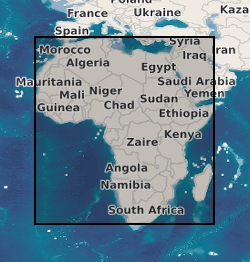
A geographic information system (GIS) containing geo-data for the energy transition across continental Africa created by extracting data from open sources into a series of shapefiles and rasters containing information on culture, geology, geothermal and geophysical data. This data is stored in the World Geodetic System (WGS) 1984 Geographic Projection System.
 NERC Data Catalogue Service