notApplicable
Type of resources
Available actions
Topics
Keywords
Contact for the resource
Provided by
Years
Formats
Representation types
Update frequencies
Scale
Resolution
-

Oxygen and carbon isotope ratios (δ18O, δ13C) were measured on 10 to 12 shells of mixed-layer dwelling species Globigerinoides subquadratus from the 250 to 315 μm size fraction from 425 meters composite depth (mcd) until its extinction at 390 mcd. Analyses then continue with Globigerinoides spp. until 350 mcd. In a few samples, where foraminiferal density was low, only 5–7 specimens were analyzed. Analyses were made with a VG Optima mass spectrometer with multi prep device at the British Geological Survey, Keyworth, UK. When picking shells, care was taken to exclude individuals with broken or missing chambers, although preservation of specimens was generally excellent (Fox & Wade, 2013). The external reproducibility of our measurements is ±0.07‰ and ±0.05‰ for δ18O and δ13C respectively. To examine the reproducibility of the results, duplicate measurements were made on 35 samples (5%), which indicate mean reproducibility better than ±0.12‰ and ±0.14‰ for δ18O and δ13C, respectively. Oxygen isotope data are reported as per mil on the VPDB scale (Table S1) calibrated through laboratory and international standards. At ODP Site 1146, δ18O and δ13C were measured by Holbourn et al., (2010) on the mixed-layer dwelling planktonic foraminifera Globigerinoides obliquus or Gs. subquadratus, using 10 to 20 well-preserved tests from the size fraction 250-350 μm. Paired measurements in 51 samples indicate no significant offset in δ18O and δ13C between Gs. obliquus and Gs. subquadratus. Detailed methods are outlined in Holbourn et al., (2010). δ13C data are not used here. For Mg/Ca analyses, we selected 25–35 specimens of Trilobatus quadrilobatus (140–550 μg) from the 250 to 315 μm size fraction; the same size fraction as used for δ18O analysis, to minimize size-related intraspecific elemental variation (Elderfield et al., 2002). Analyses were performed on 86 samples over the studied interval. The tests were gently crushed and subsequently cleaned according to the protocol of Martin & Lea (2002) to remove clays. Cleaning included a reductive step with hydrazine to remove Mn-(hydr)oxides. Samples were measured on an ICP-AES device at Christian-Albrechts-Universität zu Kiel, Germany. Analytical precision is ~1.1%, based on measurements of an internal laboratory standard. Replicate Mg/Ca measurements revealed an average standard deviation of ~0.08 mmol/mol. Adequate cleaning is indicated by very low Fe/Ca, Al/Ca and Mn/Ca ratios.
-
Rheometry data on ash from Mt Meager, British Columbia, Canada. All measurements that generated these data were performed using an Anton Paar MCR302 rotational rheometer with an Anton Paar powder flow cell attached. The rotating measuring geometry is 24.16 mm in diameter and contains 20 evenly spaced depressions of 1.75 mm that extend the entire length of the measuring cylinder. The profiled nature of this geometry prevents particle slip during rotation. Shear rate sweeps were performed to characterise the rheological behaviour of our pyroclast-gas mixtures. ~50 g of sample (ash from Mt Meager, British Columbia, Canada) was loaded into the powder flow cell with the measuring geometry inserted. Then for a constant gas flux applied to the base of the powder flow cell, the measuring geometry was rotated to apply a range of shear rates starting at 0.1 s-1 ramping up to 328 s-1 with approximately 20 data points generated per decade. These shear rate sweeps were performed for monodisperse grain sizes from 500 µm to 63 µm at a range of volumetric gas flow rates. Specifically for the 500 µm sample the rheology experiments were performed at 0, 15, 30, 45, 50, 55, 60, 65, and 70 L min-1. For the 250 µm sample the rheology experiments were performed at 0, 15, 20, 25, 30, 35, and 40 L min-1. For the 125 µm sample the rheology experiments were performed at 0, 1, 2, 3, 4, 5, 7, 8, 9, and 10 L min-1. For the 63 µm sample the rheology experiments were performed at 0, 0.25, 0.5, 1, 1.5, 2, 3, 4, and 5 L min-1.
-
Analyses of archive rock and soil samples from the Mushgai Khudug (Mongolia), Dalucao, Miaoya and Lizhuang (China) rare earth element deposits. Data characterise mineralogy, bulk rock geochemistry and sequential leaching experiments on laterite, weathered rock and soil overlying carbonatite related REE deposits. The data was collected to determine enrichment and depletion of the REE relative to bedrock, the mineral host of REE and the ease of extraction.
-
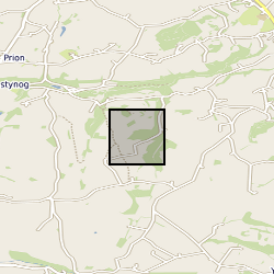
Long-period Magnetotelluric time series recorded in Jan to Feb 2022 at site NT91 near Alnham, England, UK (NT91). Funded by NERC, grant number: NE/V002694/1 "SWIMMR Activities in Ground Effects (SAGE)". These data consist of measurements of the Earth’s natural magnetic and electric field variations.
-
This poster on the UKCCSRC Call 2 project, Performance of Flow Meters with Dense Phase CO2 and CCS Recovery Streams, was presented at the Cardiff Biannual, 10.09.14. Grant number: UKCCSRC-C2-201.
-

FWHM of 19 aragonite samples precipitated from seawater, using a pH stat titrator using the constant composition technique between August 2020 and December 2022. Aragonite precipitation rates are estimated from the rate of titrant dosing. Data were collected to determine how changes in the calcification fluids of calcareous organisms affect aragonite structure. Data were collected by Cristina Castillo Alvarez and Nicola Allison and interpreted by Cristina Castillo Alvarez, Nicola Allison, Adrian Finch, Kirsty Penkman, Roland Kröger and Matthieu Clog.
-
This dataset contains raw data from synthetic and experimental velocity steps analyzed using the MATLAB routine ‘steadystate.m’, as presented by Giacomel, P., Faulkner, D.R., Lambert, V., Allen, M.J (2024): ‘steadystate: A MATLAB-based routine for determining steady-state friction conditions in the framework of rate- and state- friction analysis’ – GSA, Geosphere. The data is provided in .zip folder containing the Velocity Steps and the outputs from steadystate.m, along with the scripts used to generate the figures shown in the Manuscript and Supplementary Material. The folder ‘Velocity_Steps’ notably contains the complete suite of mechanical data (subfolder ‘Mechanical_Data), the modelled rate- and state- friction parameters (subfolder ‘Modelled_RSF_Parameters SlipLaw’) obtained by assuming steady state at different displacements, as well as the linear detrended end members (i.e., at short to large displacements) fitted via inverse modelling (subfolder ‘Detrended_Velocity_Steps + Fit-Inversions’). Such observations were foundational for the development of the steadystate.m routine. Each subfolder is accompanied by a README.txt file that reports on the link between the raw .txt data with the MATLAB scripts generating the associated figures. For the sepiolite fault gouge used during the friction velocity steps, please refer to: Sánchez-Roa, C., Jiménez-Millán, J., Abad, I., Faulkner, D. R., Nieto, F., and García-Tortosa, F. J., 2016, Fibrous clay mineral authigenesis induced by fluid-rock interaction in the Galera fault zone (Betic Cordillera, SE Spain) and its influence on fault gouge frictional properties: Applied Clay Science, v. 134, p. 275-288.
-
This dataset includes raw point cloud data from repeat terrestrial laser scans (TLS) for a field of protodunes that initiated and developed on a desert gravel interdune surface close to Helga's dune at Gobabeb, Namibia. As well as the TLS data, additional measurements of the wind speed through a CSAT 3D sonic anemometer and sediment transport using a Sensit.
-
In March 2010, the Scottish CCS (Carbon Capture & Storage) Consortium began an extensive Front End, Engineering and Design (FEED) study to assess what would be required from an engineering, commercial and regulatory, perspective in order to progress the CCS demonstration project at Longannet Power station in Scotland through to construction. The study yielded invaluable knowledge and the resulting material are available for download here. This section of the report illustrates how the End-to-End CCS chain must be considered as a system as well as separate elements. It builds upon the description of the individual elements contained in Section 3, and captures the development of the End-to-End CCS chain design carried out during FEED. Specifically, this section focuses on the following aspects: Commissioning the system in preparation for operations, as well as decommissioning at the end of the capture and storage period; Operations and maintenance activities; Control; Metering and monitoring; Venting; This section also provides some selected information on the individual CCS chain elements and a summary of the RAM (reliability, availability and maintainability) analysis undertaken during FEED of which one of the key outputs was the anticipated CO2 injection profile for the project. The appropriate summary section from the Feed Close Out Report can be downloaded as a PDF (End to end CCS chain operation.pdf). The main text of the FEED Close Out Report, together with the supporting appendix for this section can be downloaded as PDF files. Note this dataset is a duplicate of the reports held at the National Archive which can be found at the following link - http://webarchive.nationalarchives.gov.uk/20121217150421/http://decc.gov.uk/en/content/cms/emissions/ccs/ukccscomm_prog/feed/scottish_power/ccs_chain/ccs_chain.aspx
-
Microgravity data collected at Uturuncu Volcano located in the Altiplano-Puna Volcanic Complex, central Andes, in November 2022. Raw data collected along a survey line spanning from Laguna Colorada to Laguna Verde using a field gravimeter. All data have been preprocessed and corrected for tidal and drift effects. Data are reported with respect to reference station UBAS located to the west of Uturuncu near the Laguna Colorada.
 NERC Data Catalogue Service