1993
Type of resources
Available actions
Topics
Keywords
Contact for the resource
Provided by
Years
Formats
Representation types
Update frequencies
Scale
-
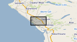
The Nirex Digital Geoscience Database (NDGD) holds extensive sets of data describing geoscientific, geographical, hydrogeological and logistical aspects of the Sellafield area in western Cumbria region. Some datasets comprise unmodified field data (as collected, measured or observed in the field). Others include values assessed during laboratory analysis or testing. Derived or interpolated information, resulting from modelling activity or the integration of several datasets, also accounts for a significant portion of the NDGD holding. The data consists of mainly borehole derived information including Borehole location and survey information, Sample location information, Logistics, Geological, geophysical (including borehole geophysical logs) and geotechnical borehole Geology datasets and Hydrological, hydrogeological and hydrochemical borehole datasets (though information from the down-hole monitoring strings and most groundwater related information is not held in the NDGD). The NDGD holds all of the raw and processed digital data arising from the Nirex (Nuclear Industry Radioactive Waste Executive) Sellafield Geological investigations boreholes drilled during their investigation programme into the suitability of Sellafield as a site for the disposal of intermediate and long-lived low level radioactive waste between 1989 and 1997. The ownership of Nirex (Nuclear Industry Radioactive Waste Executive) was transferred from the nuclear industry to the UK Government departments DEFRA and DTI in April 2005, and then to the UK's Nuclear Decommissioning Authority (NDA) in November 2006.
-
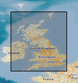
Laboratory results for the analysis of soil samples collected from urban areas during the baseline geochemical mapping programme of Britain. Sample sites are described on field slips. Chemical results are subjected to high level of quality control in the laboratory. Results are the raw data processed (standardisation and normalisation) to give seamless geochemical images and the value added G-BASE (Geochemical Baseline Survey of the Environment) data in the BGS geochemistry database.
-
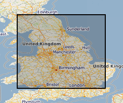
Soil samples collected in urban areas throughout the UK are analysed for their major and trace element geochemistry, their pH and organic matter content. Samples are collected at two depths; 0-15cm and 35-45cm at sites selected using a stratified, random design. The data can be used to identify and prioritize contaminated sites. In 1993, the Geochemical Baseline Survey Of The Environm (G-BASE) rural geochemical mapping programme was extended to include sampling in urban areas and to date around 22 urban centres have been sampled. Data is available on key inorganic contaminants including Cr, Cu, Cd, Ni, As, Pb, Zn, Sn and Sb. Results have been standardised to ensure seamless joins between geochemical sampling campaigns. Urban centres are selected in areas where rural sampling is undertaken or where the BGS urban programme is active. Urban centres will continue to be sampled until completion of the rural programme, scheduled for 2015.
-

A set of seismic track data and accompanying interpretations in XGEO proprietary format. All of the data are project based and are commercially obtained. The interpretations and track data are confidential to the customer. Track data is digitised from maps and charts and combined with digitised seismic profile data interpreted by the geologist. Data are held by project and by user id. All project based datasets are complete but these data are not available to users except where explicit permission has been sought from the data supplier. Seismic track data is usually sampled at every 10th shotpoint. This represents a sampling interval of 250m. The seismic sections will have limits in two way time up to 10 seconds. Data is presented to UKOOA and SEQ standards in terms of data formats. There is a low level of consistency in reflector nomenclature inter-project but totally consistent intra-project.
-

MONA LISA (Marine and Onshore North Sea Acquisition for Lithospheric Seismic Analysis) seismic data was acquired by BIRPS (the British Institutions Reflection Profiling Syndicate) across the Ringkobing-Fyn High of the central North Sea were designed to study the crust near a hypothesized Caledonian age triple junction associated with the colliding continental crust of Laurentia, Avalonia (Gondwanaland) and Baltica. The specific target was the eastward continuation of the Caledonian Front (Iapetus Suture), as previously recognised on NEC (North East Coast line), MOBIL (Measurements over Basins to Image Lithosphere), NSDP (North Sea Deep Profile) and BABEL (Baltic and Bothnian Echoes from the Lithosphere) profiles, in northern Europe. 1112 km of data were acquired, recorded to 26 s two-way time.
-

WESTLINE was acquired by BIRPS (the British Institutions Reflection Profiling Syndicate). The seismic data image the faulted conjugate margins of the Rockall Trough and the intrabasinal sediments. The seismic data were shot to 18 s two-way time along a single 450 km-long transect.
-
In January 1993, as part of the Joule II Non-nuclear Energy Research Programme, the European Commission initiated a two year study of the potential for the disposal of industrial quantifies of carbon dioxide underground, with a view to reducing emissions to the atmosphere. The participants in the study were the British Geological Survey (UK), TNO Institute of Applied Geoscience (The Netherlands), BRGM (France), CRE Group Ltd (UK), IKU Petroleum Research (Norway), RWE AG (Germany), University of Sunderland Renewable Energy Centre (UK) and Statoil (Norway). The objective of the study was to examine whether carbon dioxide emissions from large point sources such as power stations, could be disposed of safely, economically and with no adverse effects on man and the environment. Project No. CT92-0031.
-
The Lexicon of Named Rock Units provides definitions of lithostratigraphic, lithodemic, and litho-morpho-genetic geological units of the United Kingdom and its associated continental shelf. The Lexicon focuses mainly on units of Member, Formation, Group and higher rank (and equivalents) but it also includes information on some units of lesser rank, notably economically important coal seams and laterally extensive marine bands. It includes superficial and bedrock units. It includes synonyms and other names not currently recognised by the BGS or regarded as obsolete. Full Lexicon entries include geological unit name, a persistent unique identifier, map code, currency, rank, parent unit and rank, age, lithology, definitions of boundaries, thickness, previous and alternative names, geographical extent, type localities, and bibliographical references.
-
The SAM II instrument, aboard the Earth-orbiting Nimbus 7 spacecraft, was designed to measure solar irradiance attenuated by aerosol particles in the Arctic and Antarctic stratosphere. The scientific objective of the SAM II experiment was to develop a stratospheric aerosol database for the polar regions by measuring and mapping vertical profiles of the atmospheric extinction due to aerosols. This database allows for studies of aerosol changes due to seasonal and short-term meteorological variations, atmospheric chemistry, cloud microphysics, and volcanic activity and other perturbations. The results obtained are useful in a number of applications, particularly the evaluation of any potential climatic effect caused by stratospheric aerosols. This dataset collection contains 14 years of polar Arctic and Antarctic aerosol extinction profiles, atmospheric temperature and pressure data obtained from the Stratospheric Aerosol Instrument II (SAM II) on the NIMBUS 7 satellite.
-
This dataset comprises linear and areal habitat information and vegetation species recorded during an ecological survey of stratified random 1km square sites across England in 1992 and 1993. The survey was carried out by the Institute of Terrestrial Ecology (which later became part of the Centre for Ecology & Hydrology (CEH)) and was commissioned in order to carry out survey work into habitats which were perceived to be under threat or which represented areas of concern to the Department for the Environment (named as 'Key Habitats'). The habitats (or landscape types) in question were: Lowland heaths, chalk and limestone grasslands, coasts and uplands. The survey was designed to complement CEH's national ecological survey, the 'Countryside Survey'. Full details about this dataset can be found at https://doi.org/10.5285/7aefe6aa-0760-4b6d-9473-fad8b960abd4
 NERC Data Catalogue Service