
Earthquakes
Type of resources
Available actions
Topics
Keywords
Contact for the resource
Provided by
Years
Formats
Representation types
Update frequencies
Service types
Scale
-
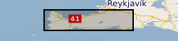
Contains location and associated parameter information for microseismicity detected in the Reykjanes peninsula between June 2020 and August 2021. Primary detection and location carried out using Quakemigrate. Template matching used to find very small magnitude events. GrowClust used to obtain accurate relative relocations. Local magnitudes of events also computed. Data from a total of 42 stations were used for the detection and location process. Repository also includes the 1-D velocity model used for the relocation.
-

Ascii files and tables with earthquake source and model parameters for five events in the Azores archipelago.
-
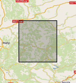
Terrestrial laser scanning datasets (including GPS data for georeferencing), and field photographs collected during the 2016 Central Italian Earthquake sequence. Data were collected from multiple localities to capture the co- seismic near-fault deformation along the earthquake surface ruptures from the 30th Oct Norcia Earthquake. See the scan_data.xlsx for individual details of each laser scan location, and readme.txt for a complete description. In each scan site folder you can find the unprocessed raw files and processed ascii files. Field photographs taken at the site and in the aftermath of the 2016 Norcia Earthquake (30th October 2016, Mw6.6) are provided. Relevant references are: Wilkinson, MW, KJW McCaffrey, RR Jones, GP Roberts, RE Holdsworth, LC Gregory, RJ Walters, LNJ Wedmore, H Goodall, F Iezzi (2017). Near-field fault slip of the 2016 Vettore Mw 6.6 earthquake (Central Italy) measured using low-cost GNSS. Scientific Reports 7: 4612. Walters, RJ, LC Gregory, LNJ Wedmore, TJ Craig, K McCaffrey, M Wilkinson, J Chen, Z Li, JR Elliott, H Goodall, F Iezzi, F Livio, AM Michetti, G Roberts, E Vittori (2018). Dual control of fault intersections on stop-start rupture in the 2016 Central Italy seismic sequence. Earth and Planetary Science Letters 500, 1-14. Wedmore, LNJ, LC Gregory, KJW McCaffrey, H Goodall, RJ Walters (in review). Partitioned off-fault deformation in the 2016 Norcia earthquake captured by differential terrestrial laser scanning. Submitted to Geophysical Research Letters (directly related to this dataset). The dataset will also be available on opentopography.com once the above paper is accepted.
-
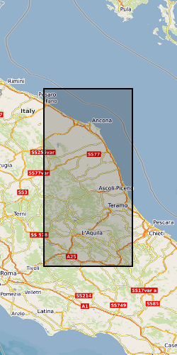
The data collection consists of 25 3-component broadband seismic station at 100sps (approx. 45mb per station, per day) located in the epicentral area of the 26th August 2016, M=6.0 Amatrice earthquake. The sequence evolved with strong mainshocks for over 6 months reaching a maximum magnitude of M=6.4 that struck Norcia town on October 30th, 2016. In line with SEIS-UK guidelines data was archived with the IRIS data management facility (https://ds.iris.edu/ds/nodes/dmc/) under the FDSN network code YR and using the network name “Amatrice Sequence International”. The project has the digital identifier https://doi.org/10.7914/SN/YR_2016.
-

Terrestrial laser scanning datasets (including GPS data for georeferencing), structure from motion datasets, and field photographs collected during the 2016 Central Italian Earthquake sequence. Data were collected from multiple localities to capture the co- and post- seismic near-fault deformation along the earthquake surface ruptures. See the scan_data.xlsx for individual details of each laser scan location, and readme.txt for a complete description. In each scan site folder you can find the unprocessed raw files and processed ascii files. Note, not all processed files are georeferenced.This is due to time constraints on field data collection. Georeferencing for these data can be achieved by point cloud matching to other georeferenced scans. Photos for structure from motion (SfM) datasets were collected with a Nikon camera. All original photos are provided. Field photographs taken in the aftermath of the 2016 Norcia Earthquake (30th October 2016, Mw6.6) are also provided. Relevant references are: Wilkinson, MW, KJW McCaffrey, RR Jones, GP Roberts, RE Holdsworth, LC Gregory, RJ Walters, LNJ Wedmore, H Goodall, F Iezzi (2017). Near-field fault slip of the 2016 Vettore Mw 6.6 earthquake (Central Italy) measured using low-cost GNSS. Scientific Reports 7: 4612. Walters, RJ, LC Gregory, LNJ Wedmore, TJ Craig, K McCaffrey, M Wilkinson, J Chen, Z Li, JR Elliott, H Goodall, F Iezzi, F Livio, AM Michetti, G Roberts, E Vittori (2018). Dual control of fault intersections on stop-start rupture in the 2016 Central Italy seismic sequence. Earth and Planetary Science Letters 500, 1-14. Wedmore, LNJ, LC Gregory, KJW McCaffrey, H Goodall, RJ Walters (in review). Partitioned off-fault deformation in the 2016 Norcia earthquake captured by differential terrestrial laser scanning. Submitted to Geophysical Research Letters.
-
This catalogue contains the times, locations, families, and durations of earthquakes identified near Parkfield, California, USA. Collected over the period of 2020 – 2022. The methodology used to identify the earthquakes is described by Huang, H., Hawthorne, J.C. Linking the scaling of tremor and slow slip near Parkfield, CA. Nat Commun 13, 5826 (2022). https://doi.org/10.1038/s41467-022-33158-3. The data provided here are also provided in the supplement of that paper. This catalogue contains the times (columns 1-2), locations (columns 3-5: latitude, longitude, and depth), families (column 6), and durations (columns 7).
-

This is a set of data points for constructing a seismic hazard map of the UK, plotting the intensity (EMS) with a return period of 475 years, equivalent to a 90% probability of not being exceeded in 50 years. Individual data points should NOT be used.
-
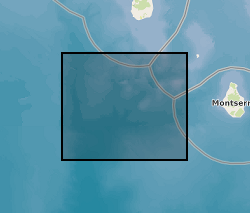
Earthquake hypocenters for all earthquakes detected on Montserrat by the Montserrat Volcano Observatory seismic network from July 1995 to February 2018 inclusive. Information includes: Origin Time, Latitude, Longitude, Depth, Hypocenter Errors, RMS and the number of stations used for each location.
-

Theoretical waveforms computed to study earthquakes in the Azores archipelago. Grant abstract: How do earthquakes happen? Understanding the nature of earthquakes is a key fundamental question in Geociences that holds many implications for society. Earthquakes are typically associated with a sudden release of energy that has slowly accumulated over hundreds to thousands of years, being strongly controlled by friction in faults buried several kilometers beneath our feet under quite extreme conditions. For example, the amount of heat produced in just a few seconds is such that it can dramatically change the nature of the fault zone near the sliding surface. Moreover, there is abundant evidence of substantial frictional weakening of faults (i.e., fault strength weakens with increasing slip or slip rate) during earthquakes. However, there are still many open questions related to earthquake source processes: How similar are earthquakes in different temperature-pressure conditions? What is the earthquake's energy budget, which controls the intensity of ground motions? What are the physical mechanisms responsible for fault weakening? Recent progress in seismological imaging methods, theoretical fracture mechanics and rupture dynamics simulations can help solve these questions. Huge volumes of freely available seismic and geodetic data from around the world now allow the routine calculation of earthquake models where earthquakes are typically described as single space-time points. Time is now ripe for systematically building robust, more detailed seismic models bearing information on earthquake's physics by using recently developed sophisticated modelling tools along with high-quality images of the 3-D Earth's interior structure enabled by high performance computing facilities. Moreover, it is now possible to model ruptures theoretically in detail using both analytical fracture mechanics calculations and numerical rupture dynamics simulations, and, for example, estimate the fault temperature during the rupture process, which is the most direct way to quantify friction. However, systematic quantitative links between these calculations and seismological observations are still lacking. This project addresses these issues through a coordinated effort involving seismology and rock mechanics aiming at estimating fault temperature rise during earthquakes from new macroscopic seismic source models. We will use advanced seismic source imaging methods to build a new set of robust kinematic, static and dynamic earthquake source parameters for a large selected set of global earthquakes (e.g., average fault length, width, rupture speed and time history, stress drop, radiated and fracture energy). These solutions will then be used as input parameters to estimate fault temperature using analytical and numerical rupture dynamics calculations. This will lead to an improved understanding of how local fault processes occurring at scales from few microns to tens of centimetres translate into macroscopic seismological properties, how energy is partitioned during earthquakes and which are the mechanisms responsible for fault weakening. Ultimately this project will shed new light on many basic questions in earthquake science such as the similarity of earthquakes in different P-T conditions and the potential geological record left by ruptures (e.g., melt). More broadly, this project will benefit hazard models and any studies relying on accurate earthquake source parameters such as studies in seismic tomography, active tectonics and microseismicity (e.g., associated with hydraulic fracturing).
-

Observed global seismograms used to study earthquakes in the Azores. The seismograms have been processed and then have been used to perform source inversions of the events.