 NERC Data Catalogue Service
InSAR ground motion data between 2015 and 2017 over UKGEOS - Glasgow
The data represent ground motion results obtained from Interferometric Synthetic Aperture Radar (InSAR) for the UKGEOS – Glasgow site. The InSAR techniques used is called Interferometric Point Target Analysis (IPTA) and the BGS processing is based on Sentinel-1 radar satellite data for the period August 2015 - June 2017. The results include time series of displacement (in mm) during this interval and average velocity across the whole period (in mm/yr) along the satellite Line of Sight (Hanssen, 2001). InSAR has provided information on the baseline conditions of ground stability ahead of any underground activity planned in at the Glasgow Geothermal Energy Research Field Site (GGERFS) as described in Bateson and Novellino (2019). References: Bateson, L.; Novellino, A.. 2019 Glasgow Geothermal Energy Research Field Site : ground motion survey report. Nottingham, UK, British Geological Survey, 35pp. (OR/18/054) (Unpublished). Available at
http://nora.nerc.ac.uk/id/eprint/524555/
Hanssen, R., 2001. Radar Interferometry: Dordrecht Kluwer Academic Publishers, The Netherlands (2001) (308 pp.)
Simple
- Date (Creation)
- 2021-02-03
Distributor
British Geological Survey
-
Enquiries
0115 936 3276
The Lyell Centre, Research Avenue South
,
EDINBURGH
,
LOTHIAN
,
EH14 4AP
,
United Kingdom
0115 936 3142
0115 936 3276
Point of contact
British Geological Survey
-
Enquiries
0115 936 3276
The Lyell Centre, Research Avenue South
,
EDINBURGH
,
LOTHIAN
,
EH14 4AP
,
United Kingdom
0115 936 3142
0115 936 3276
Distributor
British Geological Survey
-
Enquiries
0115 936 3276
Environmental Science Centre, Nicker Hill, Keyworth
,
NOTTINGHAM
,
NOTTINGHAMSHIRE
,
NG12 5GG
,
United Kingdom
0115 936 3143
0115 936 3276
Point of contact
British Geological Survey
-
Enquiries
0115 936 3276
Environmental Science Centre, Nicker Hill, Keyworth
,
NOTTINGHAM
,
NOTTINGHAMSHIRE
,
NG12 5GG
,
United Kingdom
0115 936 3143
0115 936 3276
- Maintenance and update frequency
- notPlanned Not planned
- GEMET - INSPIRE themes, version 1.0
- BGS Thesaurus of Geosciences
-
- Radar
- InSAR
- dataCentre
- Keywords
-
- NERC_DDC
- Access constraints
- otherRestrictions Other restrictions
- Other constraints
- licenceOGL
- Use constraints
- otherRestrictions Other restrictions
- Other constraints
- The copyright of materials derived from the British Geological Survey's work is vested in the Natural Environment Research Council [NERC]. No part of this work may be reproduced or transmitted in any form or by any means, or stored in a retrieval system of any nature, without the prior permission of the copyright holder, via the BGS Intellectual Property Rights Manager. Use by customers of information provided by the BGS, is at the customer's own risk. In view of the disparate sources of information at BGS's disposal, including such material donated to BGS, that BGS accepts in good faith as being accurate, the Natural Environment Research Council (NERC) gives no warranty, expressed or implied, as to the quality or accuracy of the information supplied, or to the information's suitability for any use. NERC/BGS accepts no liability whatever in respect of loss, damage, injury or other occurence however caused.
- Other constraints
- Available under the Open Government Licence subject to the following acknowledgement accompanying the reproduced NERC materials "Contains NERC materials ©NERC [year]"
- Spatial representation type
- vector Vector
- Metadata language
- EnglishEnglish
- Topic category
-
- Geoscientific information
- Geographic identifier
-
Glasgow [id=1298677]
- Date (Revision)
- 2002
N
S
E
W
))
- Begin date
- 2015-08-15
- End date
- 2017-06-11
- Unique resource identifier
- WGS 84 (EPSG::4326)
- Distribution format
-
-
Comma-separated values (CSV)
(
witheld
)
-
Comma-separated values (CSV)
(
witheld
)
Distributor
British Geological Survey
-
Enquiries
0115 936 3276
The Lyell Centre, Research Avenue South
,
EDINBURGH
,
LOTHIAN
,
EH14 4AP
,
United Kingdom
0115 936 3142
0115 936 3276
Distributor
British Geological Survey
-
Enquiries
0115 936 3276
Environmental Science Centre, Nicker Hill, Keyworth
,
NOTTINGHAM
,
NOTTINGHAMSHIRE
,
NG12 5GG
,
United Kingdom
0115 936 3143
0115 936 3276
- OnLine resource
- Data ( WWW:DOWNLOAD-1.0-http--download )
- OnLine resource
-
Citation Information - Digital Object Identifier (DOI)
(
WWW:LINK-1.0-http--related
)
British Geological Survey (2021): InSAR ground motion data between 2015 and 2017 over UKGEOS - Glasgow. British Geological Survey. (Dataset). https://doi.org/10.5285/ce921bb4-4f8c-43bb-af50-c32e6eae9919
- Hierarchy level
- dataset Dataset
- Other
- dataset
Conformance result
- Date (Publication)
- 2011
- Explanation
- See the referenced specification
- Pass
- No
Conformance result
- Date (Publication)
- 2010-12-08
- Explanation
- See http://eur-lex.europa.eu/LexUriServ/LexUriServ.do?uri=OJ:L:2010:323:0011:0102:EN:PDF
- Pass
- No
- Statement
- InSAR (and IPTA) can measure terrain displacements along the satellite Line of Sight (LOS) using the radar signal phase change between two images acquired over the same area at different times, co-registered to form an interferogram (Rosen et al., 2000). Rosen, P.A., Hensley, S., Joughin, I.R., Li, F.K., Madsen, S.N., Rodriguez, E., Goldstein, R., 2000. Synthetic aperture radar interferometry. Proc. IEEE, 88, pp. 333-382, 10.1109/5.838084
- File identifier
- bc11ffe2-c6b9-0480-e054-002128a47908 XML
- Metadata language
- EnglishEnglish
- Hierarchy level
- dataset Dataset
- Date stamp
- 2026-05-03
- Metadata standard name
- UK GEMINI
- Metadata standard version
- 2.3
Point of contact
British Geological Survey
Environmental Science Centre, Keyworth
,
NOTTINGHAM
,
NOTTINGHAMSHIRE
,
NG12 5GG
,
United Kingdom
+44 115 936 3100
- Dataset URI
- http://data.bgs.ac.uk/id/dataHolding/13607715
Overviews
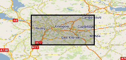
Spatial extent
N
S
E
W
Provided by

Associated resources
Not available