From 1 - 4 / 4
  • The UK Geoenergy Observatories (UKGEOS) Glasgow bedrock model outputs, created by the British Geological Survey, provide a semi-regional overview of the depth and extent of bedrock lithostratigraphic units, coals and faults. The model allows users to visualise the likely subsurface sequence to be found beneath this part of Glasgow, applicable at a scale of around 1: 25,000 to 1: 10,000. The data is supplied as grids, triangulated surfaces and shapefiles over a 5 by 4.15 km area, with the depth range to around 350 m below Ordnance Datum. This model describes an interpretation of the bedrock geology after the UKGEOS Glasgow boreholes had been drilled, the results of the nine UKGEOS boreholes that penetrated bedrock have been incorporated. Further details and model limitations can be found in the accompanying metadata report http://nora.nerc.ac.uk/id/eprint/531157/

  • The UK Geoenergy Observatories (UKGEOS) Glasgow superficial deposits GSI3D model outputs, created by the British Geological Survey, provide a semi-regional overview of the depth, thickness and extent of glacial and post-glacial lithostratigraphic units above rockhead. The model allows users to visualise the likely subsurface sequence to be found beneath this part of Glasgow, applicable at a scale of around 1: 25,000 to 1: 10,000. The data is supplied as grids and shapefiles over a 7 by 4.15 km area, with the depth range to around 40 m below Ordnance Datum. This model describes an interpretation of the shallow geology updated to incorporate the results of drilling the 12 UKGEOS Glasgow boreholes (post-drill model). Further details and model limitations can be found in the accompanying metadata report http://nora.nerc.ac.uk/id/eprint/531155/ . DOI: https://doi.org/10.5285/915f690f-32cf-41b7-984e-c32344d3a543

  • The UK Geoenergy Observatories (UKGEOS) Glasgow 3D coal mine model outputs, created by the British Geological Survey, provide a semi-regional overview of the depth and extent of surveyed and probable coal mine workings, plus stone and coal roads surveyed within the mines. The model allows users to visualise the surveyed and probable coal mine workings to be found beneath this part of Glasgow, applicable at a scale of around 1: 25,000 to 1: 10,000. The data is supplied as grids, triangulated surfaces over a 5 by 4.15 km area, with the depth range to around 300 m below Ordnance Datum. The mine extents are ‘cut out’ of the UKGEOS Glasgow post-drill bedrock model. This model describes both surveyed (recorded on mine abandonment plan) and probable coal mine workings. An area of probable workings has been updated to account for the results of drilling borehole GGC01. Further details and model limitations can be found in the accompanying metadata report http://nora.nerc.ac.uk/id/eprint/531157/

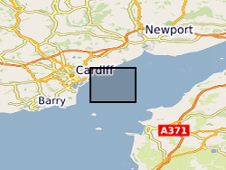
  • MEDIN Data. Within the project (WFA-CPC EMFF Protecting Our Seas), benthic and geophysical surveys were undertaken in the Severn Esturary/Môr Hafren SAC to explore the location of Sabellaria alveolata reefs, and collected bathymetry, sidescan sonar, AGDS and acoustic imagery data (ARIS) to identify areas of variable ground or potential features. A ten-day survey was undertaken in July 2020 to collect broad-scale acoustic data using an interferometric swath bathymetric system (GeoSwath Plus) and Acoustic Ground Discrimination System (RoxAnn™ AGDS). Twelve secondary survey areas were selected to be investigated in greater detail using high frequency sidescan sonar and an Acoustic Resonance Inspection System (ARIS Explorer 3000) camera in a second ten-day survey conducted in August 2020 (https://www.envision.uk.com/wp-content/uploads/2022/03/2018-1008-NRW-WFA-Protecting_Our_Seas_Final_Report_20210201.pdf) The data sets include: SSS (.tif) collected using Trident SeaStar MBES (.xyz) collected using GeoSwath Plus, AGDS (.csv and .asc) collected using RoxAnn™ AGDS ARIS imagery (.png and .mp4) collected using ARIS Explorer 3000 camera Shapefiles (.shp etc)