
1968
Type of resources
Topics
Keywords
Contact for the resource
Provided by
Years
Formats
Representation types
Update frequencies
Scale
-
[This metadata record has been superseded, see http://data.bgs.ac.uk/id/dataHolding/13480412].The G-BASE programme involves systematic sampling and the determination of chemical elements in samples of stream sediment, stream water and soil, to build up a picture of the surface chemistry of the UK. G-BASE for SW England is the most recent area of the UK sampled by this on-going project The average sample density for stream sediments is approximately one site per 2km square. Density for soils in SW England is variable across the area, ranging from 1 per 2km square to one per 5km square, depending on underlying parent material. Analytical precision is high with strict quality control to ensure countrywide consistency. Results have been standardised to ensure continuity with existing G-BASE geochemical data. The data provide baseline information on the natural abundances of elements, against which anomalous values due to such factors as mineralisation and industrial contamination may be compared. Analytical data for the sub150 microns fraction of stream sediment and the sub 2mm fraction of soil samples are available for some or all of: Ag, Al, As, Ba, Bi, Br, Ca, Cd, Ce, Cl, Co, Cr, Cs, Cu, Fe, Ga, Ge, Hf, I, In, K, La, Mg, Mn, Mo, Na, Nb, Nd, Ni, P, Pb, Rb, S, Sb, Sc, Se, Si, Sm, Sn, Sr, Ta, Te, Th, Ti, Tl, U, V, W, Y, Yb, Zn, and Zr.
-
The British Geological Survey onshore borehole collection database of core and sample types and depths contains records of over 15 000 onshore boreholes drilled in the UK by BGS, commercial and public bodies. Material types include continuous drillcore, core samples, individual hand specimens, bulk samples, unwashed cuttings, washed and dried cuttings, plugs, powders and bulk samples. The physical collection and database was developed as part of the British Geological Survey's responsibility to establish and maintain a national borehole collection. Details of the collection are held in the Borehole Materials Database, and may be accessed via the BGS website. The collection was initiated in 1968, and the database is updated daily by the addition of new data and by modification of existing data. Most material is stored at the facility in BGS Keyworth. Some material is held at BGS Edinburgh. The majority of borehole cores and samples are available for study and sub-sampling by bona fide academics and commercial companies. Commercial companies are charged for access; academics will need to complete an academic waiver form. Some boreholes, especially recent hydrocarbon wells, are confidential, and depths and sample details may not be given. If you require further information about these boreholes, contact kwcorestore@bgs.ac.uk for details of the owner. In a few cases, the precise map references are also confidential.
-

Laboratory results for the analysis of geochemical samples (stream sediments, soil and water) collected for the high resolution geochemical mapping of mainland Britain. The programme of regional geochemical sampling began in 1968 in the northern Highlands of Scotland. Sample sites are described on field slips. Chemical results are subjected to high level of quality control in the laboratory. Results are the raw data processed (standardisation and normalisation) to give seamless geochemical images and the value added G-BASE (Geochemical Baseline Survey of the Environment ) data in the BGS geochemistry database.
-

The BGS Geochemical Baseline Survey of the Environment (G-BASE) was the national strategic geochemical mapping programme in Great Britain. The project set out to establish the chemistry of the surface environment by the collection and analysis of stream sediment, stream water and soil samples. Beginning in the late 1960s in northern Scotland and moving southwards across the country, the primary focus was mineral exploration, however, the project quickly developed to address important environmental concerns. The final G-BASE samples were collected in southern England in 2014. The outputs from the G-BASE project provide an invaluable, systematic baseline of geochemical information for Great Britain, serving as a marker of the state of the environment against which to measure future change. Sampling Stream sediments were the primary sample medium for G-BASE. The sediment was collected from the centre of the stream and sieved through two sieves (2 mm and 150 µm) to obtain a fine grain-size fraction of <150 µm. Excess material from the <2 mm fraction was panned to collect a heavy mineral concentrate. Stream water samples were collected also at each drainage site. Four different water samples were collected routinely: two filtered waters (for major and trace elements) and two unfiltered waters (for pH, conductivity and alkalinity). The routine collection of soil samples was introduced in 1986 in areas of poor drainage density, and urban soil sampling commenced in 1991. Further details of the sampling methodology can be found in the G-BASE field procedures manual (https://nora.nerc.ac.uk/id/eprint/5190/). Sample analysis Stream water pH, conductivity and alkalinity were determined in the field. Water samples were returned to our laboratories and analysed by inductively coupled atomic emission and mass spectrometry (ICP-AES/MS), ion chromatography (IC) / ion selective electrode (ISE) for up to 50 chemical parameters. Waters were also analysed for non-purgeable organic carbon (NPOC) to determine dissolved organic carbon content. Most water samples were analysed for alkalinity, pH, conductivity, F and U and some for multi-element analyses including Al, Cl, Na, Si, SO4, NO4, and TOC. The <150 µm fraction of the stream sediment and the <2 mm fraction of topsoil were analysed by techniques including X-ray fluorescence (XRF) / direct reading optical emission spectrometry (DR-OES) to determine the concentration of up to 53 major and trace elements. Loss on ignition (LOI) and pH were determined in topsoil samples. Analytical data for the 150 micron fraction of soil and stream sediment samples are available for some or all of: Ag, As, B, Ba, Bi, Be, Ca, Ce, Cd, Co, Cr, Cs, Cu, Fe, Ga, K, La, Li, Mg, Mn, Mo, Nb, Ni, P, Pb, Rb, Sb, Se, Sn, Sr, Th, Ti, U, V, Y, Zn, Zr. In later stages, the project also routinely determined the elements listed in the <2 mm fraction of surface soils. Sample storage and archive After preparation and analyses all soil, stream sediment and panned concentrate samples and excess material were stored and archived at the National Geoscience Data Centre (NGDC). The archive holds more than 40 years’ worth of material collected across the UK. Archived samples can be made available for further tests and analyses on request by contacting BGS Enquiries (mailto:enquiries@bgs.ac.uk).
-

A collection of hydrogeological maps created by the British Geological Survey between 1967 and 1994. The maps in the collection cover aspects of groundwater availability, exploitation and quality, and were published at various scales from 1:25 000 to 1:625 000. A hydrogeological map is a specialized type of map that illustrates the distribution and characteristics of hydrogeological features in a particular area. Hydrogeological maps of the UK provide information on major aquifers, including geological and lithological information, surface drainage systems and water quality issues. The 23 maps show information on surface water features, the three dimensional geometry of aquifers, groundwater levels, abstractions and quality including saline intrusion in varying amounts of detail. They range in scale from 1:625 000, for the national map of the hydrogeology of England and Wales, down to 1:25 000 for some of the smaller regional maps. These maps are important tools for understanding and managing groundwater resources, as well as for addressing water-related environmental issues. These maps are hard-copy paper records stored in the National Geoscience Data Centre (NGDC), and are delivered as digital scans through the BGS website.
-

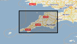
Coastal photographs consisting of cliff views with approximately 60% overlap, some annotated with geological information. The collection is limited to coast from Hartland, Devon to Bude, and Bournemouth Cliffs. There are approximately 200 prints.