 NERC Data Catalogue Service
annually
Type of resources
Available actions
Topics
Keywords
Contact for the resource
Provided by
Years
Formats
Representation types
Update frequencies
Service types
Scale
Resolution
-
In 2011 the British Geological Survey (BGS) decided to begin the assembly of a National Geological Model (NGM) from its existing and on-going geological framework models , comprising integrated national crustal, bedrock and Quaternary models. The bedrock component is the most advanced of these themes and comprises both the calculated models and a complementary network of cross-sections that provide a fence diagram for the bedrock geology of Great Britain. This fence diagram, the GB3D_v2012 dataset is available in a variety of formats from the BGS website www.bgs.ac.uk as free downloads. It complements the existing 1:625 000 scale mapsheets published by BGS utilising the same colour schema and geological classification. The 121 component cross-sections extend to depths between 1.5 and 6 km; they have an aggregate length of over 20,000 km, and they are snapped together at their intersections to ensure total consistency. The sections are based on the existing BGS geological framework models where they cut through them, they also take account of the vast wealth of published data on the subsurface structure of Britain both from BGS and in the literature. Much of this is in the form of cross-sections, contour maps of surfaces, and thicknesses (isopachs). The fence diagram has been built in the Geological Surveying and Investigation in 3D (GSI3D) software. It is envisaged that this dataset will form a useful educational resource for geoscience students and the general public, and also provide the bedrock geology context and structure for regional and catchment scale studies. The fence diagram was built in 2009-12 using funding from the BGS National Capability Programme and the Environment Agency of England and Wales. 14 expert regional geologists compiled the sections.
-

The database contains images of the UK, recorded from various airborne multispectral sensors operated by or on behalf of the NERC airborne remote sensing facility. It includes data from the ATM, CASI, PMI, and thermal line scanner instruments. The data are stored in proprietary formats on various types of magnetic media. Full datasets belong to the NERC but BGS has access, the NERC earth observation data centre, NEODC, hold the data. For all enquiries contact NEODC at http://www.neodc.rl.ac.uk.
-
The data comprises GIS layers representing the permeability of artificial deposits for Great Britain. The permeability data has been derived from DiGMap-GB (Digital Geological Map Data of Great Britain), and therefore reflects the scale of DiGMap-GB. For the majority of the Great Britain, the scale is 1:50,000. The data is updated annually, or after a major new release of DiGMap-GB. The permeability data describes the fresh water flow through these deposits and the ability of a lithostratigraphical unit to transmit water. Maximum and minimum permeability indices are given for each geological unit to indicate the range in permeability likely to be encountered and the predominant flow mechanism (fracture or intergranular). Neither of the assigned values takes into account the thickness of either the unsaturated or saturated part of the lithostratigraphical unit. The data can be used freely internally, but is licensed for commercial use. It is best displayed using a desktop GIS, and is available in vector format as ESRI shapefiles and MapInfo TAB files.
-

The GeoSure Insurance Product (GIP) dataset identifies potential natural ground movement hazard within Great Britain by postcode. These data are available in GIS point feature and database format, updated on a 6 monthly basis. The GeoSure Insurance Product represents the end of an interpretation process starting with the BGS Digital Geological Map of Great Britain at the 1:50,000 scale (DiGMapGB-50). This digital map is the definitive record of the types of rocks underlying Great Britain (excluding Northern Ireland), as represented by various layers, starting with Bedrock and moving up to overlying Superficial layers. In 2003, the BGS published a series of GIS digital maps identifying areas of potential natural ground movement hazard in Great Britain, called GeoSure, demonstrating a grade of potential for 6 separate hazards: shrink-swell clays, slope instability, dissolution of soluble ground, running sand, compressible and collapsible deposits. These maps were derived by combining the rock-type information from DiGMapGB-50 with a series of other influencing factors which may cause the geological hazards (e.g. steep slopes, groundwater). In 2005, the BGS used the GeoSure maps to make an interpretation of subsidence insurance risk for the British property insurance industry, released as the GeoSure Insurance Product. This represents the combined effects of the 6 GeoSure hazards on buildings in a postcode database. The combined hazard is represented numerically in the database as the Total Hazard Score, with a breakdown into the component hazards. The methodology behind these data involves balancing the 6 GeoSure natural ground stability hazards against each other. The GeoSure maps themselves have a fivefold coding (A to E), and the balancing exercise involves comparing each level across the six hazards e.g. comparing a level C shrink-swell clay area with a level C running sand area. Each level of each of the hazards is given a 'hazard score' which can then be added together to derive a Total Hazard Score within a 300m radius from the population weighted postcode point.
-

This file documents the strontium isotope data, and the manner in which it has been processed, to supply the reference data for isotope domains of the Biosphere Isotope Domains GB (V1) map. It includes a summary of the analytical methods used to determine the isotope ratios though time.
-

The DiGMap Plus dataset is a series of GIS layers describing the engineering properties of materials from the base of pedological soil down to c. 3m depth (ie the uppermost c.2m of geology). These deposits display a variable degree of weathering, but still exhibit core engineering characteristics relating to their lithologies. The 'Strength' dataset covers England, Scotland and Wales and characterises the material lithology, and its strength (for field description purposes) as outlined in documentation relating to BS5930 (1999 and 2003 and Eurocode7).
-

The official BGS photographic archive contains an estimated 300,000 photographs. The archive has been built up systematically since its founding in 1891 and is becoming a very popular educational resource for images of the geology of the UK and overseas. A wide range of topics is represented: field geology, landscapes, oblique aerial photographs, geohazards, marine operations, fossil, rocks and photomicrographs of rocks and minerals in thin section. In addition there are an estimated 225,000 photographs held with former groups, projects and individual geoscientists. The collections hold a diverse range of photographic material which includes black and white or colour negatives, transparencies and prints. The film formats range from 35mm to 10"X8" which includes both film and large format glass plates.
-
Collection of annual publications from the global network of magnetic observatories. They typically contain tabulations of hourly, monthly and annual mean values of the geomagnetic elements. Contains all magnetic observatory year books held by the World Data Centre for Geomagnetism (Edinburgh).
-
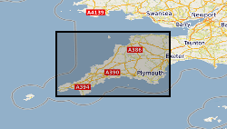
[This metadata record has been superseded, see http://data.bgs.ac.uk/id/dataHolding/13480412].The G-BASE programme involves systematic sampling and the determination of chemical elements in samples of stream sediment, stream water and soil, to build up a picture of the surface chemistry of the UK. G-BASE for SW England is the most recent area of the UK sampled by this on-going project The average sample density for stream sediments is approximately one site per 2km square. Density for soils in SW England is variable across the area, ranging from 1 per 2km square to one per 5km square, depending on underlying parent material. Analytical precision is high with strict quality control to ensure countrywide consistency. Results have been standardised to ensure continuity with existing G-BASE geochemical data. The data provide baseline information on the natural abundances of elements, against which anomalous values due to such factors as mineralisation and industrial contamination may be compared. Analytical data for the sub150 microns fraction of stream sediment and the sub 2mm fraction of soil samples are available for some or all of: Ag, Al, As, Ba, Bi, Br, Ca, Cd, Ce, Cl, Co, Cr, Cs, Cu, Fe, Ga, Ge, Hf, I, In, K, La, Mg, Mn, Mo, Na, Nb, Nd, Ni, P, Pb, Rb, S, Sb, Sc, Se, Si, Sm, Sn, Sr, Ta, Te, Th, Ti, Tl, U, V, W, Y, Yb, Zn, and Zr.
-

The (GEBCO) aims to provide the most authoritative, publicly available bathymetry datasets for the world's oceans. Coastline dataset to support the General Bathymetric Chart of the Oceans.