1980
Type of resources
Topics
Keywords
Contact for the resource
Provided by
Years
Formats
Representation types
Update frequencies
Scale
-
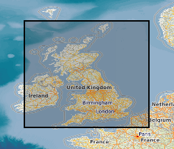
This document data set contains paper copies of many of the seismic reflection survey sections from the original seismic sections data set (ORIGSEISECS) . These have been made for interpretation. Most data are within the UK onshore area; although there are some UK near-shore and offshore (North Sea, Irish Sea) and foreign data. Most data were acquired for commercial hydrocarbon exploration and subsequently provided to BGS for use on specific projects. Some data were acquired by BGS and other public-sector bodies, e.g. BIRPS (British Institutes Reflection Profiling Syndicate ), for academic research. The documents are dyeline prints or plain-paper photocopies. They are stored folded in boxes, approx 40 sections per box, approx 530 boxes. There are a lot of duplicates, there being an interpreted and uninterpreted copy of many profiles. Mostly concentrated in areas prospective for coal, oil and gas.
-
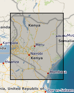
The Samburu - Marsabit Geological Mapping and Mineral Exploration Project was a joint Kenyan and British technical co-operation project, carried out by staff of the Mines and Geological Department, Ministry of Environment and Natural Resources, Kenya and staff from the British Geological Survey. The first phase of the project commenced in 1980, and covered the area between 36degrees and 38degrees E and from the equator to 2degrees N. The second phase, carried out between 1984 and 1986 covered the area between 36degrees and 38degrees E and from 2degrees N to the Ethiopian border. Sampling was carried out concurrently with geological mapping and was largely constrained by the requirements of that exercise. Little or no sampling was done in areas previously mapped by other bodies. Sampling was mainly confined to areas underlain by basement rocks of the Mozambique Belt and was very sparse over most of the Tertiary and Quaternary volcanic cover. Chemical analyses for the stream sediments were: Ag, Ba, Co, Cu, Fe, Li, Mn, Mo, Ni, Pb, Sr, and Zn. Raw data is available from the Mines and Geological Survey Department, Ministry of Environment and Natural Resources, Nairobi, Kenya. Sampling densities varied considerably across the Phase 1 project area, but generally a stream sediment sample density of one per 4 to 8 km2 and a panned concentrate density of one per 13 to 16 km2 was achieved. In the Phase 2 area, which was mainly very arid, a few samples were collected from dry stream beds, as part of a helicopter survey of the area, to provide some idea of the geochemistry of the major lithological units. Stream sediments were collected by combining grab samples from 5 to 10 points within a 10m radius of the selected site. If necessary the samples were dried before being sieved and the fine (-80 mesh B.S.) fraction retained for analysis. Heavy mineral concentrates were obtained by taking 2 to 5kg of material from the sample site and panning at the base camp, where water was available, or at the Mines and Geological Department headquarters at Nairobi.
-

Experimental lycimeters investigating the vertical movement of heavy metals in the subsurface of a single UK site at Uffington, Berkshire.
-

Digital index to the availability of published medium scale geological maps at 1:50000 scale and 1:63360 scale (one inch to one mile) produced by the Survey. The index was set up in the 1980's and currently contains some 1100 entries covering the whole of Great Britain. Entries for all registered maps but not all fields are complete for all entries.
-
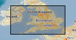
The data comprises information on the subsurface structure of stratigraphic levels and units in the United Kingdom, detailing depth to and thickness of the units. These result from projects in different parts of the UK performed at different times. Common working scales are 1:50 000 and 1:250 000 with appropriate differences in detail. Much mapping results from interpretation of seismic data, and as a result many of the structural maps are in time rather than depth, although some have been depth converted.
-
Series of water/rock and water/mineral interaction experiments at a range of temperatures and pressures. Most experimental runs now held in Excel spreadsheets. All runs held as paper records in the laboratory. Analytical results also held in Excel format. Kinetic information held in Access database for a range of minerals. Also have several reference datasets in Hypercard and End Note.
-
Index to BGS geological map 'Standards', manuscript and published maps for Great Britain produced by the Survey on County Series (1:10560) and National Grid (1:10560 & 1:10000) Ordnance Survey base maps. 'Standards' are the best interpretation of the geology at the time they were produced. The Oracle index was set up in 1988, current holdings are over 41,000 maps. There are entries for all registered maps, but not all fields are complete on all entries.
-
This dataset contains daily water discharge data from Trout Beck in the Moor House-Upper Teesdale National Nature Reserve in the northern Pennines, Cumbria, UK. Data were automatically recorded at a gauging station located on a weir on the Trout Beck and collated by a variety of staff at the Moor House Research Station on behalf of the Wear and Tees River Board and the National Rivers Authority. Full details about this dataset can be found at https://doi.org/10.5285/9e044339-dd06-4f69-b93c-40a79562931c
-
Data from onshore wells provided to BGS as part of an agreement with NSTA/OGA/DECC Digital data (includes, well logs, well reports and downhole data) for oil and gas exploration and appraisal wells drilled in the UK and held on behalf of the North Sea Transitory Authority (formerly the Oil & Gas Authority, formerly the Department of Energy and Climate Change). External data therefore BGS has no control on quality. Provided to OGA/DECC/BGS by oil companies as part of their obligations under licensing regulations, PON 9b regulations notice.
-
Database of hydrogeological properties measured on core samples. Contains most determinations generated by BGS Wallingford Physical Properties Lab but some data is only available on paper. High quality data produced to strict laboratory quality standards.
 NERC Data Catalogue Service