 NERC Data Catalogue Service
University of Bristol
Type of resources
Topics
Keywords
Contact for the resource
Provided by
Years
Formats
Representation types
Update frequencies
Resolution
-

The data are magnesium (Mg) isotope composition, i.e. the relative difference of isotope ratios as defined in Coplen (2011, doi: 10.1002/rcm.5129). The reference was DSM-3 (see Galy et al., 2003, doi: 10.1039/b309273a) and data are given in per mil. Samples consisted of terrestrial peridotites and basalts as well as a suite of meteorites including chondrites, shergottites, diogenites and one angrite. A large portion of the data have been published in Hin et al. (2017, doi: 10.1038/nature23899).
-
This dataset contains over 4000 faecally-contaminated environmental samples collected over 2 years across 53 dairy farms in England. The samples were analysed for E. coli resistance to amoxicillin, streptomycin, cefalexin, tetracycline and ciprofloxacin and detection of resistant strains is presented in the dataset as a binary result, along with mechanisms of resistance to third generation cephalosporins where relevant. In addition there is comprehensive farm management data including antibiotic usage data. Full details about this dataset can be found at https://doi.org/10.5285/c9bc537a-d1c5-43a0-b146-42c25d4e8160
-
This dataset consists of faecally-contaminated samples taken from the environment around pre-weaned calves on 51 farms in South-West England during 2017/2018 and is a subset of a larger dataset investigating antibiotic resistance in E. coli across 53 farms. The samples were analysed for presence of E. coli resistant to amoxicillin, streptomycin, cephalexin, tetracycline and/or ciprofloxacin. Management factors deemed related to pre-weaned calves are included, including antibiotic usage data at farm level. Full details about this dataset can be found at https://doi.org/10.5285/808b2b62-14db-4483-b0e6-5f533c007eec
-
This dataset represents a cohort of heifers followed from birth to 18 months or first pregnancy on 37 farms in the South West of England. Faecally-contaminated environmental samples were collected over 2 years and the samples analysed for E. coli resistance to amoxicillin, cefalexin and tetracycline with detection of resistant strains presented in the dataset as a binary result. Farm-level antibiotic usage data is also given. Full details about this dataset can be found at https://doi.org/10.5285/7c3ad803-fbd4-45c3-826b-fa04c902ded8
-
The resource consists of cartesian coordinates, expressed in units of pixels for groups of eight individual fish, swimming in a shoal. The fish were filmed from above with a high resolution video camera. The data were generated from the images and video using automated two-dimensional tracking software. A food stimulus delivering a single food reward was presented six times per trial. The data were collected between July and August 2017 in a controlled fish laboratory at the University of Bristol by the data authors. The data were collected to test the effects of group behaviour in fish shoals on foraging performance. There are instances where one or more fish in a frame could not be tracked. Where such instances occur are indicated in the data files. The research was funded through NERC grant NE/P012639/1 Hunger and knowledge: foraging decisions in an uncertain and social world All procedures regarding the use of animals in research followed United Kingdom guidelines and were approved by the University of Bristol Ethical Review Group (UIN UB/17/060). Full details about this nonGeographicDataset can be found at https://doi.org/10.5285/08305a43-79b5-432f-ad20-2ddffe0d1077
-
This dataset provides 100 model realisations of daily river flow in cubic metres per second (m3/s) for 1,366 catchments, for the period 1962 to 2015. The dataset is model output from the DECIPHeR hydrological model driven by observed climate data (CEH-GEAR rainfall and CHESS-PE potential evapotranspiration). The modelled catchments correspond to locations of National River Flow Archive (NRFA) gauging stations and provide good spatial coverage across the UK. The dataset was produced as part of MaRIUS (Managing the Risks, Impacts and Uncertainties of drought and water Scarcity) to provide national scale probabilistic flow simulations and predictions for UK drought risk analysis. MaRIUS was a UK NERC-funded research project (2014-2017) that developed a risk-based approach to drought and water scarcity. Full details about this dataset can be found at https://doi.org/10.5285/d770b12a-3824-4e40-8da1-930cf9470858
-
The resource consists of cartesian coordinates, expressed in units of pixels, for fish swimming individually, in groups of six individuals, and in groups of six individuals while presented repeatedly with a food stimulus delivering two food items until satiation. The fish were filmed from above with a high resolution video camera. The data were generated from the images and video using automated two-dimensional tracking software. The data were collected between September 2019 and March 2020 in a controlled fish laboratory at the University of Bristol by the data authors. The data were collected to test how individual temperament and the acquisition of knowledge and satiation interact when animals make foraging decisions in groups. There are instances where one or more fish in a frame could not be tracked. Where such instances occur are indicated in the data files. The research was funded through NERC grant NE/P012639/1 Hunger and knowledge: foraging decisions in an uncertain and social world. All procedures regarding the use of animals in research followed United Kingdom guidelines and were approved by the University of Bristol Ethical Review Group (UIN UB/17/060). Full details about this nonGeographicDataset can be found at https://doi.org/10.5285/26f045c3-946b-4115-baf1-defb19bdba42
-
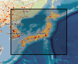
This MS Excel dataset contains tephra depth and age data from ocean drilling expeditions around Japan. IODP, ODP and DSDP shipboard core description records were examined for mentions of volcanic ash, tephra etc., according to criteria described in Mahony et al. 2014. Data are from shipboard visual core descriptions of ocean drilling expeditions located within a few hundred km of Japan. Cores without published age-depth data are not included in this dataset. The expeditions occurred between 1973 (DSDP 31) to 2013 (IODP 346). Tephra layers are dated as being deposited between 0.003-18.5 Ma. This data will be of interest to volcanologists or anyone interested in the location of volcanic ash layers within IODP cores.
-
In this project we developed a new geobarometer for mafic and ultramafic igneous rocks, which can be used by the scientific community for a wide range of mineralogical and petrological studies. The material here include the description of the geobarometer, guidelines for its use, software and chemical data acquired for some case studies.
-

Supporting data from paper: Hill et al. 2019 Evolution of jaw disparity in fishes. Palaeontology 61: 847-854. The data consists of two files: (1) an Excel spreadsheet listing the taxa used in the study, specimen number, clade, age; (2) a Word document outlining the data collection and analysis procedure used in the study.