Scottish SDI
Type of resources
Available actions
Topics
Keywords
Contact for the resource
Provided by
Years
Formats
Representation types
Update frequencies
Service types
Scale
-
The GeoSure data sets and reports from the British Geological Survey provide information about potential ground movement or subsidence in a helpful and user-friendly format. The reports can help inform planning decisions and indicate causes of subsidence. The methodology is based on BGS DiGMap (Digital Map) and expert knowledge of the behaviour of the formations so defined. This dataset provides an assessment of the potential for a geological deposit to show running sand behaviour under the action of flowing water, a characteristic usually of saturated sand and silt grade material. Complete Great Britain national coverage is available. The storage formats of the data are ESRI and MapInfo but other formats can be supplied.
-
This layer of the map based index (GeoIndex) shows sites where regularly monitored rest water level data are available, usually covering a long time period. The data shows seasonal fluctuations in the water table and responses to periods of high or low rainfall.
-
An index to over 600 ground geophysical surveys carried out in the UK for a variety of projects. A large number of these surveys were done in conjunction with the DTI Mineral Reconnaissance Programme in the 1970's and 80's, and many others were carried out at the request of BGS field mapping groups. Information held describes the survey objective, location of measurements, geophysical methods and equipment used, reports and publications, storage locations of data and results (for analogue and digital data), dates and personnel. There are two datasets; one shows the outline of the survey areas, and the other shows the actual survey lines within each area.
-
The hydrogeological map indicates aquifer potential in generalised terms using a threefold division of geological formations: those in which intergranular flow in the saturated zone is dominant, those in which flow is controlled by fissures or discontinuities and less permeable formations including aquifers concealed at depth beneath covering layers. Highly productive aquifers are distinguished from those that are only of local importance or have no significant groundwater. Within each of these classes the strata are grouped together according to age or lithology. The 1:625 000 scale data may be used as a guide to the aquifers at a regional or national level, but should not be relied on for local information.
-
This low-resolution image has been produced from BGS airborne and marine magnetic data. The colour was generated using the BGS COLMAP software package. Colour levels are defined by histogram equalisation. Combining this image with the grey shaded relief image produces a similar image to the colour shaded relief image. A published coloured shaded relief map, using the full resolution of the data and produced at a scale of 1: 1500 000, is available. The map covers a larger area than this image, and includes additional data from other sources. The data used to compile this image are available in various forms for academic and commercial licensing. The data from surveys covering the UK mainland have been digitised from their original analogue form. Elsewhere data were acquired digitally. Standard methods of processing were used to remove diurnal and secular variations and to minimise line intersection errors. While efforts have been made to remove artefacts from the data, some may remain between adjacent datasets. Generally anomalies over man-made structures have not been removed. The data have been interpolated onto a 1km x 1km grid using a variable tension technique, and smoothed.
-
This layer of the map based index (GeoIndex) shows the path the survey ship took whilst undertaking the ship gravity, magnetic and bathymetry survey. This index is based on data from approximately 350,000 line kilometres of multi-instrument geophysical survey lines. The data itself includes seismic, sonar, magnetic, gravity, echo sounder, multibeam bathymetry and navigation data, both in digital and analogue format. The data were primarily collected by BGS and the collection also includes additional third party data.
-
This layer of the map based index (GeoIndex) shows the locations of known mines, mineral showings and localities, including sites where minerals of economic interest have been identified in panned concentrates. The information for the index is taken from the Mineral Occurrence Database. The Mineral Occurrence Database holds information on mineral occurrences in the UK including locations of known mines, deposits, prospects and mineral showings, including sites where minerals of potential economic interest have been identified in panned concentrates. Data is normally taken from published sources or from internal BGS records, such as field sheets, rock and stream sediment collection cards. Data compilation started ca. 1994 and the database currently holds about 13 000 records, but details of many more old workings and occurrences remain to be added.
-
The map shows the localities of significant fossil samples, either collected by BGS Staff, or donated by individuals and institutions. The BGS fossil collections contain over 2 million specimens, including a sizeable quantity of type, figured and cited material. Since a small number of fossil locations are confidential, you are unable to view this dataset at large scales. However, if you send a data enquiry, such information may be made available. Enquiries are normally free, but a charge may be levied depending upon the time taken; users will be notified in advance. Material is available for inspection on application by e-mail. Specimens are sometimes available for loan to bona fide academics.
-
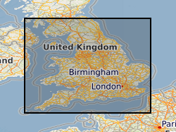
This layer of the map based index (GeoIndex) shows the availability of 1:63360 scale geological maps. The maps are available for most of England and Wales and show early geological mapping covering the OS Old Series one inch map sheet areas.
-
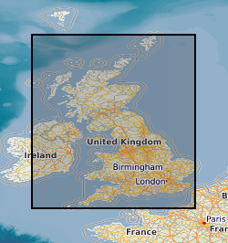
The map shows the localities of significant fossil samples, either collected by BGS Staff, or donated by individuals and institutions. The BGS fossil collections contain over 2 million specimens, including a sizeable quantity of type, figured and cited material. Since a small number of fossil locations are confidential, you are unable to view this dataset at large scales. However, if you send a data enquiry, such information may be made available. Enquiries are normally free, but a charge may be levied depending upon the time taken; users will be notified in advance. Material is available for inspection on application by e-mail. Specimens are sometimes available for loan to bona fide academics.
 NERC Data Catalogue Service