NERC Data Catalogue Service
GeoSure Running Sand Deposits
Default
Identification info
- Metadata Language
- English (en)
- Dataset Reference Date ()
- 2005-05-09
0115 936 3276
0115 936 3276
0115 936 3276
- Maintenance and update frequency
- asNeeded
- GEMET - INSPIRE themes, version 1.0
- BGS Thesaurus of Geosciences
-
- UK Location (INSPIRE)
- Scottish SDI
- Natural hazards
- Keywords ()
- Keywords
-
- NERC_DDC
- Limitations on Public Access
- otherRestrictions
- Use constraints
- otherRestrictions
- Other constraints
- The copyright of materials derived from the British Geological Survey's work is vested in the Natural Environment Research Council [NERC]. No part of this work may be reproduced or transmitted in any form or by any means, or stored in a retrieval system of any nature, without the prior permission of the copyright holder, via the BGS Intellectual Property Rights Manager. Use by customers of information provided by the BGS, is at the customer's own risk. In view of the disparate sources of information at BGS's disposal, including such material donated to BGS, that BGS accepts in good faith as being accurate, the Natural Environment Research Council (NERC) gives no warranty, expressed or implied, as to the quality or accuracy of the information supplied, or to the information's suitability for any use. NERC/BGS accepts no liability whatever in respect of loss, damage, injury or other occurence however caused.
- Other constraints
- The dataset is made available to external clients under BGS Digital Data Licence terms and conditions. Revert to the IPR Section (iprdigital@bgs.ac.uk ) if further advice is required with regard to permitted usage.
- Spatial representation type
- vector
- Denominator
- 50000
- Topic category
-
- Geoscientific information
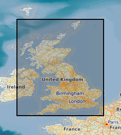
- Extent
-
ENG
- Dataset Reference Date ()
- 2009
- Extent
-
ENGLAND [id=150000]
- Dataset Reference Date ()
- 1979
- Extent
-
SCOTLAND [id=140000]
- Dataset Reference Date ()
- 1979
- Extent
-
SCT
- Dataset Reference Date ()
- 2009
- Extent
-
WALES [id=170000]
- Dataset Reference Date ()
- 1979
- Extent
-
WLS
- Dataset Reference Date ()
- 2009
))
- End date
- 2005
- Additional information
- Geotechnical data abstracted from NGDC site investigation collection and entered into the BGS geotechnical database. Methodology may be revised in the light of new knowledge or customer feedback. Changes in DiGMapGB-50 base data will require periodic or continuous revision. Complete GB National Coverage, subject to revision in line with changes in DiGMapGB-50 lithology codes. Based on 1:50 000 DiGMapGB-50 linework. Methodology consistent throughout. Otherwise subject to logical consistency of DiGMapGB-50.
Distribution Information
- Data format
-
-
ESRI Shapefile
(
Current BGS version
)
-
ESRI Shapefile
(
Current BGS version
)
- Resource Locator
-
BGS GeoSure Homepage
Information about the data and how to purchase the dataset are available via this URL link.
- Resource Locator
-
Running sand
Further information about the data can be viewed via this URL.
- Resource Locator
-
BGS GeoSure Homepage
Information about the data and how to purchase the dataset are available via this URL link.
- Resource Locator
-
Running sand
Further information about the data can be viewed via this URL.
- Quality Scope
- dataset
- Other
- dataset
Report
- Dataset Reference Date ()
- 2011
- Explanation
- See the referenced specification
- Degree
Report
- Dataset Reference Date ()
- 2010-12-08
- Explanation
- See http://eur-lex.europa.eu/LexUriServ/LexUriServ.do?uri=OJ:L:2010:323:0011:0102:EN:PDF
- Degree
- Statement
- Methodology devised by the GeoHazard project. Latest version and earlier versions are held in project files.
Metadata
- File identifier
- 9df8df52-d607-37a8-e044-0003ba9b0d98 XML
- Metadata Language
- English (en)
- Resource type
- dataset
- Metadata Date
- 2024-07-25
- Metadata standard name
- UK GEMINI
- Metadata standard version
- 2.3