University of Oxford
Type of resources
Topics
Keywords
Contact for the resource
Provided by
Years
Formats
Representation types
Update frequencies
Resolution
-

This data contains high-resolution XRF data scanned from IODP cores recovered from Expedition 369, IODP Sites U1513, U1514 and U1516. Sietske Batenburg was responsible for scanning the Cenomanian-Turonian interval at Sites U1513 and U1516, and the lower half of the Eocene at U1514. Data is available from IODP database: http://web.iodp.tamu.edu/LORE/
-
Gro for GooD Rainfall Data from 23 Manual Rain Gauges, Kwale County, Kenya (NERC grant NE/M008894/1)
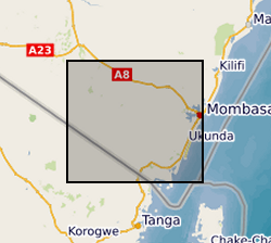
The dataset consists of daily rainfall data for 23 manual rain gauge stations installed by Gro for GooD project within and about the study area. The installed stations covering four river catchments name Ramisi River, Mukurumudzi River, Mtawa River and Mwachema River in Kwale County. The dataset period is from January 2016 to November 2018. Gro for GooD: Groundwater Risk Management for Growth and Development
-
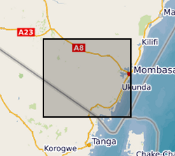
The file contain groundwater level/depth (WL), Groundwater and Surface Water Quality data (EC (micro-siemens per centimetre or µS/cm), Temperature (degrees C) and pH) for 49 points under fortnightly monitoring relevant to Gro for GooD research project in Kwale County, Kenya. Blank - Data not available. Note this is same dataset as NGDC record number 118189 with extended time series. Gro for GooD: Groundwater Risk Management for Growth and Development
-
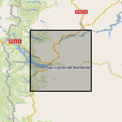
Volcanic ash samples were collected and analysed following the 2015 eruption of Calbuco volcano, Chile. Datasets uploaded are: Calbuco2015 Probe Data - excel Calbuco2015 Locations and Grain Size – excel Calbuco Deposit Measurements grl54177-sup-0002-tables3 Published as supplement to A.R. van Eaton et al (2016) Volcanic lightning and plume behavior reveal evolving hazards during the April 2015 eruption of Calbuco volcano, Chile, Geophysical Research Letters 43 (7), 3563-3571 Electron Probe Micro Analysis Major element compositions of plagioclase, groundmass glass and melt inclusions were analysed with a JEOL JXA-8600 wavelength-dispersive electron microprobe (EMP), equipped with four spectrometers, at the Research Laboratory for Archaeology and the History of Art, University of Oxford using a defocused beam (5¿m), low beam current (4nA) and accelerating voltage of 15 kV. Full analytical conditions are detailed in Rawson et al. (2015). Secondary standards used were Gor128-G and StHs/80-G for glass (Jochum et al., 2006). Glass (melt inclusion and groundmass) totals were normalised to 100% to account for variable secondary hydration. Stoichiometry and charge balancing was used to determine the amount of Fe2O3 and FeO in plagioclase. Pyroxene and magnetite grains were analysed with a defocused beam (5¿m), higher beam current (10nA), and an accelerating voltage of 15 kV. Secondary standards used were hornblende (USNM 111356), Pyrope (USNM 1143968) and ilmenite (USNM 96189; (Jarosewich et al., 1980). Stoichiometry and charge balancing was used to determine the amounts of Fe2O3 and FeO, following Droop (1987). Thickness and Grain size analysis Ash fallout thicknesses were measured in the field shortly after deposition, and samples collected for follow-up analysis of grainsize and chemical composition. Grain size analysis was conducted using a Malvern Laser Particle Sizer Mastersizer 2000 at the University of Oxford.
-
This dataset contains information about the ringing records of mainly great tits, blue tits, marsh tits and coal tits, and a few other bird species. The data were collected in Wytham woods, Oxfordshire, UK during 2020 and 2021, as part of a long-term population monitoring project on the breeding biology and behaviour of birds. Full details about this dataset can be found at https://doi.org/10.5285/af4c9b5a-fba9-4133-b782-2a2cbc927280
-
Dataset of material characterisation (X-ray diffraction) analyses to constrain the nature of materials produced during Fe(II)-silicate precipitation experiments from seawater in the presence of various metals.
-
The project is aimed at understanding how a number of economically and geologically important chemical elements partition themselves between the silicates of the outer parts of the Earth and sulphides, minerals and liquids rich in sulphur. Although sulphur is not very abundant in the Earth, it has a powerful impact on the behaviour of a wide range of elements in Earth's crust and underlying mantle. For example, the majority of ore bodies rich in nickel, copper, gold and platinum are sulphides. Many of them are formed when sulphides separate from molten silicates in volcanic areas. A principal aim of my project is to experimentally reproduce the conditions under which sulphides separate and to determine how they extract the economically important elements from the host volcanic rocks. A second aim is to use my experimental results to determine whether or not a large mass of sulphide was extracted from the molten earth early in its history (4500 million years ago) and dissolved into the metallic core. In order to study how elements are distributed into sulphide I perform experiments at high pressures and temperatures, typically 15000 atmospheres pressure and 1400 degrees C in a large hydraulic press. After treatment at high pressure and temperature, the samples (typically about 1x1x1 millimeters) are rapidly cooled to room temperature and pressure and examined using a range of microanalytical techniques. The latter enables me to resolve chemical composition on the scale of 10 microns (or 10 millionth's of a meter).
-
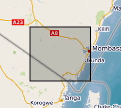
This dataset contains digital terrain data that describes the topography of the area under study at 90m resolution based on SRTM 90m Digital Elevation Data from the CGIAR-CSI (Consultative Group on International Agricultural Research - Consortium for Spatial Information). Gro for GooD: Groundwater Risk Management for Growth and Development, https://upgro.org/consortium/gro-for-good/
-
Here, we provide data corresponding to the experimental conditions used, the results gained via electron microprobe for natural and experimental volcanic samples. Mass balance calculations and a compilation of monitoring data for recent explosive eruptions.
-
(I) Handpump Vibration Data For each handpump, data is organized in one CSV file per day. These files are grouped together over batches, where each batch approximately corresponds to three months. (II) Borehole Water Level Data Water level data at the borehole of each handpump is recorded in one CSV file per handpump. Both uncompensated (raw) and compensated (with respect to atmospheric pressure) data are available. (III) Data Time Logs A separate Excel file lists the locations of the monitoring sites and the time logs corresponding to both (I) and (II) per handpump. References: [1] P. Thomson, R. Hope, and T. Foster, “GSM-enabled remote monitoring of rural handpumps: a proof-of-concept study,” Journal of Hydroinformatics, vol. 14, no. 4, pp. 829–839, 05 2012. [Online]. Available: https://doi.org/10.2166/hydro.2012.183 [2] F. Colchester, “Smart handpumps: a preliminary data analysis,” IET Conference Proceedings, pp. 7–7(1). [Online]. Available: https://digital-library.theiet.org/content/conferences/10.1049/cp.2014.0767 [3] H. Greeff, A. Manandhar, P. Thomson, R. Hope, and D. A. Clifton, “Distributed inference condition monitoring system for rural infrastructure in the developing world,” IEEE Sensors Journal, vol. 19, no. 5, pp.1820–1828, March 2019. [4] F. E. Colchester, H. G. Marais, P. Thomson, R. Hope, and D. A. Clifton, “Accidental infrastructure for groundwater monitoring in africa,” Environmental Modelling Software, vol. 91, pp. 241 – 250, 2017. [Online]. Available:http://www.sciencedirect.com/science/article/pii/S1364815216308325 [5] A. Manandhar, H. Greeff, P. Thomson, R. Hope, and D. A. Clifton, “Shallow Aquifer Monitoring Using Handpump Vibration Data,” In-review, 2019.
 NERC Data Catalogue Service