Engineering geology
Type of resources
Topics
Keywords
Contact for the resource
Provided by
Years
Formats
Representation types
Update frequencies
Scale
-
A list of the laboratory reports produced from testing in the engineering geology laboratory. It includes report number, title and author's name(s). The reports themselves contain data on a wide range of geotechnical and geophysical laboratory tests, from standard and index tests to complex research. Test materials are highly varied, soils and rock, from the UK or overseas.
-
The Geotechnical Database contains information about site investigation reports, boreholes and samples. It contains geotechnical measurements taken over borehole intervals and on samples. Some of the data is obtained digitally from AGS files (Association of Geotechnical and Geoenvironmental Specialists - File Transfer Format), some is obtained manually from Site Investigation Reports stored in the National Geoscience Data Centre. The database currently contains geotechnical data from over 450 000 laboratory test samples and core descriptions, borehole observations and in situ tests from over 96 000 boreholes extracted from over 4800 site investigation reports. The database underpins BGS Geo-engineering properties and processes research and is an important information resource for answering enquiries and providing for the data needs of external customers.
-
Index to reports of site investigations produced by external organisations carried out for all forms of site investigation. The Oracle index was setup in 1988 and covers the whole of Great Britain, all site investigation reports are indexed but the level of detail in the index for each record may vary. The reports date back to the 1950's and may contain information on boreholes, trial pits, laboratory tests and chemical analyses etc.
-
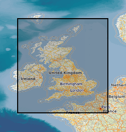
The Quaternary deposits summary lithologies dataset is a digital geological map across the bulk of the UK Continental Shelf (UKCS), for areas up to a water depth of 200 m, which groups the deposits into classes based on similar engineering geology characteristics. The map is derived from (unpublished) BGS 1:1,000,000 scale Quaternary digital geological mapping, so is effective at that scale. The map was produced in 2014 in collaboration with, and co-funded by, The Crown Estate as part of a wider commissioned project to assess seabed geological constraints on engineering infrastructure across the UKCS. The divisions on the map combine the Quaternary deposits into 7 categories of similar strength and lithological variability, each with a ‘Category’ title that summarises their main lithological character: diamict; firm to hard interbedded (layered); firm to hard mud; sand and gravel; soft interbedded; soft mud; undifferentiated. These categories can be used as a basis for assessing, in conjunction with a range of other geological factors, the geological constraints on engineering structures at or close to the seabed. The data are held by the BGS as an ESRI ArcGIS Shapefile.
-
The BGS GeoCoast Dataset is a Geographic Information System (GIS)-based analysis for indicating multi-hazards and interdependencies within the coastal zone of Great Britain (not including Orkney and Shetland). GeoCoast represents the natural geological coastline (around the mainland of Great Britain) as if no coastal defences or made ground are present. This will be of particular value in areas where coastal defences are no longer maintained. GeoCoast will offer anyone with assets, or an interest in the coastline around Great Britain, access to easy-to-use datasets linked to geohazard data. This will allow users to interpret potential interdependencies in terms of erosion, flooding, habitat and other vulnerabilities. These datasets are divided into two data packages: Premium and Open datasets, which include the following information: The data is delivered in GIS ESRI point, polyline and polygon format (other formats available on request).
-
This dataset is a characterisation of discontinuity types found within rocks and soils in Great Britain. Discontinuities are breaks, fractures or planes of weakness in the rock mass. The dataset includes type, frequency and orientation of discontinuities within rock and soil materials at formation (local to regional) scale. The discontinuities are classified in 3 categories: stratification (bedding planes), foliation (mineral banding) and rock mass description. The dataset aims to facilitate the preliminary research for planning and design of buildings, infrastructure and resource extraction. It forms part of the DiGMap Plus dataset series of GIS layers which describes the engineering properties of materials from the base of pedological soil down to c. 3m depth (ie the uppermost c.2m of geology). These deposits display a variable degree of weathering, but still exhibit core engineering characteristics relating to their lithologies.
-
Reports of site investigations produced by external organisations carried out for all forms of site investigation The reports date back to the 1950s and may contain information on boreholes, trial pits, laboratory tests and chemical analyses etc. The collection covers the whole of Great Britain with concentrations in urban areas and transportation routes. The interpreative parts of the reports are not available to public.
-
New acquisitions of all forms of geological data received from external organisations are recorded in the accessions database and the digital or analogue data itself is then available to users. Data is in the form of reports, plans and digital information. This information comes from a wide variety of sources, including public bodies and agencies and commercial organisations. The data itself will be incorporated into existing corporate collections or may form a new collection in its own right. The rate of transfer will depend on priorities and requirements of both internal and external users. Data is continuously removed from the collection, all except recently received material will have been processed.
-
Index to acquisitions and donations of all types of geological record data. This information has been received from a variety of external organisations including public bodies and commercial concerns. The Oracle index was set up in 1988 and holds basic index information about the donor and the donation. The index has been expanded in 2009 to include other sections of BGS and covers all their donations. The majority are from Great Britain.
-
Index to the reports of work carried out by the BGS and its precursors. The index was set up in 1988 and has worldwide coverage. These reports cover a wide range of scientific and technical disciplines and were produced for a variety of purposes. The reports are not published but copies can be provided on demand subject to any restrictions. All registered Technical Reports held in collection are indexed. Start date of digital index circa 1988. Technical reports date from circa 1950 onwards.
 NERC Data Catalogue Service