 NERC Data Catalogue Service
BGS GeoCoast GB version 1 Open
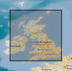
The BGS GeoCoast Dataset is a Geographic Information System (GIS)-based analysis for indicating multi-hazards and interdependencies within the coastal zone of Great Britain (not including Orkney and Shetland). GeoCoast represents the natural geological coastline (around the mainland of Great Britain) as if no coastal defences or made ground are present. This will be of particular value in areas where coastal defences are no longer maintained. GeoCoast will offer anyone with assets, or an interest in the coastline around Great Britain, access to easy-to-use datasets linked to geohazard data. This will allow users to interpret potential interdependencies in terms of erosion, flooding, habitat and other vulnerabilities. The data is delivered in GIS ESRI point, polyline and polygon format (other formats available on request).
Simple
- Date (Creation)
- 2022-03
Distributor
British Geological Survey
-
Enquiries
0115 936 3276
Environmental Science Centre, Nicker Hill, Keyworth
,
NOTTINGHAM
,
NOTTINGHAMSHIRE
,
NG12 5GG
,
United Kingdom
0115 936 3143
0115 936 3276
Point of contact
British Geological Survey
-
Enquiries
0115 936 3276
Environmental Science Centre, Nicker Hill, Keyworth
,
NOTTINGHAM
,
NOTTINGHAMSHIRE
,
NG12 5GG
,
United Kingdom
0115 936 3143
0115 936 3276
- Maintenance and update frequency
- notPlanned Not planned
- GEMET - INSPIRE themes, version 1.0
- BGS Thesaurus of Geosciences
-
- Coastal management
- Coastal features
- Coastal erosion
- Water flooding
- Coasts
- Cliffs
- Engineering geology
- dataCentre
- Keywords
-
- NERC_DDC
- Access constraints
- otherRestrictions Other restrictions
- Other constraints
- licenceOGL
- Use constraints
- otherRestrictions Other restrictions
- Other constraints
- The copyright of materials derived from the British Geological Survey's work is vested in the Natural Environment Research Council [NERC]. No part of this work may be reproduced or transmitted in any form or by any means, or stored in a retrieval system of any nature, without the prior permission of the copyright holder, via the BGS Intellectual Property Rights Manager. Use by customers of information provided by the BGS, is at the customer's own risk. In view of the disparate sources of information at BGS's disposal, including such material donated to BGS, that BGS accepts in good faith as being accurate, the Natural Environment Research Council (NERC) gives no warranty, expressed or implied, as to the quality or accuracy of the information supplied, or to the information's suitability for any use. NERC/BGS accepts no liability whatever in respect of loss, damage, injury or other occurence however caused.
- Other constraints
- Available under the Open Government Licence subject to the following acknowledgement accompanying the reproduced NERC materials "Contains NERC materials ©NERC [year]"
- Spatial representation type
- vector Vector
- Denominator
- 50000
- Metadata language
- EnglishEnglish
- Topic category
-
- Geoscientific information
- Geographic identifier
-
GBN
- Date (Revision)
- 2009
- Geographic identifier
-
GREAT BRITAIN [id=139600]
- Date (Creation)
- 1979
N
S
E
W
))
- End date
- 2022
- Supplemental Information
- GeoCoast_v1_Erosion_Profile_Domains: The intention of the coastal domains dataset is to group ‘similar’ sections of the coast based on two primary sets of parameters; the susceptibility of the coastline to erosion and the presence or absence of a buffer between direct wave action and the coastline geology, and the height and profile shape of the coastline. GeoCoast_v1_Authority_Coastline_Cliff_Erosion_MEAN & WORST: The coastal erosion susceptibility data have been provided as a separate dataset due to its importance in assessing the coast/cliff properties and stability. It considers a suite of geological engineering properties for cliff sections (and low-lying deposits) around the GB coastline. The data is a result of a detailed vertical cliff analysis by expert geologists to provide the sequence of lithologies present in any given cliff section of the coast. The analysis then assesses key lithological properties, including presence of discontinuities, material strength and permeability. The aim is to help to identify the areas of coastline that could be more, or less susceptible, to erosion. The susceptibility scoring and classification only considers the rock/sediment properties themselves, not any man-made features such as coastal defences or previous instability (landslides). GeoCoast_v1_Authority_Coastline_Inundation, and GeoCoast_v1_Authority_Coastline_Multi_Formations: A range of regional, summary statistics have been generated from the GeoCoast Premium datasets and mapping of key infrastructure (such as railway, roads and urban areas) to provide a regional assessment of the potential impact of inundation arising from sea level rise. The data is based on the UK Climate Projections 2018 (UKCP18) and include statistics on the area and % of roads, railways and urban areas susceptibility under 2050, 2080 and 2100 climate scenarios. GeoCoast_v1_Authority_Area_Inundation: A range of regional, summary statistics have been generated from the GeoCoast Premium datasets and mapping of key infrastructure (such as railway, roads and urban areas) to provide a regional assessment of the potential impact of inundation arising from sea level rise. The data is based on the UK Climate Projections 2018 (UKCP18) and include statistics on the area and % of roads, railways and urban areas susceptibility under 2050, 2080 and 2100 climate scenarios. GeoCoast_v1_SMP_Coastline_Cliff_Erosion_MEAN & WORST, GeoCoast_v1_SMP_Coastline_Inundation, GeoCoast_v1_SMP_Coastline_Length, and GeoCoast_v1_SMP_Coastline_Multi_Formations: A range of regional statistics have been generated from the GeoCoast premium datasets to provide Shoreline Management Plan & Local Plan Districts (Scotland) level overviews of coastal characteristics, cliff erosion and flood susceptibility. These are provided under an Open Government Licence and include the data described in the table below. The table below shows the overall attributes for the combined SMP and LPD statistics. GeoCoast_v1_Historic_Data: This is provided as a quick-reference source for any relevant coastal sections, figures or photographs that are currently embedded within BGS memoirs and reports. There are large amounts of information, particularly coastal cliff sections, cross sections and images that are currently ‘locked’ away in individual BGS Memoirs, reports and documents, which are not currently easily accessible or catalogued. The aim of this data layer is to start making this data more accessible. This historic data ranges in scale and date of capture, and therefore provides a snapshot in time and allows coastal changes to be identified. GeoCoast_v1_Historic_Data_Sections: This is provided as a quick-reference source for any relevant coastal cross-sections, that are currently embedded within BGS maps or digital 3D outputs that intersect with the GB coastline. The aim of this data layer is to start making this data more accessible.
- Unique resource identifier
- OSGB 1936 / British National Grid (EPSG::27700)
- Distribution format
-
-
ESRI Shapefile
(
1994
)
-
ESRI Shapefile
(
1994
)
Distributor
British Geological Survey
-
Enquiries
0115 936 3276
Environmental Science Centre, Nicker Hill, Keyworth
,
NOTTINGHAM
,
NOTTINGHAMSHIRE
,
NG12 5GG
,
United Kingdom
0115 936 3143
0115 936 3276
- OnLine resource
-
BGS Datasets - GeoCoast Open
(
WWW:DOWNLOAD-1.0-http--download
)
GeoCoast Open provides a range of historic images and diagrams extracted from our archives, memoirs and other publications that can provide a reference for coastal change. It also contains a detailed suite of statistical data based on the underlying datasets (GeoCoast Premium).
- Hierarchy level
- dataset Dataset
- Other
- dataset
Conformance result
- Date (Publication)
- 2011
- Explanation
- See the referenced specification
- Pass
- No
Conformance result
- Date (Publication)
- 2010-12-08
- Explanation
- See http://eur-lex.europa.eu/LexUriServ/LexUriServ.do?uri=OJ:L:2010:323:0011:0102:EN:PDF
- Pass
- No
- Statement
- GeoCoast_v1_Erosion_Profile_Domains: Extract the grid from the Erosion Susceptibility data and attribute with additional values of proximity to backshore sediments and cliff complexity. Two domain groupings are created from these attributes. The erosion domains are created from erosion class and backshore width. The profile domains are created from cliff height and cliff range. GeoCoast_v1_Authority_Coastline_Cliff_Erosion_MEAN & WORST: Split Cliff Erosion Susceptibility coastline by OS Boundary-Line™ May 2019 data. Calculate the percentage of coastline per administrative boundary with high cliff score category. GeoCoast_v1_Authority_Coastline_Inundation: Split Cliff Erosion Susceptibility coastline by OS Boundary-Line™ May 2019 data. Calculate the percentage of coastline per administrative boundary at risk of inundation for 2050, 2080 & 2100. GeoCoast_v1_Authority_Coastline_Multi_Formations: Split Cliff Erosion Susceptibility coastline by OS Boundary-Line™ May 2019 data. Calculate the percentage of coastline per administrative boundary with cliffs composed of multiple formations. GeoCoast_v1_Authority_Area_Inundation: The statistics are developed by applying a geometric intersection of BGS GeoCoast Inundation with the ONS Output Areas (Population 2011), OS Boundary-Line™ May 2019: District_borough_unitary_region, OS Strategi® Jan 2013: Urban_region, and the OS Vectormap® Local - 2019: Building, Road, Railway Track, and Railway Station datasets. The results are provided at both County and Shore Management Plan (SMP) levels and for the three inundation scenarios available (2050, 2080, 2100). For consistency, all layers are clipped by the OS Boundary-Line™ May 2019: High water polyline. GeoCoast_v1_SMP_Coastline_Cliff_Erosion_MEAN & WORST: Split the Cliff Erosion Susceptibility coastline by Shoreline Management Plan (SMP) & Flood Risk Management by Local Plan Districts (LPD) data. Calculate the percentage of coastline per administrative boundary with cliffs composed of multiple formations. GeoCoast_v1_SMP_Coastline_Inundation: Split Cliff Erosion Susceptibility coastline by Shoreline Management Plan (SMP) & Flood Risk Management by Local Plan Districts (LPD) data. Calculate the percentage of coastline per administrative boundary at risk of inundation for 2050, 2080 & 2100. GeoCoast_v1_SMP_Coastline_Length: Split Cliff Erosion Susceptibility coastline by Shoreline Management Plan (SMP) & Flood Risk Management by Local Plan Districts (LPD) data. Calculate the percentage of coastline per administrative boundary. GeoCoast_v1_SMP_Coastline_Multi_Formations: Split Cliff Erosion Susceptibility coastline by Shoreline Management Plan (SMP) & Flood Risk Management by Local Plan Districts (LPD) data. Calculate the percentage of coastline per administrative boundary with cliffs composed of multiple formations. GeoCoast_v1_Historic_Data: Coastal sections, figures or photographs that are currently embedded within BGS Memoirs, reports and documents covering England and parts of Wales, are sourced to create this dataset. Where possible, all reference to a grid reference location was recorded and used to create a GIS point dataset. Each data point contains an attribute record for: Image number, Image location, Easting, Northing, Map sheet number, Source document type, Source document name, Source image link (URL), Year of publication. GeoCoast_v1_Historic_Data_Sections: Cross sections from BGS 1: 50 000 scale series map marginalia, memoirs and reports were scanned and georeferenced using GIS polylines of the sections, and relevant BGS GSi3D models for parts of England and southern North East border region of Scotland. Each section is then attributed a source link to allow user access to the original images. Each section contains an attribute record for: Image number, Image location, Map sheet number, Source document type, Source document name, Source document link, Year of publication.
- File identifier
- dc24a8ff-0859-0b3a-e053-0937940a96d4 XML
- Metadata language
- EnglishEnglish
- Hierarchy level
- dataset Dataset
- Date stamp
- 2026-05-03
- Metadata standard name
- UK GEMINI
- Metadata standard version
- 2.3
Point of contact
British Geological Survey
Environmental Science Centre, Keyworth
,
NOTTINGHAM
,
NOTTINGHAMSHIRE
,
NG12 5GG
,
United Kingdom
+44 115 936 3100
- Dataset URI
- http://data.bgs.ac.uk/id/dataHolding/13607927
Overviews
Spatial extent
N
S
E
W
Provided by

Associated resources
Not available