Geological mapping
Type of resources
Topics
Keywords
Contact for the resource
Provided by
Years
Formats
Representation types
Update frequencies
Scale
-
This database comprises field notebooks reporting geological field work associated with NERC Standard Grant NE/R001324/1 from 1/10/2017 – 30/6/2021. The fieldwork involved examination of Ordovician – Devonian sequences from North Wales and Scotland. Samples were collected for palynological analysis. Palynological processing involves the recovery of organic-walled microfossils by hydrochloric and hydrofluoric acid maceration. Details of other non-NERC-funded fieldwork undertaken during this period is included in the field notebooks.
-
Field notebook photos and scans for NERC grant Tellurium and Selenium Cycling and Supply. Various sites in Ireland, Scotland, England, North Wales, Norway, Utah, Colorado and Wyoming.
-
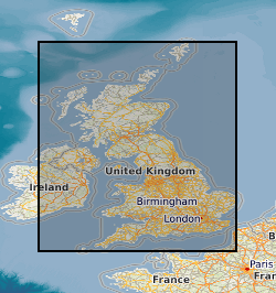
This layer of the GeoIndex shows the location of available 1:25000 scale digital geological maps within Great Britain. The Digital Geological Map of Great Britain project (DiGMapGB) has prepared 1:625 000, 1:250 000 and 1:50 000 scale datasets for England, Wales and Scotland. The datasets themselves are available as vector data in a variety of formats in which they are structured into themes primarily for use in geographical information systems (GIS) where they can be integrated with other types of spatial data for analysis and problem solving in many earth-science-related issues. The DiGMapGB-10 dataset is as yet incomplete, current work is concentrated on extending the geographical cover, especially to cover high priority urban areas.
-
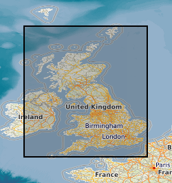
This layer of the GeoIndex shows the location of available 1:10000 scale digital geological maps within Great Britain. The Digital Geological Map of Great Britain project (DiGMapGB) has prepared 1:625 000, 1:250 000 and 1:50 000 scale datasets for England, Wales and Scotland. The datasets themselves are available as vector data in a variety of formats in which they are structured into themes primarily for use in geographical information systems (GIS) where they can be integrated with other types of spatial data for analysis and problem solving in many earth-science-related issues. The DiGMapGB-10 dataset is as yet incomplete, current work is concentrated on extending the geographical cover, especially to cover high priority urban areas.
-
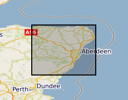
The database contains basic tabulated field data resulting from the work of the BGS East Grampians Project in the early 1980s to mid 1990s. Records include the locations of stations at which field observations were made, structural measurements and sample locations. To this end, the database provides an index to locations and structural data. However, it needs to be stated clearly that labels given to structural elements are largely subjective beyond the identification of bedding. This means that the structural data are largely unusable without a clear understanding of their context and with regard to the primary paper record on which descriptions of the observed structures are recorded. The data are held in MS ACCESS tables which are related via the Station number as the primary key. The coverage is mainly confined to the North East Grampian Highlands of Scotland. The database is currently unused and has not been added to since the end of the East Grampians Project. The station location and structural data are effectively complete. However, fields in the sample database, such as the sample stratigraphy, are largely incomplete because, at the time the data were acquired, the stratigraphy at each station was formally undefined. The most effective way of presenting and investigating the data is via GIS.
-

The BGS collection of 1:10 560 / 1:10 000 National Grid Series geological maps. These maps are based on the Ordnance Survey National Grid series of maps, which are defined by the 10 km intervals of the larger 100 km square identified by a specific two-letter code. Each map is thus denoted by a unique reference, e.g. SP 29 NW. SP=100 km square; 29=10 km square; NW=5 km square. Since field mapping is generally undertaken at the scale of 1:10 000 (or equivalent), these maps are the largest-scale main series of geological maps that BGS holds. A small number of remote areas were mapped at 1:25 000 scale, the subsequent maps are also at 1:25 000 scale and are included in this series. The equivalent to the National Grid Series prior to the 1960s is the County Series (at 1:10 560 scale). In the 1960s, this series started to be replaced by 6 inches to 1 mile (1:10 560 scale) National Grid sheets based on the four quadrants (NW, NE, SW, SE) of a 10 km Ordnance Survey National Grid square. Areal coverage provided by the National Grid series of large-scale maps is limited in extent and the preceding County series of six-inch maps can still be the most up to date map available for some areas. Geological maps represent a geologist's compiled interpretation of the geology of an area. A geologist will consider the data available at the time, including measurements and observations collected during field campaigns, as well as their knowledge of geological processes and the geological context to create a model of the geology of an area. This model is then fitted to a topographic basemap and drawn up at the appropriate scale, with generalization if necessary, to create a geological map, which is a representation of the geological model. Explanatory notes and vertical and horizontal cross sections may be published with the map. Geological maps may be created to show various aspects of the geology, or themes. The most common map themes held by BGS are solid (later referred to as bedrock) and drift (later referred to as superficial). These maps are, for the most part, hard-copy paper records stored in the National Geoscience Data Centre (NGDC) and are delivered as digital scans through the BGS website.
-

For much of the Geological Survey's existence, the County Series of maps were the standard large-scale maps on which geological mapping was undertaken. These maps are based on the Ordnance Survey County (or six-inch to the mile) series of maps. These maps were cut up to be used in the field to record geological observations, and on return to the office, the geology was transferred to a complete County Series map, which after approval was known as a 'standard' (England / Wales) or 'clean copy' (Scotland). This dataset contains the 'standard' or 'clean copy' County Series maps held by BGS. Geological maps represent a geologist's compiled interpretation of the geology of an area. A geologist will consider the data available at the time, including measurements and observations collected during field campaigns, as well as their knowledge of geological processes and the geological context to create a model of the geology of an area. This model is then fitted to a topographic basemap and drawn up at the appropriate scale, with generalization if necessary, to create a geological map, which is a representation of the geological model. Explanatory notes and vertical and horizontal cross sections may be published with the map. Geological maps may be created to show various aspects of the geology, or themes. The most common map themes held by BGS are solid (later referred to as bedrock) and drift (later referred to as superficial). These maps are hard-copy paper records stored in the National Geoscience Data Centre (NGDC) and are delivered as digital scans through the BGS website.
-

A series of maps at the detailed scale of 1:25 000 have been produced for areas of outstanding geological interest in Great Britain. Some maps are accompanied by explanatory booklets. The maps were published between 1954 and 2007. About 60 maps have been published, some showing solid geology, some drift geology and some combined solid and drift. Most of the maps include geological cross sections and generalised vertical sections. Geological maps represent a geologist's compiled interpretation of the geology of an area. A geologist will consider the data available at the time, including measurements and observations collected during field campaigns, as well as their knowledge of geological processes and the geological context to create a model of the geology of an area. This model is then fitted to a topographic basemap and drawn up at the appropriate scale, with generalization if necessary, to create a geological map, which is a representation of the geological model. Explanatory notes and vertical and horizontal cross sections may be published with the map. Geological maps may be created to show various aspects of the geology, or themes. These maps are hard-copy paper records stored in the National Geoscience Data Centre (NGDC) and are delivered as digital scans through the BGS website.
-

The 1:63 360 / 1:50 000 scale map series are the most useful scale for most purposes. They provide almost complete coverage of onshore Great Britain. The BGS collection of 1:63 360 and 1:50 000 scale maps comprises two map series: - Geological Survey of England and Wales 1:63 360 / 1:50 000 Geological Map Series [New Series]. These maps are based on the Ordnance Survey One-inch New Series topographic basemaps and provide almost complete coverage of England and Wales, with the exception of sheet 180 (Knighton). The quarter-sheets of 1:63 360 Old Series sheets 91 to 110 coincide with sheets 1 to 73 of the New Series maps. These earlier maps often carry two sheet numbers which refer to the Old Series and the New Series. - Geological Survey of Scotland 1:63 360 / 1:50 000 Geological Map Series. These maps are based on the Ordnance Survey First, Second, Third and Fourth editions of the One-inch map of Scotland. The maps used the most recent topographic basemap available at the time. In the Western Isles, one-inch mapping was abandoned and replaced by maps at 1:100 000 scale, which are associated with this series. Sheets were traditionally issued at 1:63 360 scale, with the first 1:50 000 maps appearing in 1972. Sheets at 1:50 000 scale may be either facsimile enlargements of an existing 1:63 360 sheets, or may contain new geology and cartography. The latter bear the additional series designation '1:50 000 series'. Within the Scottish series, new mapping at 1:50 000 scale was split into east and west sheets. For example, the original one-inch sheet 32 became 1:50 000 sheets 32E and 32W. A number of irregular sheets were also introduced with the new 1:50 000 scale mapping. There are a number of irregular special sheets within both series. Geological maps represent a geologist's compiled interpretation of the geology of an area. A geologist will consider the data available at the time, including measurements and observations collected during field campaigns, as well as their knowledge of geological processes and the geological context to create a model of the geology of an area. This model is then fitted to a topographic basemap and drawn up at the appropriate scale, with generalization if necessary, to create a geological map, which is a representation of the geological model. Explanatory notes and vertical and horizontal cross sections may be published with the map. Geological maps may be created to show various aspects of the geology, or themes. The most common map themes held by BGS are solid (later referred to as bedrock) and drift (later referred to as superficial). These maps are, for the most part, hard-copy paper records stored in the National Geoscience Data Centre (NGDC) and are delivered as digital scans through the BGS website.
-

The UTM series of maps are based on 1:250 000 base maps published by the Ordnance Survey. Mapping is divided into squares which cover 1 degree by 1 degree of latitude / longitude in the Universal Transverse Mercator (UTM) projection, and coverage extends offshore and onto the continental shelf. The UTM series are available in three different themes: - Solid geology (complete coverage within the mapped area, including most of the UK continental shelf) - Sea bed sediments (coverage for most offshore areas) - Quaternary geology (coverage for the UK sector of the North Sea, Irish Sea and the Atlantic margin) Also included within this series are two small-scale (1:500 000) bedrock geology maps of the Central Rockall Basin and North Rockall Basin. These maps supersede the older quarter-inch series of maps which were published for England / Wales and Scotland. Geological maps represent a geologist's compiled interpretation of the geology of an area. A geologist will consider the data available at the time, including measurements and observations collected during field campaigns, as well as their knowledge of geological processes and the geological context to create a model of the geology of an area. This model is then fitted to a topographic basemap and drawn up at the appropriate scale, with generalization if necessary, to create a geological map, which is a representation of the geological model. Explanatory notes and vertical and horizontal cross sections may be published with the map. These maps are, for the most part, hard-copy paper records stored in the National Geoscience Data Centre (NGDC) and are delivered as digital scans through the BGS website.
 NERC Data Catalogue Service