Sampling
Type of resources
Available actions
Topics
Keywords
Contact for the resource
Provided by
Years
Formats
Representation types
Update frequencies
Service types
Scale
-
The National Geotechnical Properties Database contains information about site investigation reports, boreholes and samples. It contains geotechnical measurements taken over borehole intervals and on samples. Some of the data are obtained digitally from AGS files (Association of Geotechnical and Geoenvironmental Specialists - File Transfer Format), some are obtained manually from site investigation reports stored in the National Geoscience Data Centre (NGDC). The database currently contains geotechnical data from over 450 000 laboratory test samples and core descriptions, borehole observations and in-situ tests from over 96 000 boreholes extracted from over 4800 site investigation reports. The database underpins BGS geo-engineering properties and processes research and is an important information resource for answering enquiries and providing for the data needs of external customers. The distribution of data often follows major UK infrastructure developments and the coverage of BGS research, including UK rocks and soils engineering geology studies or the areas covered by ground information for sustainable development and geohazards projects. Much of the data are from site investigations for major trunk road construction schemes, often provided by Highways England (formerly the Highways Agency) and other major engineering projects. A small proportion of the data is from BGS laboratory test results. The final investigation data and information are supplied to BGS by clients, consultants and contractors either as final paper records or as Association of Geotechnical and Geoenvironmental Specialists (AGS) digital data transfer format files. AGS digital data transfer format files (.ags) are the preferred method of receiving data because they can be added to the database much more quickly and accurately than adding data by hand from paper records.
-
The dataset contains details of field collection of groundwater samples with use of different water intake devices and the measurement results of gaseous compounds (methane) obtained during analytical method validation performed in order to develop a methodology of groundwater sampling for analysis of dissolved gases. The dataset is not intended to be used for any site characterisation. Sampling sites were chosen based on high probability of occurrence of measureable methane content in groundwater. Furthermore, the data will be used for formal procedure to obtain the methodology accreditation from the Polish Centre for Accreditation (PCA). The dataset was created within SECURe project (Subsurface Evaluation of CCS and Unconventional Risks) - https://www.securegeoenergy.eu/. This project has received funding from the European Union’s Horizon 2020 research and innovation programme under grant agreement No 764531
-

The borehole information pack from borehole GGC01, site 10 of the UK Geoenergy Observatories (UKGEOS) Glasgow facility. This initial data release pack from BGS contains composite and digital wireline logs; drillers summary logs and prognosis; sample recovery information spreadsheets; and daily driller's borehole records. The cored, seismic monitoring borehole was drilled between 19 November and 12 December 2018 to 199m producing a core of 102 mm diameter. The borehole was wireline logged in December 2018 and a string of 5 seismometers were installed in February 2019. A range of fluid, water and core samples were taken during the drilling process.
-

The borehole information pack from borehole TH0410 at the UK GeoEnergy Observatories (UKGEOS) Cheshire facility. This release from the British Geological Survey (BGS) contains a borehole schematic, borehole metadata, a report from the drilling contractors, geophysical wireline logs, and an index to samples collected from the borehole, which are archived in the National Geological Repository at BGS Keyworth. No core scanning data is available for this borehole and the core has been disposed of.
-
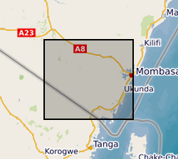
Results of two sampling campaigns conducted in Kwale County Kenya in March and June 2016 by GHS/UPC as part of the Gro for GooD project. Water samples from over 79 groundwater and 6 surface water (SW) locations were analysed for major ions, stable isotopes, selected trace constituents, electrical conductivity, nitrates, ammonia, pH, DO (Dissolved Oxygen), Eh (oxidation / reduction potential), Temperature, TOC (Total Organic Carbon) and field alkalinity. Most locations were sampled in both March (dry season) and June (wet season). Geology at each location recorded as follows: P - Pliocene Sands, Pls - Pleistocene Sands, Plc - Pleistocene corals. Reference: First step to understand the importance of new deep aquifer pumping regime in groundwater system in a developing country, Kwale, Kenya; Ferrer et al, Geophysical Research Abstracts, Vol. 18, EGU2016-16969, 2016; http://meetingorganizer.copernicus.org/EGU2016/EGU2016-16969.pdf; https://upgro.files.wordpress.com/2015/09/egu16_groforgood_v1.pdf UPC - The Departement of Civil Enginyering de la Universitat Politecnica de Catalunya GHS - Grupo de Hidrologia Subterranea
-

This dataset relates to sample metadata and the results of geochemical analyses conducted on samples as part of the Mineral Reconnaissance Programme (MRP). It contains metadata including sample names, sample project areas, sample types and analytes. The MRP was a programme undertaken by BGS which ran continuously from 1973 to 1997, funded by the UK Government's Department of Trade and Industry (DTI). The datasets it produced provide baseline information on areas prospective for the occurrence of metallic minerals in particular locations across Great Britain. The programme was designed to stimulate private sector exploration and to encourage the development of Britain's indigenous mineral resources. The emphasis during the MRP varied in response to market conditions and strategic interests. Work on ‘strategic’ metals, such as platinum, palladium, chromium, cobalt and nickel, dominated the 1980s. From the late 1980s, the principal focus of the programme was gold. Numerous studies examined gold mineralisation in porphyry, epithermal, orogenic and unconformity-related settings. Towards the end of the programme, a small number of projects concerned with gemstones and industrial minerals were also completed. Various samples were taken throughout the course of the programme, including rock, soil, stream sediment, stream water and deep overburden samples. These samples underwent analysis for a variety of analytes, the results of which are held by BGS. This dataset includes the geochemical information derived from the samples and sample metadata, including the location of sampling. The sampling and analysis methodology varied by MRP project area. For more information about the samples from a specific project area, refer to the MRP report for that project: https://nora.nerc.ac.uk/cgi/search/archive/advanced?screen=Search&dataset=archive&_action_search=Search&series=Mineral+Reconnaissance+Programme For more information about obtaining the results of sample analyses, contact BGS Enquiries (enquiries@bgs.ac.uk). For more information about the MRP, see the MineralsUK website: https://www.bgs.ac.uk/mineralsuk/exploration-and-maps/mrp-reports/.
-

The borehole information pack from borehole TH0419 at the UK GeoEnergy Observatories (UKGEOS) Cheshire facility. This release from the British Geological Survey (BGS) contains a borehole schematic, borehole metadata, a report from the drilling contractors, geophysical wireline logs, metadata relating to the electrical resistivity tomography (ERT) installation and an index to samples collected from the borehole, which are archived in the National Geological Repository at BGS Keyworth. No core scanning data is available for this borehole and the core has been disposed of.
-

This Web service provides a spatial index into the BGS collection of onshore borehole materials in the UK and the Isle of Man, including drillcore, bulk specimens, washed and unwashed cuttings and processed material. The boreholes have been drilled by BGS, or by commercial or public bodies. The name of the borehole, its unique reference code and number (BGS_ID) and the type of material is provided. For some boreholes, multiple types of material are available. Details of the collection are held in the Borehole Materials Database, and may be accessed via the BGS website.
-
The British Geological Survey onshore borehole collection database of core and sample types and depths contains records of over 15 000 onshore boreholes drilled in the UK by BGS, commercial and public bodies. Material types include continuous drillcore, core samples, individual hand specimens, bulk samples, unwashed cuttings, washed and dried cuttings, plugs, powders and bulk samples. The physical collection and database was developed as part of the British Geological Survey's responsibility to establish and maintain a national borehole collection. Details of the collection are held in the Borehole Materials Database, and may be accessed via the BGS website. The collection was initiated in 1968, and the database is updated daily by the addition of new data and by modification of existing data. Most material is stored at the facility in BGS Keyworth. Some material is held at BGS Edinburgh. The majority of borehole cores and samples are available for study and sub-sampling by bona fide academics and commercial companies. Commercial companies are charged for access; academics will need to complete an academic waiver form. Some boreholes, especially recent hydrocarbon wells, are confidential, and depths and sample details may not be given. If you require further information about these boreholes, contact kwcorestore@bgs.ac.uk for details of the owner. In a few cases, the precise map references are also confidential.
-
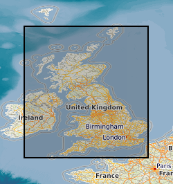
The BGS Geochemical Baseline Survey of the Environment (G-BASE) was the national strategic geochemical mapping programme in Great Britain. The project set out to establish the chemistry of the surface environment by the collection and analysis of stream sediment, stream water and soil samples. Beginning in the late 1960s in northern Scotland and moving southwards across the country, the primary focus was mineral exploration, however, the project quickly developed to address important environmental concerns. The final G-BASE samples were collected in southern England in 2014. The outputs from the G-BASE project provide an invaluable, systematic baseline of geochemical information for Great Britain, serving as a marker of the state of the environment against which to measure future change. Sampling Stream sediments were the primary sample medium for G-BASE. The sediment was collected from the centre of the stream and sieved through two sieves (2 mm and 150 µm) to obtain a fine grain-size fraction of <150 µm. Excess material from the <2 mm fraction was panned to collect a heavy mineral concentrate. Stream water samples were collected also at each drainage site. Four different water samples were collected routinely: two filtered waters (for major and trace elements) and two unfiltered waters (for pH, conductivity and alkalinity). The routine collection of soil samples was introduced in 1986 in areas of poor drainage density, and urban soil sampling commenced in 1991. Further details of the sampling methodology can be found in the G-BASE field procedures manual (https://nora.nerc.ac.uk/id/eprint/5190/). Sample analysis Stream water pH, conductivity and alkalinity were determined in the field. Water samples were returned to our laboratories and analysed by inductively coupled atomic emission and mass spectrometry (ICP-AES/MS), ion chromatography (IC) / ion selective electrode (ISE) for up to 50 chemical parameters. Waters were also analysed for non-purgeable organic carbon (NPOC) to determine dissolved organic carbon content. Most water samples were analysed for alkalinity, pH, conductivity, F and U and some for multi-element analyses including Al, Cl, Na, Si, SO4, NO4, and TOC. The <150 µm fraction of the stream sediment and the <2 mm fraction of topsoil were analysed by techniques including X-ray fluorescence (XRF) / direct reading optical emission spectrometry (DR-OES) to determine the concentration of up to 53 major and trace elements. Loss on ignition (LOI) and pH were determined in topsoil samples. Analytical data for the 150 micron fraction of soil and stream sediment samples are available for some or all of: Ag, As, B, Ba, Bi, Be, Ca, Ce, Cd, Co, Cr, Cs, Cu, Fe, Ga, K, La, Li, Mg, Mn, Mo, Nb, Ni, P, Pb, Rb, Sb, Se, Sn, Sr, Th, Ti, U, V, Y, Zn, Zr. In later stages, the project also routinely determined the elements listed in the <2 mm fraction of surface soils. Sample storage and archive After preparation and analyses all soil, stream sediment and panned concentrate samples and excess material were stored and archived at the National Geoscience Data Centre (NGDC). The archive holds more than 40 years’ worth of material collected across the UK. Archived samples can be made available for further tests and analyses on request by contacting BGS Enquiries (mailto:enquiries@bgs.ac.uk).
 NERC Data Catalogue Service