 NERC Data Catalogue Service
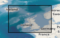
Marine survey data from around the UK (1966 onwards)
Simple
- Alternate title
- Marine survey data
- Date (Creation)
- 1966
0115 936 3276
0115 936 3276
- Maintenance and update frequency
- irregular Irregular
- GEMET - INSPIRE themes, version 1.0
- BGS Thesaurus of Geosciences
-
- Geology
- Magnetic data
- Marine seismic surveys
- Seismic surveys
- Geological data
- Magnetic surveys
- Marine geology
- Seismic data
- Site investigations
- Boreholes
- Bathymetry
- Gravity surveys
- Drilling
- Geological surveys
- Marine gravity surveys
- Marine magnetic surveys
- Geophysical data
- Geophysical surveys
- Geophysics
- Gravity data
- Geochemical data
- Marine geochemistry
- Marine geophysics
- Marine surveys
- Offshore drilling
- Sampling
- Sea floor
- Seismic reflection surveys
- Core drilling
- Geochemistry
- dataCentre
- Keywords
-
- NERC_DDC
- Access constraints
- otherRestrictions Other restrictions
- Use constraints
- otherRestrictions Other restrictions
- Other constraints
- The copyright of materials derived from the British Geological Survey's work is vested in the Natural Environment Research Council [NERC]. No part of this work may be reproduced or transmitted in any form or by any means, or stored in a retrieval system of any nature, without the prior permission of the copyright holder, via the BGS Intellectual Property Rights Manager. Use by customers of information provided by the BGS, is at the customer's own risk. In view of the disparate sources of information at BGS's disposal, including such material donated to BGS, that BGS accepts in good faith as being accurate, the Natural Environment Research Council (NERC) gives no warranty, expressed or implied, as to the quality or accuracy of the information supplied, or to the information's suitability for any use. NERC/BGS accepts no liability whatever in respect of loss, damage, injury or other occurence however caused.
- Other constraints
- Available under the Open Government Licence subject to the following acknowledgement accompanying the reproduced NERC materials "Contains NERC materials ©NERC [year]"
- Spatial representation type
- vector Vector
- Metadata language
- EnglishEnglish
- Topic category
-
- Geoscientific information
- Geographic identifier
-
BRISTOL CHANNEL [id=2001350]
- Date (Revision)
- 2010
- Geographic identifier
-
CELTIC SEA [id=2001353]
- Date (Revision)
- 2010
- Geographic identifier
-
ENGLISH CHANNEL [id=2001401]
- Date (Revision)
- 2010
- Geographic identifier
-
INNER SEAS OFF THE WEST COAST OF SCOTLAND [id=2001428]
- Date (Revision)
- 2010
- Geographic identifier
-
IRISH SEA [id=2001430]
- Date (Revision)
- 2010
- Geographic identifier
-
NORTH ATLANTIC OCEAN [id=2002262]
- Date (Revision)
- 2010
- Geographic identifier
-
NORTH SEA [id=2001452]
- Date (Revision)
- 2010
- Geographic identifier
-
NORTHEAST ATLANTIC OCEAN (40W) [id=2001453]
- Date (Revision)
- 2010
- Geographic identifier
-
NORTHWEST EUROPEAN CONTINENTAL SHELF [id=121700]
- Date (Creation)
- 1979
- Geographic identifier
-
UK CONTINENTAL SHELF [id=121701]
- Date (Creation)
- 1979
))
- Begin date
- 1966
Reference System Information
- Distribution format
-
-
Digital data
()
-
Digital images
()
-
Physical specimens
()
-
Paper hard-copy records
()
-
SEG-Y
()
-
ESRI Shapefile
(
1994
)
-
Image (BMP)
()
-
Image (JPEG)
()
-
Image (PNG)
()
-
Image (GIF)
()
-
Image (SVG)
()
-
Image (TIFF)
()
-
Digital data
()
0115 936 3276
- OnLine resource
-
GeoIndex_Offshore_offshore_data
(
OGC:WMS
)
One or more layers for the dataset is provided through this OGC WMS (view) service. This URL is the service end-point and is intended for consumption by software clients that understand the WMS API.
- OnLine resource
- GeoIndex (offshore) ( WWW:LINK-1.0-http--link )
- Hierarchy level
- dataset Dataset
- Other
- dataset
Conformance result
- Date (Publication)
- 2011
- Explanation
- See the referenced specification
- Pass
- No
Conformance result
- Date (Publication)
- 2010-12-08
- Explanation
- See http://eur-lex.europa.eu/LexUriServ/LexUriServ.do?uri=OJ:L:2010:323:0011:0102:EN:PDF
- Pass
- No
- Statement
- Data were collected using various survey techniques. This dataset has been managed by BGS over a considerable period of time. Legacy paper records have undergone selective scanning and/or transcription to digital formats, with QC of the information captured and migration into the BGS database. More recent data are captured digitally and loaded to the database. The related sample material is curated and managed as part of the physical materials collections. Information is delivered via the BGS web site.
- File identifier
- c35c748d-3f7d-682d-e044-0003ba9b0d98 XML
- Metadata language
- EnglishEnglish
- Hierarchy level
- dataset Dataset
- Date stamp
- 2026-05-03
- Metadata standard name
- UK GEMINI
- Metadata standard version
- 2.3
- Dataset URI
- http://data.bgs.ac.uk/id/dataHolding/13605638
Overviews
Spatial extent
Provided by
