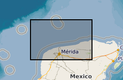
 NERC Data Catalogue Service
Geophysical data
Type of resources
Topics
Keywords
Contact for the resource
Provided by
Years
Formats
Representation types
Update frequencies
Scale
-

An initial core scanning dataset from the TH0424 borehole that was drilled onshore at Thornton Science Park, Cheshire, UK as part of the UK Geoenergy Observatories (UKGEOS) Cheshire ground investigation funded by UKRI/NERC. The approximately 100 m long core succession comprises the Sherwood Sandstone Group. The core scanning dataset contains X-ray radiographic images and geophysical property data obtained using a Geotek rotating X-ray computed tomography (RXCT) core scanner and a Geotek multi-sensor core logger (MSCL-S) at the Core Scanning Facility (CSF) at the British Geological Survey (BGS).
-

These data comprise four phases of geophysical survey carried out in 2002, 2007, 2008 and 2011, covering various areas within the Thames Estuary as part of an overarching archaeological investigation called the London Gateway project (2001-2020) ahead of planned dredging works. 88635_49575_2002 - Area of sidescan sonar data within the Thames Estuary (shell haven) area. The data were acquired in OSGB36 British National Grid coordinates and covers the area: Top Left - 570395.312500 E, 183444.953125 N, Top Right - 604097.250000 E, 183444.953125 N, Bottom Right - 604097.250000 E, 177590.140625 N, Bottom Left - 570395.312500 E, 177590.140625 N. 88635_61207_2007 - Geophysical survey comprising sidescan sonar data acquired over 13 separate wreck sites. Corresponding MBES data were acquired previously in 2005 and are deposited with the UKHO. SSS data comprise a total of 83 .xtf files with 2 channels. Acquired in WGS84 UTMz31N coordinates. 400 KhZ frequency. Range 50 m. Sensor positions rather than ship positions for each line in metadata. Each wreck location is centred on (UTMz31N): Amethyst - 364468 E, 5708659 N; Ancient - 325490 E, 5708230 N; Argus - 359499 E, 5706071 N; Ash - 360905 E, 5706497 N; Atherton - 359708 E, 5706186 N; Dynamo - 401449 E, 5743755 N; EastOaze - 362786 E, 5707385 N; ErnaBoldt - 403551 E, 5746997 N; Letchworth - 357544 E, 5705592 N; London - 343115 E, 5707365 N; Pottery - 346619 E, 5706276 N; SS Storm - 406001 E, 5747115 N; Unknown wreck - 375530 E, 5714052 N. 88635_61208_2008 - Geophysical survey comprising sidescan sonar and multibeam echosounder data over a single wreck site. SSS data comprise a total of 7 .xtf files with 2 channels. 400 KhZ frequency. Range 50 m. Acquired in WGS84 Geographic coordinates. Sensor positions rather than ship positions for each line in metadata. Wreck location in WGS84 UTMz31N: Aisha - 363982 E, 5707656 N. 88635_79800_2011 - Geophysical survey comprising magnetometer, sidescan sonar and multibeam echosounder data undertaken over three separate blocks; Area 9to11, Area 26to36 and Area 105. Area9to11:332980 E, 5708675 N; 332980 E, 5708226 N; 338586 E, 5707813 N; 338681 E, 5708242 N. Area26to36:339693 E, 5708096 N; 339571 E, 5707680 N; 345670 E, 5706229 N; 350490 E, 5706371 N; 350338 E, 5706838 N; 345680 E, 5706685 N. Area105:383734 E, 5719704 N; 384035 E, 5719369 N; 385920 E, 5720804 N; 385619 E, 5721134 N. Where corresponding multibeam echosounder data were acquired, these data have been archived with the United Kingdom Hydrographic Office (UKHO). Overarching full archaeological investigation, including results of the assessment of these data, and technical reports are archived with the Archaeology Data Service (ADS) (https://doi.org/10.5284/1083494).
-
The British Geological Survey hold a collection of data recorded during marine geophysical surveys which includes digital data and analogue records. These data result from approximately 350,000 line kilometres of multi-instrument geophysical survey lines. The data include seismic, sonar, magnetic, gravity, echo sounder, multibeam bathymetry and navigation data. The seismic data are mainly for airgun, sparker, boomer and pinger. The data were primarily collected by BGS and the collection also includes additional third party data. The data are primarily from the UKCS (United Kingdom Continental Shelf). The data are stored within the National Geoscience Data Centre (NGDC) and the Marine Environmental Data and Information Network (MEDIN) Data Archive Centre (DAC) for Geology and Geophysics. The majority of legacy geophysical paper records are available as scanned images viewable via the BGS Offshore GeoIndex www.bgs.ac.uk/GeoIndex/offshore.htm. Other records can be scanned on request. Older records are of variable quality. Data not yet available online including segy are available on request enquiries@bgs.ac.uk. The data are applicable to a wide range of uses including environmental, geotechnical, geophysical and geological studies. Reference: Fannin, NGT. (1989) Offshore Investigations 1966-87. British Geological Survey Technical Report WB/89/2, British Geological Survey.
-
This dataset comprises data from Wessex Archaeology surveys which were conducted over various wreck sites between 2003 and 2010. Three of these datasets were acquired in English waters, one in Welsh waters and one in Scottish waters. The geology and geophysics component of the data are archived by British Geological Survey (BGS) in the Marine Environmental data and Information Network (MEDIN) Data Archive Centre (DAC) for Geology and Geophysics. The data include multibeam echosounder, single-beam echosounder, sidescan sonar, sub-bottom profiler, magnetometer, and geological data (vibrocore logs and photos). Data were also provided to other archive centres as appropriate - UKHO (bathymetry), Royal Commission Ancient and Historic Monuments Wales (geophysics), Royal Commission on the Ancient and Historical Monuments of Scotland (geophysics and diving/ROV), Archaeology Data Service (diving/ROV). Although generated for archaeological purposes, these high quality and resolution data are capable of re-use by marine surveyors and scientists from a range of different fields. Data are delivered via the BGS Offshore GeoIndex www.bgs.ac.uk/GeoIndex/offshore.htm and additional data are available on request enquiries@bgs.ac.uk.
-
The map shows the location and names of boreholes with digital geophysical logs acquired by the former National Coal Board and British Coal during their exploration for coal in the UK. Ownership of UK coal exploration data was transferred to the Coal Authority (Coal Authority) following privatisation of the UK coal industry. The Coal Authority have appointed the British Geological Survey as custodian of this important national geological data archive. These data are in general publicly available; however, access to data within active mining licences is restricted in that it requires the consent of the mining licensee. The Coal Authority data archive includes digital data for some of the geophysical borehole logging. These are mainly in the form of original field tapes; however, also available are some data transcribed onto more modern media during BGS projects. The BGS will be pleased to provide information on data availability for named boreholes or within specified geographic areas, together with cost estimates and options for supplying copies.
-

A comprehensive core scanning dataset from the Prees-2C borehole. This borehole was drilled onshore in the Cheshire Basin, Shropshire, UK, in November and December 2020 as part of the JET project (Integrated understanding of Early Jurassic Earth system and timescale - https://gtr.ukri.org/projects?ref=NE 2FN018508 2F1) and principally funded by the ICDP, NERC, and DFG. The approximately 620 m-long Early Jurassic core succession (>99% recovery) mainly comprises mudstone, limestone, and siltstone. The core scanning dataset contains optical images, radiographic images, geophysical and geochemical property data obtained using a Geotek rotating X-ray computed tomography core scanner (RXCT), a Geotek multi-sensor core logger (MSCL-S) and a Cox Analytical Systems XRF core scanner (Itrax MC) at the Core Scanning Facility (CSF) at the British Geological Survey (BGS).
-

The 3D multi channel seismic data were acquired as part of a collaborative investigation into models of magmatic segmentation between the Scripps Institute of Oceanography and BIRPS (the British Institutions Reflection Profiling Syndicate). The 3D EPR (East Pacific Rise) ARAD (Anatomy of a Ridge Axis Discontinuity) EW9707 cruise was undertaken in September and October 1997 to provide both refelction and wide-angle seismic data for the study of the overlapping spreading centre (OSC) at 9 degrees 3 minutes N on the East Pacific Rise. The data were acquired with a single source and a single streamer with a nominal line spacing of 100 m. The 3D-EPR ARAD survey was a joint NERC/NSF (US National Science Foundation) funded project and the copyright for this survey is held jointly. Reference: Bazin, S. Harding, AJ. et al. (2001) Three-dimensional shallow crustal emplacement at the 9 degree 03 minute N overlapping spreading center on the East Pacific Rise, Journal of Geophysical Research.
-

MONA LISA (Marine and Onshore North Sea Acquisition for Lithospheric Seismic Analysis) seismic data was acquired by BIRPS (the British Institutions Reflection Profiling Syndicate) across the Ringkobing-Fyn High of the central North Sea were designed to study the crust near a hypothesized Caledonian age triple junction associated with the colliding continental crust of Laurentia, Avalonia (Gondwanaland) and Baltica. The specific target was the eastward continuation of the Caledonian Front (Iapetus Suture), as previously recognised on NEC (North East Coast line), MOBIL (Measurements over Basins to Image Lithosphere), NSDP (North Sea Deep Profile) and BABEL (Baltic and Bothnian Echoes from the Lithosphere) profiles, in northern Europe. 1112 km of data were acquired, recorded to 26 s two-way time.
-
The British Institutions Reflection Profiling Syndicate (BIRPS) shot approximately 12,000 km of deep, multi-channel seismic reflection data around the British Isles from 1981 to 1991 during 14 surveys. Recording depths vary depending on the purpose of the survey but range from 15 s to 40 s two-way time. Raw and processed digital data are archived by BGS who make the data available subject to the cost of reproduction and handling. Seismic sections and other analogue ancillary data are available for some surveys. Gravity and magnetic data may also be available.
-
BIRPS (the British Institutions Reflection Profiling Syndicate) acquired almost 650 km of offshore seismic data and 300 km of onshore seismic data over the Chicxulub impact crater. The data were recorded to 18 s two-way time.