
1994
Type of resources
Available actions
Topics
Keywords
Contact for the resource
Provided by
Years
Formats
Representation types
Update frequencies
Scale
-

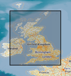
This dataset provides digital spatial information on the location of mineral resources across the onshore area of the United Kingdom at a scale of 1:50 000. The term ‘mineral resources’ has a definition under international standards that includes both an economic and geological dimension. These data are based primarily on mapped geology with limited assessment of economics. Therefore, the term ‘mineral resources’ is used here in a broad sense. The dataset allows users to visualise the extent and distribution of mineral resources across the UK and to relate them to other forms of land-use (such as urban areas or designated environmentally sensitive areas) or to other factors (such as transport infrastructure and conservation information). The UK dataset has been created by integrating mineral resource datasets originally produced for England, Scotland and Wales through a series of commissioned and grant-funded projects led by the British Geological Survey (BGS) between 1994 and 2010. These national datasets were developed separately, using a consistent geological evidence base and interpretation approach, and have subsequently been harmonised and merged to support UK-wide online spatial delivery. The BGS Mineral Resource data does not determine mineral reserves and therefore does not denote potential areas of extraction. Only onshore, mainland mineral resources are included in the dataset. This dataset has been produced by the collation and interpretation of mineral resource data principally held by the British Geological Survey. The mineral resource data presented are based on the best available information but are not comprehensive and their quality is variable. The dataset should only be used to show a broad distribution of those mineral resources which may be of current or potential economic interest.
-
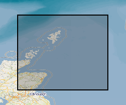
This dataset shows the distribution of Middle Jurassic, Upper Jurassic and Lower Cretaceous lithostratigraphic (UK Offshore Operators Association - UKOOA) units within the UK North Sea graben. The data are based on a subset of released exploration and appraisal wells from within the UK North Sea graben areas. The well data are concentrated in the areas overlying the deep sedimentary basins of the Viking Graben, Central Graben and the Moray Firth Basin, with fewer wells over the adjacent platforms. The UKOOA lithostratigraphic classification has been applied consistently.
-

**No longer exists**The dataset comprises the published annual reports of approximately 180 companies involved in mining or mining-related activities. The great majority are in English or are bilingual with English. A 5-year collection is maintained on a rolling basis, i.e. only the most recent 5 years' reports are retained. The dataset comprises the reports companies deemed to be the most important in minerals production world-wide. The collection is incomplete as many companies now distribute their annual reports via their web sites rather than send printed copies.
-
This dataset collection contains data from the Stratospheric Photochemistry, Aerosols and Dynamics Expedition (SPADE) which was based at NASA Ames Research Center in California during portions of 1992 and 1993. The data consist of measurements collected onboard the NASA ER-2 aircraft, and selected radiosonde soundings from stations in the region of the experiment. Flights were conducted during October and November of 1992, April and May of 1993, and October of 1993. Theory team products come in two forms: as quantities evaluated along flight tracks and as global or hemispheric fields. Meteorological quantities, such as temperature, geopotential, and potential vorticity are available in both forms. They are based on analyses from both the U.S. National Meteorological Center and from the Assimilation Model of NASA's Goddard Space Flight Center. Other quantities, available along flight tracks only, include visible reflectivity, cloud height, UV reflectivity, and total ozone. The first two are derived from GOES imagery, the last two from the Meteor TOMS sensor. Finally, calculations of mixing ratios of selected chemical species using a photochemical steady state model are available along the flight track.
-

The UK Onshore Geophysical Library was established in 1994 in conjunction with the Department of Trade and Industry (DTI) and the UK Onshore Operators Group (UKOOG). The Library manages the archive and official release of seismic data recorded over landward areas of the UK. By agreement with the DTI and HMSO, the Library operates as a registered charity, funded by revenues raised from data sales and donations, with the long term objective of bringing all available UK onshore digital seismic data into secure archival storage, whilst providing efficient access to all interested parties. BGS has access to the data at cost of copying only for science budget work. Data index on the BGS Geoscience Data Index.
-
The database contains scanned photographs (at 1016dpi) of the UK and various locations around the world. Some are single band (black&white) others are 3 band colour. The images are stored in various formats on various types of magnetic media: .COT raw scans can only be used on the Intergraph ImageStation; .JPG (Intergraph format); .TIF. Processed scans may also be saved as stereomodels (with project data) and as orthophotographs. Mono coverage for most of the UK and we are constantly acquiring stereo data. Data is updated when unscanned areas are required by projects.
-
Dataset of mineral occurrences in the UK including locations of known mines, mineral showings and localities, including sites where minerals of economic interest have been identified in panned concentrates. Data is normally taken from published sources or from internal BGS records, such as field sheets, rock and stream sediment collection cards. Data compilation started ca. 1994.
-

The map show the broad distribution of the industrial, including construction, mineral resources of Britain and the main sites where these are worked. Over extensive areas bedrock is covered by superficial deposits, including economically important sand and gravel resources. These superficial deposits are not shown on the map. Resources have been defined by dominant lithology (rock type). The map is a synthesis of the mineral resources and mineral working data held by the BGS in 1996. The published (paper) map has not been superseded however the digital mineral resources and mineral workings data has since been superseded. The map is logically consistent throughout.
-

Faeroe-Iceland Ridge Experiment (FIRE) was acquired by BIRPS (the British Institutions Reflection Profiling Syndicate). The primary target was anomalously thick oceanic crust along the Faeroe-Iceland Ridge that was possibly formed by underplating due to the proximity of the Iceland hotspot. FIRE made use of 110 land seismometers to record the airgun shots. The resulting velocity models and reflector geometries have proved critical in interpretation of variations in crustal volumes along the ridge. The data were recorded to 23 s two-way time.