 NERC Data Catalogue Service
Wessex Archaeology Marine Geology and Geophysics Survey Data (2003 to 2010)
Simple
- Date (Creation)
- 2003
0115 936 3276
0115 936 3276
0115 936 3276
- Maintenance and update frequency
- notApplicable notApplicable
- GEMET - INSPIRE themes, version 1.0
- BGS Thesaurus of Geosciences
-
- Geological data
- Geophysical data
- Marine geophysics
- Marine geology
- Bathymetry
- Bottom sampling
- Marine seismic surveys
- dataCentre
- Keywords
-
- NERC_DDC
- Access constraints
- otherRestrictions Other restrictions
- Other constraints
- licenceOGL
- Use constraints
- otherRestrictions Other restrictions
- Other constraints
- The copyright of materials derived from the British Geological Survey's work is vested in the Natural Environment Research Council [NERC]. No part of this work may be reproduced or transmitted in any form or by any means, or stored in a retrieval system of any nature, without the prior permission of the copyright holder, via the BGS Intellectual Property Rights Manager. Use by customers of information provided by the BGS, is at the customer's own risk. In view of the disparate sources of information at BGS's disposal, including such material donated to BGS, that BGS accepts in good faith as being accurate, the Natural Environment Research Council (NERC) gives no warranty, expressed or implied, as to the quality or accuracy of the information supplied, or to the information's suitability for any use. NERC/BGS accepts no liability whatever in respect of loss, damage, injury or other occurence however caused.
- Other constraints
- Available under the Open Government Licence subject to the following acknowledgement accompanying the reproduced NERC materials "Contains NERC materials ©NERC [year]"
- Spatial representation type
- vector Vector
- Denominator
- 250000
- Metadata language
- EnglishEnglish
- Topic category
-
- Geoscientific information
- Geographic identifier
-
ENGLISH CHANNEL [id=2001401]
- Date (Revision)
- 2010
- Geographic identifier
-
INNER SEAS OFF THE WEST COAST OF SCOTLAND [id=2001428]
- Date (Revision)
- 2010
- Geographic identifier
-
NORTH SEA [id=2001452]
- Date (Revision)
- 2010
- Geographic identifier
-
NORTHEAST ATLANTIC OCEAN (40W) [id=2001453]
- Date (Revision)
- 2010
- Geographic identifier
-
UK CONTINENTAL SHELF [id=121701]
- Date (Creation)
- 1979
))
- Begin date
- 2003
- End date
- 2010
- Unique resource identifier
- WGS 84 (EPSG::4326)
- Distribution format
-
-
Text file (TXT)
()
-
XTF
()
-
SEG-Y
()
-
PDF
()
-
Image (TIFF)
()
-
Image (JPEG)
()
-
Text file (TXT)
()
0115 936 3276
- OnLine resource
-
GeoIndex_Offshore_offshore_data
(
OGC:WMS
)
One or more layers for the dataset is provided through this OGC WMS (view) service. This URL is the service end-point and is intended for consumption by software clients that understand the WMS API.
- OnLine resource
-
GeoIndex_Offshore_offshore_data
(
OGC:WMS-1.3.0-http-get-capabilities
)
One or more layers for the dataset is provided through this OGC WMS (view) service.
- OnLine resource
-
GeoIndex (offshore)
(
WWW:LINK-1.0-http--link
)
The offshore GeoIndex shows the range of marine geoscience data we hold within the National Geoscience Data Centre (NGDC). This is primarily shallow geology and geophysics data collected as either part of regional or local mapping work, or provided to us by third parties. The BGS is the Marine Environment Data and Information Network (MEDIN) data archive centre (DAC) for geology, geophysics and backscatter.
- OnLine resource
-
GeoIndex Offshore
(
WWW:LINK-1.0-http--link
)
BGS GeoIndex is a web tool for professional users who need to access BGS data as part of their business requirements. The map viewer is free to use and is designed to work on desktop and mobile devices.
- Hierarchy level
- dataset Dataset
- Other
- dataset
Conformance result
- Date (Publication)
- 2011
- Explanation
- See the referenced specification
- Pass
- No
Conformance result
- Date (Publication)
- 2010-12-08
- Explanation
- See http://eur-lex.europa.eu/LexUriServ/LexUriServ.do?uri=OJ:L:2010:323:0011:0102:EN:PDF
- Pass
- No
- Statement
- Wessex Archaeology (WA) was commissioned by various organisations to acquire, process and interpret marine survey data. Data were collected using various techniques. The geological and geophysics component of the data were provided to the BGS for long term archival in the MEDIN DAC and data were provided to other archive centres as appropriate.
- File identifier
- cc2b3345-3298-4e9b-e044-0003ba9b0d98 XML
- Metadata language
- EnglishEnglish
- Hierarchy level
- dataset Dataset
- Date stamp
- 2026-05-03
- Metadata standard name
- UK GEMINI
- Metadata standard version
- 2.3
- Dataset URI
- http://data.bgs.ac.uk/id/dataHolding/13605668
Overviews
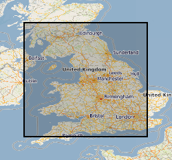
Spatial extent
Provided by
