
1996
Type of resources
Topics
Keywords
Contact for the resource
Provided by
Years
Formats
Representation types
Update frequencies
Scale
-
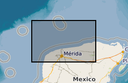
BIRPS (the British Institutions Reflection Profiling Syndicate) acquired almost 650 km of offshore seismic data and 300 km of onshore seismic data over the Chicxulub impact crater. The data were recorded to 18 s two-way time.
-

The database contains spectra of rock and soil that have predominantly been captured using a Portable Infrared Mineral Analyser although other instruments may also have been used.
-

PROJECT DETAILS ONLY - NO DATA. We aim to conduct an in-depth study of the rheology and flow dynamics of foams and bubble suspensions in Newtonian liquids with gas volume fraction in the range 0 to 75% and to apply the results to the flow of vesicular magmas and lavas in various confined and unconfined geometries. We will determine shear and bulk viscosity and viscoelastic properties as a function of bubble concentration and size-distribution. Foam breakdown under shear, flow down slopes and along pipes will be investigated by experiments and numerical models. Results will be applied to magma flow along dykes and up conduits and lava flows down slopes
-

Index data from field note record sheets. These records are produced by BGS geologists as part of the geological mapping process and are written descriptions of localities, or sections, or records of measurements taken in the field. Most are linked to a specific field map. The index was setup in 1999 and covers the whole of Great Britain.
-

[This metadata record has been superseded, see http://data.bgs.ac.uk/id/dataHolding/13608197] An index to the manuscript notebook collection was set up in the 1990's. The notebooks themselves contain detailed information gathered by BGS geologists (or other recognised geologists) from various sources as part of the mapping of Great Britain since the 1840s. Examples include observations linked directly to field slips, borehole logs, sections and drawings. All the notebooks held by National Geological Records Centre (NGRC) are indexed but other notebooks held in the Library may not be included. The index is to the notebooks and is not a detailed index of the information in the notebook. Detailed information from coalfield areas is held in the Happs Hall Index. For the basic field mapping work notebooks have now been replaced by field record sheets.
-

PROJECT DETAILS ONLY - NO DATA. To determine the p-t stability of hydrous phases in ultramafic compositions in subduction zones, and the conditions at which h2o is released from subducting slabs in dehydration reactions; to obtain thermodynamic data for hydrous phases through phase-equilibrium experiments and in situ volume measurements; and to constrain the equation of state of h2o at high pressures. Reversed phase-equilibrium experiments will be conducted on reactions in the systems mgo-sio2-h2o and mgo-al2o3-sio2-h2o; thermodynamic data for hydrous phases wil be extracted from p-t postions of solid-solid reactions; positions of dehydration reactions will constrain the equation of state of h2o; volumes of phases will be measured in situ using synchrotron radiation
-
This dataset of paper records holds details of analysis of all the sample batches (from both internal and external customers) analysed by the Analytical Geochemistry Laboratory of the BGS since June 1996. It was installed to underpin the UKAS (United Kingdom Accreditation Service) accreditation of the geochemistry laboratories at Keyworth, which was awarded in August 1999. There is a file for each batch of samples submitted for analysis. The file documents the progress of the samples through the laboratories, including sample registration, sample processing, raw data from analytical instruments and the data reported to the client. The records are archived to provide supporting evidence for any query regarding geochemical data provided by the laboratories.
-
This dataset contains scans of Applied Geology Maps (AGMs) and sections, which are also known as thematic maps, Environmental Geology Maps (EGMs) or Planning for Development Maps (PfD). They were produced as part of 'Geological Background for Planning and Development' and preliminary sand and gravel projects carried out by the British Geological Survey for the Department of the Environment, Transport and the Regions (DETR), the Scottish Development Department and Scottish Office from 1975 to 1996. The maps and sections cover a number of themes (up to 22) for specific areas relating to the project area within the United Kingdom (which are mostly urban areas). Themes include simplified bedrock and superficial maps, drift thickness, drift lithology, rockhead contours and a range of mining-related themes. Each area had its own custom set of maps and were issued with an accompanying BGS Technical Report. The maps and report were sometimes issued as a pack, but for some areas they were made available separately. The geological linework and the methods used to produce the maps are those current at the time of production. Map scales are predominantly 1:10 000 or 1:25 000, with a few 1:50 000 maps. The maps have Ordnance Survey map bases and are bounded by the project area. The maps could be used for geological, engineering geological, environmental and resources research, as an information and reference resource and for inclusion in reports and papers. These maps are hard-copy paper records and digital scans, stored in the National Geoscience Data Centre (NGDC).
-
Data from the Total Ozone Mapping Spectrometer (TOMS), which used backscattered ultraviolet radiance to infer total column ozone measurements (gridded daily for the entire globe). This 2 CD-ROM set contains the latest version (version 7) of ozone data from the TOMS (Total Ozone Mapping Spectrometer) instrument onboard the Nimbus 7 spacecraft. Data covering the entire Nimbus 7 TOMS lifetime, November 1, 1978 through May 6, 1993, are given as daily files of gridded data, as zonal means, and as monthly averages. Software is included to image the data. For scientific investigators, a similar CD-ROM containing TOMS surface reflectivity values is planned. A CD-ROM of version 7 data from the Meteor 3 TOMS instrument (August 1991 - December 1994) will be produced this summer.
-
Data from the Total Ozone Mapping Spectrometer (TOMS), which used backscattered ultraviolet radiance to infer total column ozone measurements (gridded daily for the entire globe). This 2 CD-ROM set contains the latest version (version 7) of reflectivity data from the TOMS (Total Ozone Mapping Spectrometer) instrument onboard the Nimbus 7 spacecraft. Data covering the entire Nimbus 7 TOMS lifetime, November 1, 1978 through May 6, 1993, are given as daily files of gridded data, as zonal means, and as monthly averages. A similar CD-ROM set (OPT_004A and OPT_004B) containing TOMS total ozone values is also currently available. A CD-ROM of version 7 data from the Meteor 3 TOMS instrument (August 1991 -December 1994) will be produced soon.