Soil chemistry
Type of resources
Topics
Keywords
Contact for the resource
Provided by
Years
Formats
Representation types
Update frequencies
Scale
-
Soil samples collected in urban areas throughout the UK are analysed for their major and trace element geochemistry, their pH and organic matter content. Samples are collected at two depths; 0-15cm and 35-45cm at sites selected using a stratified, random design. The data can be used to identify and prioritize contaminated sites. In 1993, the Geochemical Baseline Survey Of The Environm (G-BASE) rural geochemical mapping programme was extended to include sampling in urban areas and to date around 22 urban centres have been sampled. Data is available on key inorganic contaminants including Cr, Cu, Cd, Ni, As, Pb, Zn, Sn and Sb. Results have been standardised to ensure seamless joins between geochemical sampling campaigns. Urban centres are selected in areas where rural sampling is undertaken or where the BGS urban programme is active. Urban centres will continue to be sampled until completion of the rural programme, scheduled for 2015.
-
The G-BASE programme involves systematic sampling and the determination of chemical elements in samples of stream sediment, stream water and soil, to build up a picture of the surface chemistry of the UK. G-BASE for SW England is the most recent area of the UK sampled by this on-going project The average sample density for stream sediments is approximately one site per 2km square. Density for soils in SW England is variable across the area, ranging from 1 per 2km square to one per 5km square, depending on underlying parent material. Analytical precision is high with strict quality control to ensure countrywide consistency. Results have been standardised to ensure continuity with existing G-BASE geochemical data. The data provide baseline information on the natural abundances of elements, against which anomalous values due to such factors as mineralisation and industrial contamination may be compared. Analytical data for the sub150 microns fraction of stream sediment and the sub 2mm fraction of soil samples are available for some or all of: Ag, Al, As, Ba, Bi, Br, Ca, Cd, Ce, Cl, Co, Cr, Cs, Cu, Fe, Ga, Ge, Hf, I, In, K, La, Mg, Mn, Mo, Na, Nb, Nd, Ni, P, Pb, Rb, S, Sb, Sc, Se, Si, Sm, Sn, Sr, Ta, Te, Th, Ti, Tl, U, V, W, Y, Yb, Zn, and Zr.
-
The Mineral Reconnaissance Programme (MRP), funded by the DTI (Department of Trade and Industry) carried out baseline mineral exploration in Great Britain between 1972 and 1997. Its main aim was to stimulate private-sector exploration and the development of indigenous mineral resources. It has been subsumed into the new BGS Minerals Programme, also funded by the DTI. The Programme provides information and advice to industry, enables technology transfer and promotes wealth creation through the effective sustainable development of Britain's mineral resources. The database contains information from the MRP together with some from earlier programmes and the new Minerals Programme. Information from the early 1970s was largely concerned with the search for uranium and base-metals, while since the 1980s gold and platinum-group elements (PGEs) have dominated. A range of pathfinder elements have also been determined. Data is held on the geochemistry of drainage stream sediments, panned concentrates, soil, deep overburden, rock and drillcore samples. All geochemical results are used to populate corporate Geochemistry Database.
-
The Estimated Ambient Background Soil Chemistry England and Wales dataset indicates the estimated geometric mean topsoil Arsenic(As), Cadmium (Cd), Cr (Chromium), Nickel (Ni) and Lead (Pb) concentrations (mg kg-1). The soil chemistry data is based on GBASE (Geochemical Baseline Survey of the Environment) soil geochemical data where these are available. Elsewhere the stream sediment data are converted to surface soil equivalent potentially harmful element (PHE) concentrations. This dataset covers England and Wales but data is available for the whole of Great Britain, with the exception of the London area where an inadequate number of geochemical samples are available at the moment.
-
This dataset has now been superseded, please see the Estimated Ambient Background Soil Chemistry Scotland dataset. The BGS digital soil chemistry data indicates the estimated geometric mean concentrations (mg kg-1) of Arsenic (As), Cadmium (Cd), Chromium (Cr), Nickel (Ni) and Lead (Pb) in surface soil. The soil chemistry data is based on GBASE (Geochemical Baseline Survey of the Environment) soil geochemical data where these are available. Elsewhere the stream sediment data are converted to surface soil equivalent potentially harmful element(PHE) concentrations. This dataset covers Scotland but data is available for the whole of Great Britain, with the exception of the London area where an inadequate number of geochemical samples are available at the moment.
-
This layer shows data collected mainly by the Geochemical Baseline Survey of the Environment (G-BASE) programme. Geochemical data are available for soil samples for the Humber-Trent and East Anglia atlas areas (see the Geochemical atlas areas layer). Samples for East Midlands and part of Southeast England have been collected and are currently either undergoing analysis or data conditioning. More than twenty urban areas have also been sampled and top soil analyses are available for these urban areas (Belfast, Cardiff, Corby, Coventry, Derby, Doncaster, Glasgow, Hull, Ipswich, Leicester, Lincoln, Manchester, Mansfield, Northampton, Nottingham, Peterborough, Scunthorpe, Sheffield, Swansea, Stoke, Telford, Wolverhampton and York). Regional samples are collected at an average density of one site per 2 square kilometres, urban sampling is at a density of 4 samples per square kilometre. Top soil samples are collected at a depth of 5 - 20cm. It is sieved through a 2mm mesh and milled to less than 150 microns. The data include analyses for some or all of the following elements by XRFS: Mg, P, K, Ca, Ti, Mn, Fe, V, Cr, Co, Ba, Ni, Cu, Zn, Ga, As, Se, Rb, Sr, Y, Zr, Nb, Mo, Pb, Bi, Th, U, Ag, Cd, Sn, Sb, Cs, La, Ce, Ge, Sc, Se, Br, Hf, Ta, W, Tl, Te and I. Loss on Ignition (LOI) and pH (in a slurry of 0.01 M CaCl2 ) is now routinely determined on 50% of regional and all urban samples.
-
This dataset has now been superseded, please see the Estimated Urban Soil Chemistry dataset. There are two themes to BGS urban soil chemistry, the point source dataset and the estimated dataset. The point source urban soil chemistry data comprises the locations and concentrations (mg kg-1) of Arsenic (As). Cadmium (Cd), Chromium (Cr), Nickel (Ni) and Lead (Pb) in urban topsoil samples. The Estimated Urban Soil Chemistry data indicates the estimated geometric mean concentrations (mg kg-1) of As, Cd, Cr, Ni and Pb in topsoil derived by spatial interpolation of the Point Source Urban Soil Chemistry data. Both urban soil chemistry datasets are derived from high resolution urban soil geochemical data from the BGS Geochemical Baseline Survey of the Environment (G-BASE) project. The Urban Soil Chemistry data can be used to assist Local Planning Authorities to identify those areas where a risk assessment may need to be carried out by developers. Comparison of this spatially referenced geochemical data with information on current or historic land use and geological information might help environmental professionals decide whether high PHE concentrations in topsoils can be attributed to geogenic or anthropogenic sources. The dataset is based on, and limited to, an interpretation of the records in the possession of the BGS at the time the dataset was created.
-
The G-BASE programme involves systematic sampling and the determination of chemical elements in samples of stream sediment, stream water and soil, to build up a picture of the surface chemistry of the UK. The average sample density for stream sediments and water is about one site per 1.5-2km square, and for soils one site per 2km square. Analytical precision is high with strict quality control to ensure countrywide consistency. Results have been standardised to ensure seamless joins between geochemical sampling campaigns. The data provide baseline information on the natural abundances of elements, against which anomalous values due to such factors as mineralisation and industrial contamination may be compared. Analytical data for the 150 microns fraction of soil and stream sediment samples are available for some or all of: Ag, As, B, Ba, Bi, Be, Ca, Ce, Cd, Co, Cr, Cs, Cu, Fe, Ga, K, La, Li, Mg, Mn, Mo, Nb, Ni, P, Pb, Rb, Sb, Se, Sn, Sr, Th, Ti, U, V, Y, Zn, and Zr. Most water samples have been analysed for alkalinity, pH, conductivity, F and U and some for multi-element analyses including Al, Cl, Na, Si, SO4,NO4, and TOC. The project now routinely determines the elements listed in the <2mm fraction of surface soils.
-
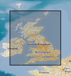
The Estimated Urban Soil Chemistry data are derived by spatial interpolation of the Measured Urban Soil Chemistry data. A unique feature of this dataset is the inclusion for the first time of estimated bioaccessible arsenic and lead data. The Estimated Urban Soil Chemistry data indicates the estimated geometric mean concentrations (mg kg-1) of Arsenic, Cadmium, Chromium, Nickel and Lead in topsoil derived by spatial interpolation of the Measured Urban Soil Chemistry data. Estimated bioaccessible As and Pb concentrations are derived using linear regression models of the relationship between total and bioaccessible concentrations. The Estimated Urban Soil Chemistry data can be used to assist Local Planning Authorities to identify those areas where a risk assessment may need to be carried out by developers. Comparison of this spatially referenced geochemical data with information on current or historic land use and geological information might help environmental professionals decide whether high potentially harmful element (PHE) concentrations in topsoils can be attributed to geogenic or anthropogenic sources. The dataset is based on, and limited to, an interpretation of the records in the possession of the BGS at the time the dataset was created. This dataset consists of two shape files Estimated Urban Soil Chemistry (As, Cr, Ni) and Estimated Urban Soil Chemistry (Cd, Pb).
-
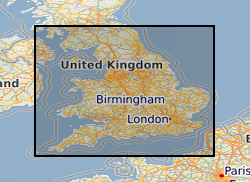
This dataset has now been superseded, please see the Estimated Ambient Background Soil Chemistry England and Wales dataset. This dataset indicates the estimated topsoil Arsenic(As), Cadmium (Cd), Cr (Chromium), Nickel (Ni) and Lead (Pb) concentrations (mg kg-1) derived by spatial interpolation of the point source urban soil PHE (potentially harmful elements) data. Urban soil geochemical data generally have large positive skewness coefficients so were transformed by taking natural logarithms. To overcome the bias associated with traditional measures of location (mean) and scale (standard deviation) for log-normal data, the inverse distance weighted (IDW) mean and standard deviation of log transformed element concentrations were used for mapping the spatial variation in As, Cd, Cr, Ni and Pb concentrations. The soil chemistry data is based on GBASE (Geochemical Baseline Survey of the Environment) soil geochemical data where these are available. Elsewhere the stream sediment data are converted to surface soil equivalent potentially harmful element(PHE) concentrations. This dataset covers England and Wales but data is available for the whole of Great Britain, with the exception of the London area where an inadequate number of geochemical samples are available at the moment.
 NERC Data Catalogue Service