 NERC Data Catalogue Service
Soil Chemistry England and Wales (version 3)
This dataset has now been superseded, please see the Estimated Ambient Background Soil Chemistry England and Wales dataset. This dataset indicates the estimated topsoil Arsenic(As), Cadmium (Cd), Cr (Chromium), Nickel (Ni) and Lead (Pb) concentrations (mg kg-1) derived by spatial interpolation of the point source urban soil PHE (potentially harmful elements) data. Urban soil geochemical data generally have large positive skewness coefficients so were transformed by taking natural logarithms. To overcome the bias associated with traditional measures of location (mean) and scale (standard deviation) for log-normal data, the inverse distance weighted (IDW) mean and standard deviation of log transformed element concentrations were used for mapping the spatial variation in As, Cd, Cr, Ni and Pb concentrations. The soil chemistry data is based on GBASE (Geochemical Baseline Survey of the Environment) soil geochemical data where these are available. Elsewhere the stream sediment data are converted to surface soil equivalent potentially harmful element(PHE) concentrations. This dataset covers England and Wales but data is available for the whole of Great Britain, with the exception of the London area where an inadequate number of geochemical samples are available at the moment.
Simple
- Date (Creation)
- 2009
Distributor
British Geological Survey
-
Enquiries
0115 936 3276
Environmental Science Centre, Nicker Hill, Keyworth
,
NOTTINGHAM
,
NOTTINGHAMSHIRE
,
NG12 5GG
,
United Kingdom
0115 936 3143
0115 936 3276
Point of contact
British Geological Survey
-
Enquiries
0115 936 3276
Environmental Science Centre, Nicker Hill, Keyworth
,
NOTTINGHAM
,
NOTTINGHAMSHIRE
,
NG12 5GG
,
United Kingdom
0115 936 3143
0115 936 3276
Custodian
British Geological Survey
-
Enquiries
0115 936 3276
Environmental Science Centre, Nicker Hill, Keyworth
,
NOTTINGHAM
,
NOTTINGHAMSHIRE
,
NG12 5GG
,
United Kingdom
0115 936 3143
0115 936 3276
- Maintenance and update frequency
- notPlanned Not planned
- GEMET - INSPIRE themes, version 1.0
- BGS Thesaurus of Geosciences
-
- Arsenic
- Lead
- Nickel
- Chromium
- Cadmium
- Soil chemistry
- dataCentre
- Keywords
-
- NERC_DDC
- Access constraints
- otherRestrictions Other restrictions
- Other constraints
- license
- Use constraints
- otherRestrictions Other restrictions
- Other constraints
- The copyright of materials derived from the British Geological Survey's work is vested in the Natural Environment Research Council [NERC]. No part of this work may be reproduced or transmitted in any form or by any means, or stored in a retrieval system of any nature, without the prior permission of the copyright holder, via the BGS Intellectual Property Rights Manager. Use by customers of information provided by the BGS, is at the customer's own risk. In view of the disparate sources of information at BGS's disposal, including such material donated to BGS, that BGS accepts in good faith as being accurate, the Natural Environment Research Council (NERC) gives no warranty, expressed or implied, as to the quality or accuracy of the information supplied, or to the information's suitability for any use. NERC/BGS accepts no liability whatever in respect of loss, damage, injury or other occurence however caused.
- Other constraints
- The dataset is made available to external clients under BGS Digital Data Licence terms and conditions. Revert to the IPR Section (iprdigital@bgs.ac.uk ) if further advice is required with regard to permitted usage.
- Other constraints
- Either: (i) the dataset is made freely available, e.g. via the Internet, for a restricted category of use (e.g. educational use only); or (ii) the dataset has not been formally approved by BGS for access and use by external clients under licence, but its use may be permitted under alternative formal arrangements; or (iii) the dataset contains 3rd party data or information obtained by BGS under terms and conditions that must be consulted in order to determine the permitted usage of the dataset. Refer to the BGS staff member responsible for the creation of the dataset if further advice is required. He / she should be familiar with the composition of the dataset, particularly with regard to 3rd party IPR contained in it, and any resultant use restrictions. This staff member should revert to the IPR Section (ipr@bgs.ac.uk ) for advice, should the position not be clear.
- Spatial representation type
- vector Vector
- Denominator
- 50000
- Metadata language
- EnglishEnglish
- Topic category
-
- Geoscientific information
- Geographic identifier
-
EAW
- Date (Revision)
- 2009
- Geographic identifier
-
ENGLAND & WALES [id=149000]
- Date (Creation)
- 1979
N
S
E
W
))
- Begin date
- 1993
- End date
- 2010
- Supplemental Information
- This dataset has been replaced by Estimated Ambient Background Soil Chemistry England and Wales.
- Unique resource identifier
- OSGB 1936 / British National Grid (EPSG::27700)
- Distribution format
-
-
ESRI Shapefile
(
1994
)
-
ESRI Shapefile
(
1994
)
Distributor
British Geological Survey
-
Enquiries
0115 936 3276
Environmental Science Centre, Nicker Hill, Keyworth
,
NOTTINGHAM
,
NOTTINGHAMSHIRE
,
NG12 5GG
,
United Kingdom
0115 936 3143
0115 936 3276
- OnLine resource
-
BGS Homepage
(
WWW:LINK-1.0-http--link
)
The BGS Homepage is an entry point to the BGS data services.
- Hierarchy level
- dataset Dataset
- Other
- dataset
Conformance result
- Date (Publication)
- 2011
- Explanation
- See the referenced specification
- Pass
- No
Conformance result
- Date (Publication)
- 2010-12-08
- Explanation
- See http://eur-lex.europa.eu/LexUriServ/LexUriServ.do?uri=OJ:L:2010:323:0011:0102:EN:PDF
- Pass
- No
- Statement
- The soil chemistry data is based on GBASE soil geochemical data where these are available. Elsewhere the stream sediment data are converted to surface soil equivalent potentially harmful element (PHE) concentrations using delineations of PM polygons as the soil geochemistry mapping unit and the statistical relationships between soil and stream sediment data to derive the equivalent soil PHE concentration from the stream sediment data. Where only Wolfson stream sediment data are available in southern England, these data are first transformed to G-BASE equivalent sediment concentrations, and then to soil equivalent concentrations. Geometric mean ambient background concentrations (ABCs) for PHEs in mineral soils are mapped within delineations of PM polygons to produce a seamless data set covering the whole of Great Britain, with the exception of the London area where an inadequate number of geochemical samples are available at the moment. PHE concentrations in organic soils (i.e. with more than 15-20% organic carbon) are likely to be significantly lower than those indicated by the ESTIMATED SOIL PHE DATA.
- File identifier
- 9df8df53-2a3a-37a8-e044-0003ba9b0d98 XML
- Metadata language
- EnglishEnglish
- Hierarchy level
- dataset Dataset
- Date stamp
- 2026-05-06
- Metadata standard name
- UK GEMINI
- Metadata standard version
- 2.3
Point of contact
British Geological Survey
Environmental Science Centre,Keyworth
,
NOTTINGHAM
,
NOTTINGHAMSHIRE
,
NG12 5GG
,
United Kingdom
+44 115 936 3100
- Dataset URI
- http://data.bgs.ac.uk/id/dataHolding/13605361
Overviews
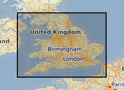
Spatial extent
N
S
E
W
Provided by

Associated resources
Not available