 NERC Data Catalogue Service
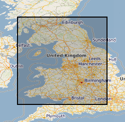
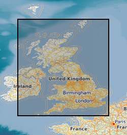
Mine shafts
Type of resources
Topics
Keywords
Contact for the resource
Provided by
Years
Formats
Representation types
Update frequencies
Scale
-

Index to the statutory notifications of the intention to drill any boreholes, shafts or wells under the Mining Industry Act 1926 or the Water Resources Act 1991 for Great Britain. Index complete for all notifications since 1952, but record data will vary. Complete and current entries generally accurate to 10 metres . Earlier entries to map sheet level only. Digital capture from October 1988.
-

The BGS collection of downhole CCTV (Closed Circuit Television) recordings and backup tapes for worldwide SKYLAB satellite imagery. CCTV recordings carried out down boreholes, mainly drilled for water, were undertaken by BGS for specific commercial contracts in Great Britain, and may also have associated geophysical data. The collection started in 1997, and the present holdings are 138 videos, with infrequent additions. Video recordings on other topics may be added.
-

Records for Great Britain of the statutory notifications of the intention to drill any boreholes, shafts or wells under the Mining Industry Act 1926 or the Water Resources Act 1991( plus voluntary notifications) . Information has been collected and maintained centrally from the 1950's, earlier records however are only on index cards. Complete for all boreholes since 1988 but record data will vary depending on the original purpose. Access restrictions apply.
-

This layer of the Map based index (GeoIndex) shows the location of records of boreholes, shafts and wells from all forms of drilling and site investigation work. Some 850,000 records dating back over 200 years and ranging from one to several thousand metres deep. Currently some 50,000 new records are being added to the collection each year. The dataset available via the GeoIndex is a snapshot, taken at a particular date, of the Single Onshore Borehole Index. Although the GeoIndex is updated at regular intervals more information may be available than is shown.
-

Index to various collections of Aerial Photographs purchased or obtained by BGS and its precursors as part of its surveying activities. The index was set up in 2000 and mainly covers Great Britain. The level of spatial detail depends on the flight plans provided, but most are referenced at least to OS quarter sheet level.
-
Primary Geological Data resulting from Open Cast Coal exploration. Collection of data includes reports, interpretations and records of research in British coalfield areas deposited by British Coal. Data for past and current collieries and for future prospects. The majority of the collection was deposited with the National Geological Records Centre by the Coal Authority in July 2001. The collection includes borehole site plans, borehole logs , analyses and geophysical data etc. BGS holdings of opencast data are to be integrated with these collections. New data from coal companies will be added as it is received.
-

The BGS collection of paper and sepia geophysical logs from boreholes drilled by BGS and external organisations. The majority of the collection are in hard copy , but significant numbers are now available digitally. Covering the UK mainland and offshore from 1949 onwards. the commercial logs are mainly related to hydrocarbon , coal exploration or water wells. The collection covers Great Britain and the types of logs and the scales used will vary depending on the equipment available and the use of the data.
-
Primary Geological Data resulting from Open Cast Coal exploration in British coalfield areas. Maps showing the site outlines of opencast coal prospecting sites annotated with site reference number. Sites date back to the 1940s. Outlines drawn on 1:25000 scale topographic bases. The majority of the collection was deposited with the National Geological Records Centre by the Coal Authority in July 2001.
-
Index, set up in 1998, to the archive collection of reports, notebooks interpretations, plans and other geological or related data received from external organisations that are not part of other collections. These cover a wide variety of different types and ages of information mainly from Great Britain but some related to BGS projects overseas.
-

An important paper archive of a wide variety of miscellaneous geological information organised on the basis of its location within 1:10 000 scale geological map sheet areas in Great Britain. The majority of the data has been produced or collected from a wide variety of sources by BGS staff since 1835. Mainly acquired as part of the mapping programme new information is added on a regular basis. The data may not fit into any of the main collections, but is valuable for future projects and answering enquiries.