Rural Focus Ltd
Type of resources
Topics
Keywords
Contact for the resource
Provided by
Years
Formats
Representation types
Update frequencies
-
The dataset contains climate data (Humidity, Rainfall, Rainfall Rate, Dewpoint, Atmospheric Pressure, Temperature, Wind Direction, Wind Gust, Wind Chill, Solar Radiation, Windspeed, Heat Index, UV & UVI) at daily temporal resolution from Maplin Professional Solar Powered Wi-Fi Weather Stations installed at Munje and Galu within the study area.
-
The dataset contains hourly river water level data for 3 monitoring sites; Mukurumudzi River (3KD06 Shimba Hills & KISCOL Weir) Ramisi River (Eshu Bridge) in Kwale County, Kenya
-
The data sets contain the rating curves and equations, approved stage (H) discharge (Q) data for the purposed of building river rating information for three hydrometric stations: 3KD06 and KISCOL weir on Mukurumudzi River and Eshu Bridge on Ramisi River, in Kwale. See also Wara et al. 2019: https://doi.org/10.4236/jwarp.2019.114028
-
The file consists of data sets from Kwale County, Kenya that describe biophysical characteristics of the catchment overlaid as layers. These include Basin, Sub-basins extent, Soil, DEM, Landuse, Slope, Rivers, Outlets and Monitoring Points. The data are in raster, shapefile, polygon, polyline and point format.
-
Gro for GooD Rainfall Data from 23 Manual Rain Gauges, Kwale County, Kenya (NERC grant NE/M008894/1)
The dataset consists of daily rainfall data for 23 manual rain gauge stations installed by Gro for GooD project within and about the study area. The installed stations covering four river catchments name Ramisi River, Mukurumudzi River, Mtawa River and Mwachema River in Kwale County. The dataset period is from January 2016 to November 2018. Gro for GooD: Groundwater Risk Management for Growth and Development
-
This dataset contains digital terrain data that describes the topography of the area under study at 90m resolution based on SRTM 90m Digital Elevation Data from the CGIAR-CSI (Consultative Group on International Agricultural Research - Consortium for Spatial Information). Gro for GooD: Groundwater Risk Management for Growth and Development, https://upgro.org/consortium/gro-for-good/
-
Gro for GooD VES (Vertical Electrical Soundings) Data, Kwale County, Kenya (NERC grant NE/M008894/1)
Results of Vertical Electrical Soundings (VES) study conducted in Kwale County, Kenya in July and August 2017 by University of Nairobi and Water Resources Management Authority as part of the Gro for GooD project (https://upgro.org/consortium/gro-for-good/) to determine the existence of deeper aquifers.
-
The data sets contain the daily record of meters of groundwater columns for 7 Heron logger transducers installed in different boreholes and wells in the study area. Missing data denoted -9999. The Barlog data for atmospheric pressure (Atmospheric Pressure data measured by Heron Barologger for the period of April 2014 to November 2018 at Munje Jabalini.) is also included. "Uncomp.HT.WTR. Above Transducer" corresponds to the actual pressure the dipperLog is measuring. "Barologger Data" corresponds to the Barlog data for atmospheric pressure at Munje Jabalini "Comp.Depth.WTR Below the Datum" is the "Depth below datum" entered in the logger setup less "Comp.HT.WTR. Above Transducer". The data was collected by Albert Folch and Nuria Ferrer (UPC), Mike Lane and Calvince Wara (Rural Focus Ltd). The PI on the Gro for GooD project was Prof. Rob Hope, University of Oxford.
-
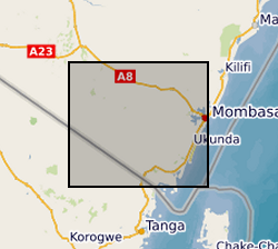
Results of Electrical Resistivity Tomography (ERT) conducted in Kwale County, Kenya December 2015 and June 2016 by University of Nairobi and Water Resources Management Authority as part of the Gro for GooD project (https://upgro.org/consortium/gro-for-good/) to characterize the aquifers in the study area. There were eight transects of length 1.2 to 6km, running W-E and NNE-SSW parallel to coastline. ERT data was analysed using RES2D inversion software. Gro for GooD - Groundwater Risk Management for Growth and Development
-
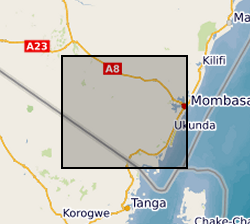
This data set contains land cover/land use data for the year 1990 and 2015 obtained through processing of Landsat images of US Geological Survey. These data sets were obtained through a supervised classification carried out with Landsat 8 image for 2015; Landsat 4 and 5 were used for land use classification of 1990. Gro for GooD: Groundwater Risk Management for Growth and Development
 NERC Data Catalogue Service