 NERC Data Catalogue Service
AWS (Automatic Weather Station) Climate Data, Kwale County, Kenya (NERC grant NE/M008894/1)
The dataset contains climate data (Humidity, Rainfall, Rainfall Rate, Dewpoint, Atmospheric Pressure, Temperature, Wind Direction, Wind Gust, Wind Chill, Solar Radiation, Windspeed, Heat Index, UV & UVI) at daily temporal resolution from Maplin Professional Solar Powered Wi-Fi Weather Stations installed at Munje and Galu within the study area.
Simple
- Date (Creation)
- 2017-10-19
Principal investigator
University of Oxford
-
Dr R A Hope
(
School of Geography and the Environment
)
Oxford
,
OX1 3QY
,
Point of contact
University of Oxford
-
Nancy Gladstone
(
Smith School of Enterprise and the Environment
)
Oxford
,
OX1 3QY
,
- Maintenance and update frequency
- notApplicable notApplicable
- GEMET - INSPIRE themes, version 1.0
- BGS Thesaurus of Geosciences
-
- Atmospheric pressure
- Climatology
- Temperature
- Solar radiation
- Wind
- Humidity
- Rainfall
- dataCentre
- Keywords
-
- NERC_DDC
- Access constraints
- otherRestrictions Other restrictions
- Other constraints
- no limitations
- Other constraints
- The dataset is made freely available for access, e.g. via the Internet. Either no third party data / information is contained in the dataset or BGS has secured written permission from the owner(s) of any third party data / information contained in the dataset to make the dataset freely accessible.
- Use constraints
- otherRestrictions Other restrictions
- Other constraints
- The copyright of materials derived from the British Geological Survey's work is vested in the Natural Environment Research Council [NERC]. No part of this work may be reproduced or transmitted in any form or by any means, or stored in a retrieval system of any nature, without the prior permission of the copyright holder, via the BGS Intellectual Property Rights Manager. Use by customers of information provided by the BGS, is at the customer's own risk. In view of the disparate sources of information at BGS's disposal, including such material donated to BGS, that BGS accepts in good faith as being accurate, the Natural Environment Research Council (NERC) gives no warranty, expressed or implied, as to the quality or accuracy of the information supplied, or to the information's suitability for any use. NERC/BGS accepts no liability whatever in respect of loss, damage, injury or other occurence however caused.
- Other constraints
- Available under the Open Government Licence subject to the following acknowledgement accompanying the reproduced NERC materials "Contains NERC materials ©NERC [year]"
- Spatial representation type
- textTable Text, table
- Metadata language
- EnglishEnglish
- Topic category
-
- Geoscientific information
- Geographic identifier
-
KE
- Date (Revision)
- 2009
- Geographic identifier
-
KEN
- Date (Revision)
- 2009
- Geographic identifier
-
KENYA [id=687000]
- Date (Creation)
- 1979
N
S
E
W
))
- Begin date
- 2016-05-12
- End date
- 2017-08-28
- Supplemental Information
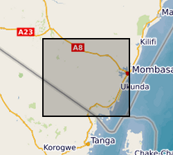
- xMin,yMin 47869.9695, 9491995.1231 : xMax,yMax 567375.2423, 9547808.6490 UTM X/Y Arc1960 (Kwale County, Kenya)
- Unique resource identifier
- Arc 1960 / UTM zone 37S (EPSG::21037)
- Distribution format
-
- OnLine resource
- Gro for GooD: Groundwater Risk Management for Growth and Development ( WWW:LINK-1.0-http--link )
- OnLine resource
- http://reshare.ukdataservice.ac.uk/853667/
- OnLine resource
- Data ( WWW:DOWNLOAD-1.0-http--download )
- Hierarchy level
- dataset Dataset
- Other
- dataset
Conformance result
- Date (Publication)
- 2011
- Explanation
- See the referenced specification
- Pass
- No
Conformance result
- Date (Publication)
- 2010-12-08
- Explanation
- See http://eur-lex.europa.eu/LexUriServ/LexUriServ.do?uri=OJ:L:2010:323:0011:0102:EN:PDF
- Pass
- No
- Statement
- Maplin Professional Solar Powered Wi-Fi Weather Station (Maplin N23DQ) installed at Galu and Munje provide high quality climate data of measured outdoor temperature, humidity, wind speed and direction, rainfall and solar / UV radiation from the all-in-one outdoor sensor. The instrument is solar powered and the data can be directly downloaded or with Wi-Fi uploads to Wunderground (www.wunderground.com) where the data can then be downloaded via the Internet. The data was obtained at 5 minute resolution then aggregated to daily resolution.
- File identifier
- 5cfd5112-e0c0-41cb-e054-002128a47908 XML
- Metadata language
- EnglishEnglish
- Hierarchy level
- dataset Dataset
- Date stamp
- 2026-05-03
- Metadata standard name
- UK GEMINI
- Metadata standard version
- 2.3
Point of contact
British Geological Survey
Environmental Science Centre,Keyworth
,
NOTTINGHAM
,
NOTTINGHAMSHIRE
,
NG12 5GG
,
United Kingdom
+44 115 936 3100
- Dataset URI
- http://data.bgs.ac.uk/id/dataHolding/13607219
Overviews
Spatial extent
N
S
E
W
Provided by

Associated resources
Not available