 NERC Data Catalogue Service
Catchment
Type of resources
Available actions
Topics
Keywords
Contact for the resource
Provided by
Years
Formats
Representation types
Update frequencies
Resolution
-
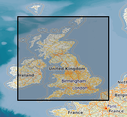
BGS GeoScour provides river scour susceptibility information for Great Britain using a three-tiered data provision allowing increasing levels of understanding at different resolutions from catchment to local (channel/reach) scales. GeoScour includes 11 GIS layers, providing information on the natural characteristics and properties of catchment and riverine environments for the assessment of river scour in Great Britain. The data product fills a gap in current scour modelling, with the input of geological properties. It provides an improved toolkit to more easily assess and raise the profile of scour risk, now and in the future, to help infrastructure providers and funders prioritise resources, identify remedial works to preclude costly and prevent disruptive failures. The data product has broad applications through its adaptation to suit multiple types of asset likely to be affected by fluvial erosion. The GeoScour Data Product is designed to be used by multiple stakeholders with differing needs and therefore, can be interrogated at a number of levels. Tier 1 data provides a summary overview of the catchment characteristics, typical response type, and evolution. It can be used as a high-level overview for incorporation into catchment management plans, national reviews and catchment comparisons. Tier 2 data are available as smaller catchment areas and focusses on providing data for more detailed catchment management, natural flood management and similar uses. It analyses geological properties such as flood accommodation space, catchment run-off potential, and geomorphology types, as well as additional summary statistics of key environmental parameters such as protected sites and urban coverage. Tier 3 data provide the detailed riverine information that is designed to be incorporated into more complex river scour models. It provides the baseline geological context for river scour development and processes and identifies important factors that should be considered in any scour model. Factors such as material mineralogy, strength and density are key properties that can influence a river’s ability to scour. In addition, an assessment of river fall, sinuosity and flood accommodation space is also provided. This data is of use to all users assessing the propensity for river scour for any given reach of a river across Great Britain. Tier 1 and 2 data are available with an OGL, Tier 3 data is licenced.
-
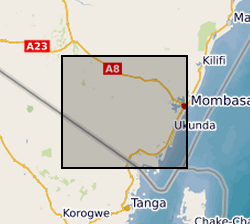
The file consists of data sets from Kwale County, Kenya that describe biophysical characteristics of the catchment overlaid as layers. These include Basin, Sub-basins extent, Soil, DEM, Landuse, Slope, Rivers, Outlets and Monitoring Points. The data are in raster, shapefile, polygon, polyline and point format.
-
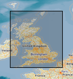
BGS GeoScour v2 provides river scour susceptibility information for Great Britain using a three-tiered data provision allowing increasing levels of understanding at different resolutions from catchment to local (channel/reach) scales. GeoScour v2 includes 18 GIS layers, providing information on the natural characteristics and properties of catchment and riverine environments for the assessment of river scour in Great Britain. The dataset product fills a gap in current scour modelling, with the input of geological properties. It provides an improved toolkit to more easily assess and raise the profile of scour risk, now and in the future, to help infrastructure providers and funders prioritise resources, identify remedial works to preclude costly and prevent disruptive failures. The product has broad applications through its adaptation to suit multiple types of asset susceptible to fluvial erosion. GeoScour looks specifically at the geological factors that influence scour and does not consider any hydraulic or hydrodynamic factors. The GeoScour Dataset Product is designed to be used by multiple stakeholders with differing needs and therefore, can be interrogated at a number of levels. Tier 1 A catchment stability dataset provides a summary overview of the catchment characteristics, typical response type, and evolution. It can be used as a high-level overview for incorporation into catchment management plans, national reviews and catchment comparisons using Tier 2 datasets are available as smaller catchment areas and focusses on providing data for more detailed catchment management, natural flood management and similar uses. It analyses geological properties such as flood accommodation space, catchment run-off potential, geomorphology types, and additional summary statistics for worst, average, and best-case scenarios for underlying surface geology scour susceptibility, as well as additional summary statistics of key environmental parameters such as protected sites and urban coverage. Tier 3 datasets provide the detailed riverine information that is designed to be incorporated into more complex river scour models. It provides the baseline geological context for river scour development and processes and identifies important factors that should be considered in any scour model. Factors such as material mineralogy, strength and density are key properties that can influence a river’s ability to scour. In addition, an assessment of river fall, sinuosity and flood accommodation space is also provided. This data is of use to those assessing the propensity for river scour for any given reach of a river across Great Britain and can be used as an input into hydraulic/hydrodynamic models. Tier 1 and 2 datasets are Open Government Licence (OGL), Tier 3 is licenced.
-
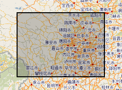
Hazards data in Sichuan (Dechang, Anning River catchment), China. Data include rainfall, earthquake, river catchment, boundary, geological map, soil map, land-cover map, road-map, DEM.
-
This dataset is a model output, from the Grid-to-Grid hydrological model driven by weather@home2 climate model data. It provides a 100-member ensemble of daily mean river flow (m3/s) for 260 catchments, for the following time periods: historical baseline (HISTBS: 1900-2006), near-future (NF: 2020-2049) and far-future (FF: 2070-2099). It also includes a baseline period (BS: 1975-2005). The catchments correspond to locations of NRFA gauging stations (http://nrfa.ceh.ac.uk/). The data were produced as part of MaRIUS (Managing the Risks, Impacts and Uncertainties of drought and water Scarcity), which was a UK NERC-funded research project (2014-2017) that developed a risk-based approach to drought and water scarcity. Full details about this dataset can be found at https://doi.org/10.5285/f6cac471-7d92-4e6d-be8a-9f7887143058
-

This image dataset was captured as part of the operation of a river gauging station on the Virkisá River, SE Iceland. The station formed part of the BGS Iceland Glacier Observatory network of sensors, deployed between 2009 and 2020 in order to characterise and identify glacial, geomorphological and hydrological drivers and processes and their timescales across the deglaciating Virkisjökull-Falljökull catchment in SE Iceland. The records presented here begin in September 2011 with the installation of the river gauging station, and continue to August 2020. Responsibility for the station passed to the Icelandic Meteorological Office in January 2018. The gauge is understood to remain operational as at August 2024. The data complements the published meteorological and river gauging datasets published here, and will be of use to researchers and students interested in the hydrology of a rapidly deglaciating landscape, including anyone interested to follow up on the various research studies published from this site in the international literature.