 NERC Data Catalogue Service
DEM
Type of resources
Topics
Keywords
Contact for the resource
Provided by
Years
Formats
Representation types
Update frequencies
Scale
-
Digital Terrain Model (DTM) at 5 metre resolution (GB-wide) derived from photogrammetry (2008-2012).

The Digital Terrain Model (DTM) is a bare earth model, posted at 5m with a vertical accuracy of less than 60cm RMSE (root mean square error). The model represents the bare ground surface without any objects like trees and buildings. The dataset covers Great Britain. The first surface model, the Digital Surface Model (DSM), which represents the earth’s surface including all objects on the surface, is produced using the digital stereo aerial photography acquired by Getmapping. The DSM is edited to produce a 5m DTM product. A suite of algorithms have been applied to semi-automatically edit the DSM and remove unwanted surface features such as buildings and vegetation. These algorithms include a routine which reduces the woodland canopy areas based on a bounding polygon. This requires some manual intervention to create bounding polygons for woodland extents and identify true ground level. In addition, break lines are captured where required to ensure true terrain features are not removed and that bodies of water, such as lakes, remain flat. The PGA Elevation data offers improved spatial resolution compared to the NEXTMap data. The data is from the Pan Government Agreement (PGA) and an in-perpetuity license has been granted to BGS. The data is being managed by the Earth and Planetary Observation and Monitoring (EPOM) Team in support of the wider BGS Programme.
-

The dataset contains detailed Digital Elevation Models (DEMs), generated from Airborne LiDAR. The data is owned by the Environment Agency and is provided to BGS for research use only. Very limited UK coverage, limited mostly to floodplains. Light Detection and Ranging (LiDAR) is an airborne mapping technique which uses a laser to measure the distance between the aircraft and the ground. This technique results in the production of a cost-effective terrain map suitable for assessing flood risk. The aircraft flies at a height of about 800 metres above ground level and a scanning mirror allows a swathe width of about 600 metres to be surveyed during a flight. Individual measurements are made on the ground at 2 metre intervals allowing a highly resolved model of the terrain to be generated. The Agency's Flood Defence function has a requirement under the Water Resources Act 1991 to monitor the flood plain. LiDAR is being used to measure land topography and assess coastal erosion and geomorphology. Products that can be generated from the LiDAR data include colour coded elevation models, height contour plots and three-dimensional perspective views allowing easy visualisation of surveyed areas.
-
The database contains scanned photographs (at 1016dpi) of the UK and various locations around the world. Some are single band (black&white) others are 3 band colour. The images are stored in various formats on various types of magnetic media: .COT raw scans can only be used on the Intergraph ImageStation; .JPG (Intergraph format); .TIF. Processed scans may also be saved as stereomodels (with project data) and as orthophotographs. Mono coverage for most of the UK and we are constantly acquiring stereo data. Data is updated when unscanned areas are required by projects.
-
GeoScholar is a set of free geological data - available in GIS format - for UK universities and the higher education sector, to support teaching and learning within the geosciences. The dataset includes digital geological map data from BGS, aerial photos from Infoterra, NEXTmap digital terrain model from Intermap Technologies, borehole data and their corresponding logs, several BGS geological map sheets. Each Geoscholar teaching package will include 12 different geographical regions, including Assynt, Coniston and South West Wales.
-
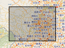
Hazards data in Sichuan (Dechang, Anning River catchment), China. Data include rainfall, earthquake, river catchment, boundary, geological map, soil map, land-cover map, road-map, DEM.