 NERC Data Catalogue Service
Photography
Type of resources
Available actions
Topics
Keywords
Contact for the resource
Provided by
Years
Formats
Representation types
Update frequencies
Scale
-

This dataset contains folders of field photographs. Photographs were collected from 4 different field locations - Warton, Glengarnock, Derwent Howe, Harrington. There is a folder for each location, and within each of those there are folders labelled by whether they are contextual, or of samples. The data was collected between 2021 and 2023. The data was collected for the purpose of documenting the appearance and characteristics of samples collected. The data was collected by John MacDonald and Robin Hilderman (University of Glasgow) who retain the original data.
-
The official BGS photographic archive contains an estimated 300,000 photographs. The archive has been built up systematically since its founding in 1891 and is becoming a very popular educational resource for images of the geology of the UK and overseas. A wide range of topics is represented: field geology, landscapes, oblique aerial photographs, geohazards, marine operations, fossil, rocks and photomicrographs of rocks and minerals in thin section. In addition there are an estimated 225,000 photographs held with former groups, projects and individual geoscientists. The collections hold a diverse range of photographic material which includes black and white or colour negatives, transparencies and prints. The film formats range from 35mm to 10"X8" which includes both film and large format glass plates.
-

This is the core collection of photographs in BGS it represents photographs taken by professional photographers and selected by subject and quality for public reference in the BGS libraries. The collection dates from c 1890 to c.1995 and is organized in a series of sub-collections depending on which office the photographers were based. The collection covers photography taken in the field during the geological mapping programme. Series A, the main Land Survey collection for England and Wales, are all taken by professional photographers and are of high quality. Dates from c.1890 to the start of the current "P" system, the first 7500 are glass plates. Series B, Edinburgh, part of the main Land Survey collection for Scotland, full plate size and all glass plates. Series C, Edinburgh, part of the main Land Survey collection for Scotland, half plate size. Series D, Edinburgh, part of the main Land Survey collection for Scotland consists of large format negative size with additional 35mm transparencies, earlier parts of the collection are black and white, later, colour. Series L, Keyworth, the main Land Survey collection for Northern England and Wales emanating from the Leeds Office, all are taken by professional photographers and include large format black and white, colour originals and colour 35 mm transparencies. Access constraints are only physical constraints relating to handling negatives and glass plates. scans are available in the Geoscience Imagebase. Photographs are either: Out of copyright; Crown or NERC.
-

The BGS archive photograph collections consists of three sub-collections, The British Association for the Advancement of Science (BAAS) photograph collection, Keyworth Library archive collection and the Archive Collection held in National Geological Records Centre (NGRC), Edinburgh. The British Association for the Advancement of Science photograph collection of prints was deposited on permanent loan from the BAAS, the photographs are of important historical interest and range in date from c. 1890 to 1940's. They are mostly field photographs of the UK and Ireland. The negatives were destroyed during the Second World War, the prints are held in the Library at Keyworth. The Keyworth library archive is an interesting assorted collection of historical photographs held in the Library Archive. Collections include subjects in the UK and overseas. Most are donated from external sources. The NGRC Edinburgh collection consists of photographs, mostly prints, held in the Scottish Land Survery Archives collection in Murchison House. They are mostly of historical interest and includes pictures of former staff.
-

Collection of aerial photographs purchased or obtained by BGS and its precursors as part of its surveying activities. Photographs for South West England at 1:10K-1:22K scale.
-
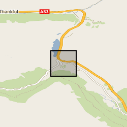
Fixed time lapse camera imagery with 15 minute interval during daytimes captured from Ben Donich (BNG: NN 2297 0637) looking towards the A83 Rest and Be Thankful / slope of Beinn Luibhean. Data were subsequently processed in https://doi.org/10.3390/rs13050893 for deformation tracking. There are data gaps during poor weather/outages, and, some camera shift requiring alignment.
-

The Geoscience Imagebase is the BGS internal corporate repository for photographic images and their metadata and run on commercial software called Assetbank from Bright Interactive. It also includes other types of images such as diagrams, PDF's etc when required. The images can be scans of analogue photographs, or images taken with a digital camera. A key feature to be aware of with the analogue material is that we often hold the metadata for an image but may not have scanned it and hence the image may not be directly available from the system. Each image is given a unique image number preceded with a 'P' this is used to reference images in publications or elsewhere. The system will allow the storage of variants of an original image, e.g. An image with a given number may be cropped and enhanced, in these cases, it is possible to hold the original and the image derived from the original together. The holdings of the Geoscience Imagebase is diverse. The 'core' of the collection is the old Land Survey field photograph collection which began in 1892. Subsequent additions are images (analogue and digital) taken by BGS geoscientists; images taken by official BGS photographers on a range of subjects including of subjects from the Material Collections e.g. fossils, rock specimens etc. and images held in the BGS archives derived from BGS or from external donations. A selection of images is made available to the public via the parallel Geoscenic.
-
A collection of aerial photographs providing national coverage supplied to BGS by Royal Commission on the Ancient and Historical Monuments of Scotland (RCAHMS). The aerial photos bought by BGS were taken during a two year period from 1988-89 and were bought by BGS for individual mapping projects. The photos are a copy of the originals held by the RCAHMS. Since 1976, RCAHMS has undertaken an annual programme of aerial survey, recording archaeological sites, monuments and buildings throughout Scotland. All RCAHMS data is crown copyright. The photos are for internal BGS use but external users are welcome to view them at BGS, an appointment must be made first. An index is provided on the Geoscience Data Index (GDI).
-
Collections of Aerial Photographs purchased or obtained by BGS and its precursors as part of its surveying activities. Data covers mainly Great Britain or areas where BGS has worked overseas and dates from the 1940's. The collection is incomplete and there are copyright and other constraints on its use.
-

The database contains colour and black and white prints and negatives of satellite images of the UK and various locations scattered around the world. It includes data from the Landsat, SPOT, Radarsat and ERS satellites. Negatives include single scenes and subsampled mosaics.