 NERC Data Catalogue Service
Aerial photographs
Type of resources
Topics
Keywords
Contact for the resource
Provided by
Years
Formats
Representation types
Update frequencies
Scale
-

This dataset comprises approximately 18600 nadir images taken from a UAS (Unmanned Aircraft Systems) and saved as .jpg files. The dataset broadly covers the area of proximal Skeiðarársandur area (~63.9 N, 17.3 W), and Skeiðarársandur coastline (63.7 N, 17.5 W) at the mouth of Gígjukvísl on 18th April 2022 in Southern Iceland. The data set broadly stretches for an area 11 km east, and 8 km north in the proximal Skeiðarársandur area. The coverage is variable as the imagery is centred on the proglacial lakes and associated drainage rivers. Data was collected over two field campaigns after the December 2021 Glacial Lake Outburst Flood, with collections occurring in April and June 2022. Flights were conducted at 120 m elevation with >60% overlap between images. Ground control points collected in the GNSS (Global Navigation Satellite System ) dataset were used to georeference the imagery. The images were collected to quantify the impacts of the flood and to try and identify strand lines and high water marks. Newcastle University was responsible for collection of the data.
-
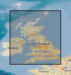
This data set is an inventory of aerial photographs held at BGS, Murchison House office and consists of a MS Excel spreadsheet containing 11 worksheets. Each worksheet contains information pertaining to the different sub-collections within the collection (9 worksheets of aerial photographs, one for aerial photograph scans, one for satellite imagery). Quality and coverage of metadata varies from worksheet to worksheet, depending on the size of the sub-collection, its pre-existing organisation, and the way in which the sub-collection was brought together (if it was not a complete entity when the inventory was started). Areal extent ranges from Shetland in the N (1200000) to the southern Lake District in the S (480000) and from Barra in the W (65000) to Stockton-on-Tees in the E (450000). By late 2001 all photos (except those being worked on by cuurently by staff) were catalogued in the inventory spreadsheet. By late 2003, the inventory spreadsheet had been updated with newly purchased and newly discovered photos as well as modified to include details of digital holdings and satellite imagery.
-
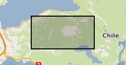
Helicopter borne LiDAR and aerial photo survey of lahar pathways deposited during the April 2015 Volcan Calbuco eruption. Terrestrial Laser Scanning data for July 2015.
-
Collections of Aerial Photographs purchased or obtained by BGS and its precursors as part of its surveying activities. Data covers mainly Great Britain or areas where BGS has worked overseas and dates from the 1940's. The collection is incomplete and there are copyright and other constraints on its use.
-

GeoScholar is a set of free geological data - available in GIS format - for UK universities and the higher education sector, to support teaching and learning within the geosciences. The dataset includes digital geological map data from BGS, aerial photos from Infoterra, NEXTmap digital terrain model from Intermap Technologies, borehole data and their corresponding logs, several BGS geological map sheets. Each Geoscholar teaching package will include 12 different geographical regions, including Assynt, Coniston and South West Wales.