 NERC Data Catalogue Service
Dunes
Type of resources
Available actions
Topics
Keywords
Contact for the resource
Provided by
Years
Formats
Representation types
Update frequencies
-
Wind, sediment transport and surface morphological data collected at Sand Creek during a month long field campaign in March and April 2019 to investigate protodune development under bimodal winds. Data is used in the accepted paper ‘Dune initiation in a bimodal wind regime’, Journal of Geophysical Research: Earth Surface, by Delorme, P., Wiggs, G.F.S., Baddock, M.C., Claudin, P., Nield, J.M. and Valdez, A. (accepted 18th September 2020, article reference number 2020JF005757R; https://repository.lboro.ac.uk/articles/Dune_initiation_in_a_bimodal_wind_regime/12973817) Surface morphological data: This is terrestrial laser scanned (TLS) data collected of the creek sand surface during multiple visits. The data is raw point cloud format in text columns of x, y and z coordinate data. It has been orientation in local format (the origin is located at 13UTM 443152, 4184478). *_full_lowres cover the whole creek surface and the banks on either side. * is the date that the data was collected in yymmdd format. All other data is high resolution section of the actual creek surface within the channel. Each data set uses the same coordinate system. Data can be viewed in any spatial software. Wind and sediment data were collected from a fixed point on the eastern edge of the creek channel. The data is in csv file format with column titles and can be viewed in any text or database software. See Delorme et al. (accepted) for more details.
-
Wind and surface morphological data collected at Medano Creek on the 15th April 2019 to investigate protodune initiation. Surface morphological data: This is terrestrial laser scanned (TLS) data collected of the creek sand surface using three different co-located Leica TLS (C10, P20 and P50). The data is raw point cloud format in text columns of x, y and z coordinate data. It has been orientation into the same local coordinate system. Each data set uses the same coordinate system. Data can be viewed in any spatial software. Data is labelled using C10, P20 or P50, followed by the scan number. Scan times are indicated in a seperate file. Wind data were collected from a fixed point next to the TLS instruments using a Gill 3D sonic anemometer. The data is in csv file format with column titles and can be viewed in any text or database software.
-

This dataset includes raw point cloud and gridded data from repeat terrestrial laser scans (TLS) for measuring barchans and protodunes in the Huab Dune Field, Huab River Valley, Skeleton Coast, Namibia. As well as the TLS data, additional measurements include wind speed, wind direction and sediment transport for some of the measurement period.
-
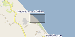
The dataset contains on-average monthly terrestrial LiDAR surveys conducted on the Lincolnshire coastline following the 2013 storm surge, collected between December 2013 and April 2015. The approximate coordinate locations of the surveys are given as follows: -EmbryoDunes (ED) 53°22'03"N 0°14'54"E -MablethorpeNorthEnd (MNE) 53°21'43"N 0°15'03"E The data were collected to record the rate and nature of recovery of the geomorphology of the back-beach and foredune zones following a storm surge in December 2013. Users interested in nearshore coastal geomorphology dynamics will find the data useful.