
Geomorphology
Type of resources
Available actions
Topics
Keywords
Contact for the resource
Provided by
Years
Formats
Representation types
Update frequencies
Scale
-
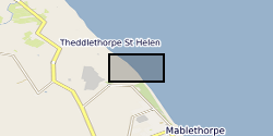
The dataset contains on-average monthly terrestrial LiDAR surveys conducted on the Lincolnshire coastline following the 2013 storm surge, collected between December 2013 and April 2015. The approximate coordinate locations of the surveys are given as follows: -EmbryoDunes (ED) 53°22'03"N 0°14'54"E -MablethorpeNorthEnd (MNE) 53°21'43"N 0°15'03"E The data were collected to record the rate and nature of recovery of the geomorphology of the back-beach and foredune zones following a storm surge in December 2013. Users interested in nearshore coastal geomorphology dynamics will find the data useful.
-
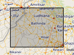
Geomorphological map of the Sutlej and Yamuna fans, northwestern India. Grant abstract: India is the largest agricultural user of groundwater in the world. The last 40 years has seen a revolutionary shift from large-scale surface water management to widespread groundwater abstraction, particularly in the northwestern states of Punjab, Haryana and Rajasthan. As a result of this, northwestern India is now a hotspot of groundwater depletion, with 'the largest rate of groundwater loss in any comparable-sized region on Earth' (Tiwari et al., 2009). This unsustainable use of groundwater becomes even more challenging when set increasing demands from a burgeoning population and industrialisation, together with potential but poorly understood effects of climate-driven changes in the water cycle. There are a number of innovative socio-economic strategies that can address this issue, including enhanced recharge and subsurface water storage, but their implementation and success depend on solid regional understanding of the geology and hydrogeology of the aquifer systems, and of the patterns and rates of groundwater flow and recharge. What we know about regional groundwater resources comes largely from either low-resolution studies based on satellite data, or from local investigations; there has been no large-scale, cross-state integrated study of the groundwater system. Groundwater in northwestern India is thought to be largely hosted within buried, sandy former river channels, which extend from the Himalayas toward the southwest and are separated by fine-grained muds. Only a few channels are visible at the surface; most are buried and their existence must be inferred. Our approach is founded on the premise that we must first understand the geology and geometry of the aquifer system before we can hope to estimate the way it will respond to a complex set of future stresses. This means that we must be able to describe the locations, sizes, and characteristics of these channels as well as their age and three-dimensional pattern. Once these characteristics are determined, we can forecast the likely future behaviour of the system. In this proposal, we will provide, for the first time, a regional assessment of the aquifer system in northwestern India, along with models for its evolution under changes in the water cycle and in the way in which groundwater is used. Our project will combine expertise in sedimentology, stratigraphy, sediment routing and basin evolution, hydrology, and isotope geochemistry to understand the geological framework of the aquifer system, the ages of the groundwaters within it, and the ways in which groundwater levels are likely to evolve over the next 50 years. The outcomes of the proposal will include (1) a comprehensive data base that covers the northwestern Indian aquifer system, (2) much better understanding of regional sources, ages, and flow rates of groundwater, and (3) a suite of predictions for how the groundwater system will respond to a range of different future scenarios.
-
The measurements and data contained here were obtained to study the chemical weathering of sedimentary rocks, and more specifically the oxidation of rock organic carbon and the associated release of CO2. The primary aim was to better understand the production and mobility of the trace element rhenium during weathering, because this element has been proposed as a proxy for rock organic carbon oxidation. The study focused on three Alpine catchments that drain sedimentary rocks, which all experience moderate to high erosion rates where oxidative weathering rates are thought to operate faster. Two catchments were located in Switzerland - the Erlenbach and Vogelbach, and one catchment in Colorado, USA - the East River. To study chemical weathering and the production and mobility of rhenium, a suite of samples were collected to capture the source and products of weathering reactions. These focused on stream and river water, river sediments and weathering profiles collected on sedimentary rocks. The Swiss catchments, water samples were collected from 2011 and 2012 to capture changes in river flow and seasonal changes in hydro-climate. Samples were collected from a gauging station operated by the Swiss Federal Institute for Forest, Snow and Landscape Research - WSL. In the East River, samples were collected from the gauging station operated by the Lawrence Berkeley National Laboratory Watershed Function Scientific Focus Area from 2015 and 2016. Additional samples included snow samples collected from the Erlenbach. All water samples were analysed for their major dissolved ion content by Ion Chromatography. Dissolved rhenium concentrations were determined by High Resolution and Quadrupole Inductively Coupled Plasma Mass Spectrometry. Solid samples were digested and analysed for Re content by ICP-MS. These geochemical measurements were paired with water discharge data to quantify the flux of dissolved elements, using rating curves and flux-weighted average methods, and interpret the hydrological context of ion production and mobility through the landscape. This new data acquisition was funded by a European Research Council Starting Grant to Robert Hilton (ROC-CO2 project, grant 678779) and a Natural Environment Research Council (NERC), UK, Standard Grant (NE/I001719/1). Further details of subsequent data analysis and interpretation can be found in Hilton, R.G., et al., 2021, Concentration-discharge relationships of dissolved rhenium in Alpine catchments reveal its use as a tracer of oxidative weathering, Water Resources Research
-

The BGS Seabed Geology: Offshore East Anglia digital map provides detailed and accurate characterisation of the seabed geology, based on seabed and shallow-subsurface data. This dataset incorporates three complementary map components (Substrate Geology, Structural Geology, and Geomorphology), provided as discrete layers for viewing within a Geographic Information System (GIS). The bedrock geology of the mapped area comprises Cretaceous age Chalk Group sedimentary rocks. These rocks crop out extensively at seabed across the southern and central parts of the dataset forming an extensive bedrock platform and Europe’s largest known offshore chalk reef. This reef has been designated the Cromer Shoal Chalk Beds Marine Conservation Zone (MCZ) owing to the range of unique floral and faunal habitats that it supports. The Chalk Group is covered across the central (partly) and southern parts of the dataset by natural superficial deposits that accreted during the Quaternary. These include preglacial delta bottom-set (Westkapelle Ground Formation) and delta top-set (Yarmouth Roads Formation); and glacial sediments and landforms that were deposited and formed during at least two separate phases of glaciation that inundated parts of the southern North Sea and adjacent East Anglia during the Middle Pleistocene (Anglian / Elsterian) and Late Pleistocene (Late Devensian / Late Weichselian). Collective geological evidence includes extensive areas of out-cropping subglacial till; the presence of largely concealed and infilled over-deepened (>100 m deep) subglacial tunnel valleys, ice-marginal moraines, and a glacially disrupted chalk surface that includes the development of incised meltwater channels, detached and transported glacitectonic bedrock rafts and megablocks. Post-glacial environments from the Late-Pleistocene – Holocene (prior to marine inundation) included fluvial and estuarine deposition, that together with variable infill of late-glacial valleys are included within the Botney Cut Formation. Holocene marine transgression flooded the region, with shallow marine sedimentation active through modern times resulting in the variable cover of unconsolidated marine sediments, as well as the distribution of extensive current-induced bedforms, e.g., sediment banks, sediment waves and fields of mega ripples which are recorded within the Seabed Geomorphology dataset. Each theme is provided as distinct layers for viewing within a Geographic Information System (GIS). The “Substrate Geology” layer shows the distribution of bedrock and unlithified superficial deposits present at the seabed (below a thin veneer of seabed sediments, ‘one-metre principle’ described below) as a series of polygons; The “Structural Geology” layer represents the structural features observed at rockhead as a polylines layer, and “Geomorphology” theme consists of points, polylines, and polygons layers to portray the main seabed morphological and geomorphological features.
-

The BGS Seabed Geology 10k: Bristol Channel v.2 digital map provides detailed and accurate characterisation of the seabed geology, based on seabed and shallow-subsurface data. This dataset incorporates three complementary map components (Substrate Geology, Structural Geology, and Geomorphology) presented at 1:10 000 scale, provided as discrete layers for viewing within a Geographic Information System (GIS). The bedrock geology is divided into 23 stratigraphical units: Aber Mawr Shale Formation (ABM); Avon Group (AVO); Bridport Sand Formation (BDS); Bishopston Mudstone Formation (BISHM); Charmouth Mudstone Formation (CHAM); Carboniferous Limestone Supergroup (CL); Devonian And Carboniferous Rocks (Undifferentiated) (DEVC); Devonian Rocks (Undifferentiated) (DEV); Dyrham Formation And Beacon Limestone Formation (Undifferentiated) (DYBN); Hangman Sandstone Formation (HASA); Inferior Oolite Group (INO); Lias Group (LI); Ludlow Rocks (Undifferentiated) (LUDL); Lavernock Shale Member (LVN); Milford Haven Subgroup (MIH); Mercia Mudstone Group (MMG); Pembroke Limestone Group (PEMB); Penarth Group (PNG); Porthkerry Member (PO); Skrinkle Sandstones Subgroup (SES); St Mary's Well Bay Member (STM); South Wales Lower Coal Measures Group (SWLCM); Triassic Rocks (Undifferentiated) (TRIA). The Lexicon code of the stratigraphical units is provided in parentheses, as defined in the ‘BGS Lexicon of Named Rock Units’. The superficial deposits mapped are comprised of only marine sediments (Marine Deposits Undifferentiated (MDU)) that were classified based on their grain size. The sediments are divided into Gravel (V): Sand (S); Mud (M); Sand and Gravel (XSV); Sand and Mud (XSM); and Gravel, Sand and Mud (XVSM). The RCS code of the stratigraphical units is provided in parentheses, as defined in the ‘BGS Rock Classification Scheme’.
-
The BGS Seabed Geology 10k: Anglesey digital map portrays the distribution of the different types of bedrock and sediments that are interpreted to represent the dominant geology within to the top 1-2 metres of the seabed to the north-west of Anglesey, at a scale of 1:10 000. It also includes the distribution of the main seabed morphological and geomorphological features (e.g. drumlins, sandwaves) and the principal structural features observed at rockhead (fractures). This digital map is the result of the interpretation of two high-resolution, multibeam echo-sounder (MBES) bathymetry datasets: (i) the Off Skerries HI1420 survey, collected by Net Survey in 2013 as part of the Civil Hydrography Programme (CHP) surveys managed by the Maritime and Coastguard Agency (MCA) for the UK Hydrographic Office; and (ii) the North St George’s Channel candidate Marine Conservation Zone (rMCZ) survey, collected jointly by JNCC and Cefas in 2012 for the Department for Environment, Food and Rural Affairs (Defra). MBES backscatter, physical samples (e.g. grabs, cores, and boreholes), academic papers and previous BGS geological interpretations at broader scales (250k and 50k scales) were used to further inform this geological interpretation. The bedrock is divided into three units: (i) Neoproterozoic to Palaeozoic age metamudstones and metasandstones of the Monian Supergroup; (ii) undifferentiated Lower Palaeozoic age rocks (mudstone, volcaniclastics, siltstone, slate); and (iii) limestone and sandstone of the Carboniferous Limestone Supergroup. The superficial deposits are composed of various types of glacial sediments (e.g. glacial till and morainic deposits) that were deposited underneath and around the margins of the last British-Irish Ice Sheet in the area, and also more recently deposited marine sediments.