2015
Type of resources
Available actions
Topics
Keywords
Contact for the resource
Provided by
Years
Formats
Representation types
Update frequencies
Service types
Scale
Resolution
-
2 papers and supplementary information produced from NERC Grant NE/I006427/1. Lear, C. H., H. K. Coxall, G. L. Foster, D. J. Lunt, E. M. Mawbey, Y. Rosenthal, S. M. Sosdian, E. Thomas, and P. A. Wilson (2015), Neogene ice volume and ocean temperatures: Insights from infaunal foraminiferal Mg/Ca paleothermometry, Paleoceanography, 30, 1437–1454, doi:10.1002/2015PA002833. Elaine M. Mawbey, Caroline H. Lear; Carbon cycle feedbacks during the Oligocene-Miocene transient glaciation. Geology ; 41 (9): 963–966. doi: https://doi.org/10.1130/G34422.1
-
High Resolution, Airborne Magnetic, Radiometric, VLF Survey over north Midlands of GB. Survey flying for the collaborative BGS and World Geoscience Corporation Ltd (WGC) high resolution geophysical and environmental survey was completed in early September 1998. The data comprise multi-channel gamma ray spectrometer, magnetometer and dual frequency VLF-EM. Flight line spacing was 400 m with tie lines at 1200 m and the total area surveyed is some 14 000 km2. Flight-line orientations are W–E over the western survey area, SW–NE over the eastern area. Ground clearance was maintained at 90 m in rural areas, increasing to about 240 m in built-up zones.
-
Description of peatland sites included in the compilation of carbon accumulation rates, including resolution (high, low), interpolation (yes/no), contributor name, country, lon, lat, peatland type, dominant plant type, no. of dates used in the last millenium carbon accumulation rate calculation, and problems with the data. Peatland sites at northern hemisphere high and mid latitudes (260), tropical (30) and southern hemisphere high latitudes (7 sites).
-

Major and trace elemental analysis of sulphide samples from the Beebe Vent Field. Geographical area - Beebe Vent Field, Cayman Trough, 18°32.798N,81°43.092W
-

The BGS database of geological maps is an index into BGS holdings of modern and historical published geological maps, geological standards and field slips, and also contains a range of other map series, including geophysical maps, geochemical maps, hydrogeological maps, thematic maps and other small-scale miscellaneous non-series maps. Historical vertical and horizontal sections, as well as indices to colours, are also included. The database comprises map metadata, including the title, theme, survey and revision years, publication years, mapped geological theme, base material, map function, colouration, approval status and the spatial extent of each map sheet. An accompanying file store contains high-resolution JPEG2000 scans for delivery, as well as various digital master and delivery formats. For a small number of maps, no scan exists. In total, the database contains over 240,000 scans of over 130,000 maps and field slips. The majority of the maps in the database cover Great Britain, but other regions are also represented, including a historical series of 1-inch maps of Ireland, 6-inch maps of the Isle of Man, 1:25 000 scale maps of the Channel Islands, and various overseas maps. The database contains a record of all geological maps produced by the British Geological Survey and its predecessors since the commencement of systematic geological mapping in the 1830s. The BGS Maps Database is mostly an archive of previous BGS maps, and is not the same as the latest BGS digital mapping. The maps within the database may differ significantly from BGS digital vector mapping. Further information about BGS digital vector mapping is available on the BGS website, under 'BGS Datasets'. The database has evolved over time, originally being a series of discrete databases. These databases have now been aggregated into a single dataset. BGS published maps, as well as 1:10 560 and 1:10 000 large-scale geological maps of England and Wales, and Scotland, are available through the BGS Maps Portal. Field slips and some thematic maps are not included on the BGS Maps Portal. The information about a map is normally a transcription from the map itself. Sometimes key information such as the title may not be actually printed on the map. Where this is the case the information is supplied in square brackets, e.g. [Kirk Maiden]. Information in square brackets means the information is supplied by the cataloguer and is not transcribed from the item.
-

The spreadsheet gathers the data collected during a brine:CO2 flow-through experiment conducted on a synthetic sandstone core sample to present the capabilities of a novel 'multiflow experimental rig for CO2 experiments' designed and assembled at the National Oceanography Centre, Southampton. The test was configured to assess geophysical monitoring techniques in shallow tight (North Sea-like) CO2 storage sandstone reservoirs. The tests were conducted in the rock physics laboratory at the National Oceanography Centre, Southampton, during 2015, as part of the DiSECCS project with funding from the United Kingdom's Engineering and Physical Sciences Research Council (EPSRC grant EP/K035878/1) and the Natural Environment Research Council (NERC). The experiment was a steady state brine-CO2 flow-through test to replicate CO2 geosequestration conditions and evaluate geophysical monitoring techniques. The confining and pore pressure conditions were similar to those estimated for shallow North Sea - like storage reservoirs, but simulating inflation/depletion cyclic scenarios for increasing brine:CO2 fractional flow rates. The data include ultrasonic P- and S-wave velocities and their respective attenuation factors, axial strains, and electrical resistivity; also relative permeability to both fluids (CO2 and brine) is displayed as a function of pore volume times, associated to increasing CO2 to brine contents in the sample.
-

The GeoSure Insurance Product (GIP) dataset identifies potential natural ground movement hazard within Great Britain by postcode. These data are available in GIS point feature and database format, updated on a 6 monthly basis. The GeoSure Insurance Product represents the end of an interpretation process starting with the BGS Digital Geological Map of Great Britain at the 1:50,000 scale (DiGMapGB-50). This digital map is the definitive record of the types of rocks underlying Great Britain (excluding Northern Ireland), as represented by various layers, starting with Bedrock and moving up to overlying Superficial layers. In 2003, the BGS published a series of GIS digital maps identifying areas of potential natural ground movement hazard in Great Britain, called GeoSure, demonstrating a grade of potential for 6 separate hazards: shrink-swell clays, slope instability, dissolution of soluble ground, running sand, compressible and collapsible deposits. These maps were derived by combining the rock-type information from DiGMapGB-50 with a series of other influencing factors which may cause the geological hazards (e.g. steep slopes, groundwater). In 2005, the BGS used the GeoSure maps to make an interpretation of subsidence insurance risk for the British property insurance industry, released as the GeoSure Insurance Product. This represents the combined effects of the 6 GeoSure hazards on buildings in a postcode database. The combined hazard is represented numerically in the database as the Total Hazard Score, with a breakdown into the component hazards. The methodology behind these data involves balancing the 6 GeoSure natural ground stability hazards against each other. The GeoSure maps themselves have a fivefold coding (A to E), and the balancing exercise involves comparing each level across the six hazards e.g. comparing a level C shrink-swell clay area with a level C running sand area. Each level of each of the hazards is given a 'hazard score' which can then be added together to derive a Total Hazard Score within a 300m radius from the population weighted postcode point.
-
Scanned images of well logs for oil and gas exploration and appraisal wells drilled on the UK Continental Shelf and held on behalf of the Oil & Gas Authority (formerly the Department of Energy and Climate Change).
-

Physical properties of four serpentinite and four gabbro samples acquired respectively at the Southern Wall (IODP leg 357) and at the Central Dome (IODP leg 304-305) of the Atlantis Massif have been measured and analysed in the frame of a NERC UK-IODP moratorium research. The physical property measurements included simultaneous ultra-sonic wave velocities (compressional and shear wave velocities), attenuation, electrical resistivity and permeability under increasing and decreasing effective pressure ranging between 5 and 45 Mpa. Measurements were carried out using the experimental physical property measurement rig of the rock Physics laboratory of the National Oceanography Centre, Southampton, UK. The porosity and the density of the samples were estimated using their wet dry weight difference and the volume of the samples, under atmospheric pressure and room temperature. The aim of this research project was to learn about the physical properties of oceanic lower crustal and upper-mantle rocks and to find a geophysical method that would allow to distinguish between these rocks, remotely. The dataset has been acquired and interpreted by a science party including researchers from the University of Southampton and the National Oceanography Centre. The ultrasonic wave velocities, attenuation and the electrical resistivity for each sample and for each effective pressure (increasing from 5 to 45 with an interval of 10 MPa and decreasing from 45 to 5 with an interval of 20 MPa) are reported in this dataset. Permeability measurements could have been carried out only on 6 samples for which the permeability was high enough to be measured with the experimental rig.
-
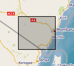
Results of two sampling campaigns conducted in Kwale County Kenya in March and June 2016 by GHS/UPC as part of the Gro for GooD project. Water samples from over 79 groundwater and 6 surface water (SW) locations were analysed for major ions, stable isotopes, selected trace constituents, electrical conductivity, nitrates, ammonia, pH, DO (Dissolved Oxygen), Eh (oxidation / reduction potential), Temperature, TOC (Total Organic Carbon) and field alkalinity. Most locations were sampled in both March (dry season) and June (wet season). Geology at each location recorded as follows: P - Pliocene Sands, Pls - Pleistocene Sands, Plc - Pleistocene corals. Reference: First step to understand the importance of new deep aquifer pumping regime in groundwater system in a developing country, Kwale, Kenya; Ferrer et al, Geophysical Research Abstracts, Vol. 18, EGU2016-16969, 2016; http://meetingorganizer.copernicus.org/EGU2016/EGU2016-16969.pdf; https://upgro.files.wordpress.com/2015/09/egu16_groforgood_v1.pdf UPC - The Departement of Civil Enginyering de la Universitat Politecnica de Catalunya GHS - Grupo de Hidrologia Subterranea
 NERC Data Catalogue Service