 NERC Data Catalogue Service
BGS Seabed Geology 10k: Anglesey version 1.0
Simple
- Date (Creation)
- 2022-08
0115 936 3276
0115 936 3276
- Maintenance and update frequency
- notPlanned Not planned
- GEMET - INSPIRE themes, version 1.0
- BGS Thesaurus of Geosciences
-
- UK Location (INSPIRE)
- Geomorphology
- Mapping
- Bed rock
- Sea floor
- Structural geology
- Geology
- Surficial geology
- EGDI
- dataCentre
- Keywords
-
- NERC_DDC
- Access constraints
- otherRestrictions Other restrictions
- Other constraints
- licenceOGL
- Use constraints
- otherRestrictions Other restrictions
- Other constraints
- The copyright of materials derived from the British Geological Survey's work is vested in the Natural Environment Research Council [NERC]. No part of this work may be reproduced or transmitted in any form or by any means, or stored in a retrieval system of any nature, without the prior permission of the copyright holder, via the BGS Intellectual Property Rights Manager. Use by customers of information provided by the BGS, is at the customer's own risk. In view of the disparate sources of information at BGS's disposal, including such material donated to BGS, that BGS accepts in good faith as being accurate, the Natural Environment Research Council (NERC) gives no warranty, expressed or implied, as to the quality or accuracy of the information supplied, or to the information's suitability for any use. NERC/BGS accepts no liability whatever in respect of loss, damage, injury or other occurence however caused.
- Other constraints
- Available under the Open Government Licence subject to the following acknowledgement accompanying the reproduced NERC materials "Contains NERC materials ©NERC [year]"
- Spatial representation type
- vector Vector
- Denominator
- 10000
- Metadata language
- EnglishEnglish
- Topic category
-
- Geoscientific information
- Geographic identifier
-
IRISH SEA [id=2001430]
- Date (Revision)
- 2010
))
- End date
- 2022-08 Before
- Unique resource identifier
- WGS 84 / UTM zone 30N (EPSG::32630)
- Distribution format
-
-
ESRI Shapefiles
()
-
ESRI Shapefiles
()
0115 936 3276
- OnLine resource
-
Datasets
(
WWW:LINK-1.0-http--link
)
This page features a curated list of our most popular and impactful datasets.
- OnLine resource
-
GeoIndex Offshore
(
WWW:LINK-1.0-http--link
)
BGS GeoIndex is a web tool for professional users who need to access BGS data as part of their business requirements. The map viewer is free to use and is designed to work on desktop and mobile devices.
- OnLine resource
-
BGS Seabed Geology 10k: Anglesey version 1.0
(
WWW:LINK-1.0-http--related
)
British Geological Survey. (2022). BGS Seabed Geology 10k: Anglesey version 1.0. British Geological Survey. (Dataset). https://doi.org/10.5285/d2f2f8e8-8e97-40fb-9207-875563d0fec0
- Hierarchy level
- dataset Dataset
- Other
- dataset
Conformance result
- Date (Publication)
- 2011
- Explanation
- See the referenced specification
- Pass
- No
Conformance result
- Date (Publication)
- 2010-12-08
- Explanation
- See http://eur-lex.europa.eu/LexUriServ/LexUriServ.do?uri=OJ:L:2010:323:0011:0102:EN:PDF
- Pass
- No
- Statement
- The delineation and classification of the geological substrate units were based primarily on what can be observed and interpreted from the multibeam echo-sounder (MBES) bathymetry data collected during the Civil Hydrography Programme (CHP) surveys managed by the Maritime and Coastguard Agency (MCA) and a candidate Marine Conservation Zone (MCZ) survey for the Department for Environment, Food and Rural Affairs (Defra). The two survey areas mapped were: • HI1420 – Off Skerries TSS Blk A-E 4m SB (2013) • 118503 North St Georges Channel MCZ 4m SB (2012) MBES backscatter, physical samples (e.g. grabs, cores, and boreholes) and previous geological mapping were also used to further inform the geological interpretation. The geological interpretation was undertaken in 2020-2021, by A. Finlayson, E. Phillips, R. Kendall, G. Carter and J. Everest in an ESRI ArcGIS project using the BGS SIGMA Desktop application. The geological linework was captured at a scale ranging from 1:5000 to 1:7000, to ensure smooth linework when the dataset is viewed at a scale of 1:10000. Bedrock and superficial deposits were mapped into two independent SIGMA layers and later merged to create the Seabed Substrate layer included in this dataset. Additional attribute fields were added to the layers, in particular to the geomorphology, to complement the information captured automatically by the SIGMA. The methodology used is described in more detail in the user guide for this dataset OR/22/059.
- File identifier
- e7aee2db-79aa-2244-e053-0937940a6829 XML
- Metadata language
- EnglishEnglish
- Hierarchy level
- dataset Dataset
- Date stamp
- 2025-11-13
- Metadata standard name
- UK GEMINI
- Metadata standard version
- 2.3
- Dataset URI
- http://data.bgs.ac.uk/id/dataHolding/13607968
Overviews
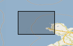
Spatial extent
Provided by
