2018
Type of resources
Available actions
Topics
Keywords
Contact for the resource
Provided by
Years
Formats
Representation types
Update frequencies
Service types
Scale
Resolution
-
Direct geological observations made during field work, tied to positional information collected by hand-held GPS.
-
Major, trace element and REE analyses of muds and mudstones from selected intervals from all of the holes. Location of the drill holes are given in the Exp. 352 cruise report (Reagan et al)
-
Clay minerals (smectites) were synthesised experimentally to determine isotope fractionation factors (Li and Mg). The data are provided here. Interpretation is ongoing.
-
This excel spreadsheet contains P-wave and S-wave velocity and attenuation data calculated with a novel rock physics model for hydrate bearing sediments. The model has been published in: Marín-Moreno, H., S. K. Sahoo, and A. I. Best (2017), Theoretical modeling insights into elastic wave attenuation mechanisms in marine sediments with pore-filling methane hydrate, Journal of Geophysical Research: Solid Earth, 122(3), 1835-1847, doi:10.1002/2016JB013577.
-
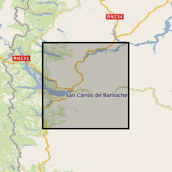
Volcanic ash samples were collected and analysed following the 2015 eruption of Calbuco volcano, Chile. Datasets uploaded are: Calbuco2015 Probe Data - excel Calbuco2015 Locations and Grain Size – excel Calbuco Deposit Measurements grl54177-sup-0002-tables3 Published as supplement to A.R. van Eaton et al (2016) Volcanic lightning and plume behavior reveal evolving hazards during the April 2015 eruption of Calbuco volcano, Chile, Geophysical Research Letters 43 (7), 3563-3571 Electron Probe Micro Analysis Major element compositions of plagioclase, groundmass glass and melt inclusions were analysed with a JEOL JXA-8600 wavelength-dispersive electron microprobe (EMP), equipped with four spectrometers, at the Research Laboratory for Archaeology and the History of Art, University of Oxford using a defocused beam (5¿m), low beam current (4nA) and accelerating voltage of 15 kV. Full analytical conditions are detailed in Rawson et al. (2015). Secondary standards used were Gor128-G and StHs/80-G for glass (Jochum et al., 2006). Glass (melt inclusion and groundmass) totals were normalised to 100% to account for variable secondary hydration. Stoichiometry and charge balancing was used to determine the amount of Fe2O3 and FeO in plagioclase. Pyroxene and magnetite grains were analysed with a defocused beam (5¿m), higher beam current (10nA), and an accelerating voltage of 15 kV. Secondary standards used were hornblende (USNM 111356), Pyrope (USNM 1143968) and ilmenite (USNM 96189; (Jarosewich et al., 1980). Stoichiometry and charge balancing was used to determine the amounts of Fe2O3 and FeO, following Droop (1987). Thickness and Grain size analysis Ash fallout thicknesses were measured in the field shortly after deposition, and samples collected for follow-up analysis of grainsize and chemical composition. Grain size analysis was conducted using a Malvern Laser Particle Sizer Mastersizer 2000 at the University of Oxford.
-
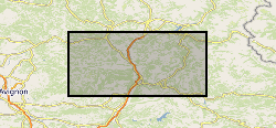
Stable Isotope and trace element analyses (Ca, Sr, Mg, Fe and Mn concentrations) derived from Cretaceous Belemnites including Duvalia tornajoensis, D. cf. lata constricta, D. binervia, D. cf. emericii, Hibolithes, H. cf. jaculoides, Berriasibelus, Castellanibelus and Pseudobelus.
-

Many tephra layers were identified in sediment cores drilled during IODP Expedition 350. Here, 1092 glass shards from 76 tephra occurrences (layer or patch) were analysed using electron probe microanalyses (EPMA). Data are not averaged, nor normalised. Geochemistry data were collected for: SiO2, TiO2, Al2O3, Cr2O3, FeO, MnO, MgO, CaO, Na2O, K2O, P2O5, SO3, Cl and O. Secondary standard data are given, as well as beam setup conditions. The data were obtained using the instruments at the University of Bristol, over two sessions during October and November 2014.
-
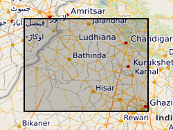
Matlab m-file code to generate a probabilistic model of aquifer-body occurrence in the subsurface of the Indo-Gangetic foreland basin, northwestern India. The accompanying ArcGIS ASCII matrix files give aquifer-body percentages in successive 10 m depth slices for use within the model. File xxx_01.txt is for depths 0-10 m, file xxx_02.txt for depths 10-20 m, etc.
-
Data consist of field spectral reflectance measurements and surface photographs of cyanobacterial soil crusts and other surficial materials in Diamantina National Park, Queensland. Data were collected as part of project NE/K011626/1 (associated with NE/K011464/1) Multiscale Impacts of Cyanobacterial Crusts on Landscape Stability. The reflectance data and associated surface photographs are of biological and physical soil crusts developed on claypan and sand dune surfaces alongside the Diamantina River (specifically on and around Lake Constance pan and Homestead pan. Data were collected and processed by Kevin White and Ian Davenport, using a Spectra Vista Hr1024i spectrometer with a spectralon reference panel. All data were processed using SVC Hr1024i PC Data acquisition software (version 1.6.7 Beta) to remove areas of spectral overlap. Photographs taken using a range of mobile device cameras. All field photographs are in JPEG (jpg) format. Data were collected for the purpose of assessing the ability to remotely sense presence/absence of cyanobacterial soil crusts for mapping purposes. Data are organised into a directory structure based on specific field experiments, each with its own directory structure. Dataset 1: Calcrete Reflectance Spectra, Diamantina National Park. Calcrete exposures are common in Diamantina National Park, forming flat-topped hills known locally as 'Jump-Ups'. Calcretes creat false positives with the commonly used biological soil crust indices from remote sensing data, so field spectra of calcretes were collected to characterise their spectral reflectance to assist with image processing. Dataset 2: Lake Constance Pan Mapping project Field Photographs, Reflectance Spectra and field notes, Lake Constance Clay Pan, Diamantina National Park. This dataset is a repeat survey undertaken in 2015, which revisited sample points first surveyed as part of the so-called 'MAM survey' in 2000. Dataset 3: Solar Radiation Photosynthesis experiment Field Photographs and Reflectance Spectra from three locations in Diamantina National Park, Lake Constance pan, a duneflank site on ‘Crusty Inlet dune’ (where no photosynthesis could be stimulated) and Homestead pan. The Homestead pan experiment was run twice (Winter 2015 and Summer 2016). Dataset 4: Shade netting experiment Spectral Reflectance measurements of a spectralon panel were taken under the shade netting to characterise the transmissivity of the netting at different solar elevation angles. Dataset 5: Photographic cards Spectral reflectance measurements of a set of photographic reference cards, which were included in the frame of all the surface photographs collected for this project. Dataset 6: Mobile Device experiment Field Photographs taken with a range of mobile device cameras (Moto G, Nexus 6 and Samsung Galaxy Note 10.1) and two cameras (Nikon Coolpix P610 and Nikon Coolpix 950 Full Spectrum), and associated reflectance spectra data, for 5 study sites Crusty Inlet Pan Surface, Crusty Inlet Dune North Flank, Lake Constance Pan and Homestead Dune. Dataset 7: Rainfall simulator Spectral reflectance data and associated field notes of sites used in a rainfall simulator/wind tunnel experiment, Lake Constance claypan (which formed part of the associated NERC project NE/K011464/1)
-

Os isotopes, highly siderophile element abundance measurements, lithophile trace element data, major element data, electron microprobe and LA-ICP-MS mineral chemistry of Cr-spinel and sulphide - all data for a suite of peridotites from the Shetland Ophiolite Complex, and published in O'Driscoll, B., Walker, R.J., Clay, P.L., Day, J.M.D., Ash, R.A. and Daly, J.S. 2018. Length-scales of chemical and isotopic heterogeneity in the mantle section of the Shetland Ophiolite Complex, Scotland. Earth and Planetary Science Letters, 488, 144-154 All samples come from a locality called The Viels, sampled within a 45 m2 area, on the island of Unst, Shetland Archipelago (UK) at HP64438 11060 (British National Grid)
 NERC Data Catalogue Service