
Caves
Type of resources
Available actions
Topics
Keywords
Contact for the resource
Provided by
Years
Formats
Representation types
Update frequencies
Scale
-

The following dataset provides climate and cave monitoring data from Cueva de Asiul northern Spain between 2010 and 2014. This data set was initially presented in Smith et al., (2016) Cave monitoring and the potential for palaeoclimate reconstruction from Cueva de Asiul, Cantabria (N. Spain). International Journal of Speleology, 45(1), 1-9. This data set represents the majority of cave monitoring undertaken at this site as part of a NERC funded PhD project (NERC studentship grant NE/I527953/1), data collection either occurred within this single cave site (43°19’0’’N, 3°35’28’’W) or within 1km of the cave in the village of Matienzo. The data set includes high resolution monitoring data for a range of climatic parameters including, cave and external temperature, rainfall direction, amount and oxygen isotope value, soil and cave air pCO2 concentration and carbon isotope value, cave drip rates and oxygen and deuterium isotope values. All data was collected using standard automated logging systems and the data/ samples were analysed either at Lancaster University, UK or at the NERC isotope geosciences laboratory, British Geological Survey, UK. Any missing data is a result of automated logger malfunction and is explained in full in the above cited paper. In combination this data offers a very high resolution, multiyear veiw into hydrological and cave ventilation processes, each of which play a major role in controlling speleothem growth and chemical makeup in Cueva de Asiul. The data set presents the pertinent background monitoring for the accurate interpretation of speleothems from this cave site. Those who may be interested in the data set include cave scientists who wish to implement a monitoring station/understand how climatic parameters influence speleothem development, or those who wish to obtain focused climate data from the Matienzo region between 2010 and 2014. The data set was collected by members of Lancaster University and the Matienzo caving expedition as part of NERC studentship grant NE/I527953/1. All cave monitoring was undertaken with kind permission from Gobierno de Cantabria, Cultura.
-
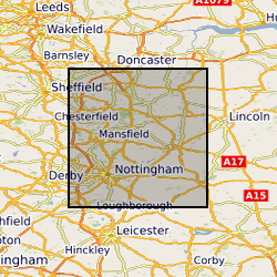
Paper records and photos used to create the Nottingham Caves digital register and maps. Includes archival material of the caves known to BGS, around northern and central Nottingham. Data mainly captured in 1989, infrequent since then approximately 1 per year.
-

Cave drip water, pool water and PO4 (phosphate) dosing experiments from Cueva Llanio, Cantabria, N. Spain and cave speleothem carbonate from global cave systems. The data set includes stable oxygen and hydrogen isotope data from the cave drip waters, cave water temperatures and the results of phosphate dosing experiments. Phosphate oxygen isotope data is presented from the dosing experiments, direct extractions from the cave water and from a number of speleothem calcite samples from global collaborators. Water samples were collected from Cueva Llanio over 3 field trips 2023-24.
-

Cave monitoring data from Cueva Llanio, Matienzo, Northern Spain, collected between February 2023 to April 2024. Monitoring parameters consist of drip water temperature, conductivity, pH and chemical composition, all measured as spot samples on collated drip waters. Chemical composition can be detailed as nitrate, phosphorus, inorganic carbon, calcium, magnesium, sodium, potassium and strontium content of the drip waters. Values of drip water oxygen and deuterium isotopes are also presented. Cave air temperature and drip rate are also logged as continuous data and presented for the duration of cave monitoring.
-

The data set provides climate and cave monitoring data from Cueva de Asiul, Cantabria, northern Spain. This data was initially presented in graphical form in Smith et al., (2015) - Drip water Electrical Conductivity as an indicator of cave ventilation at the event scale. Science of the Total Environment, 532, 517-527. All data was collected from within the cave or within a 1km radius of the cave site (43°19'0"N, 3°35'28"W) using instrumentation set up as part of a PhD project running between January 2010 and January 2014. The data set includes high resolution event based monitoring data for a range of climatic parameters - cave and external temperature, rainfall amount, soil pCO2 cave air pCO2 concentration, cave drip water calcium saturation, drip water electrical conductivity and cave air pressure. This data was analysed at Lancaster University, UK or at the NERC isotope geosciences laboratory, British Geological Survey, UK. Any missing data from this 4 year period is a result of instrument malfunction and is clearly explained within the above cited paper. The electrical conductivity component of the data set offers the first data set of this type form any cave system, using a submerged CTD Diver probe and novel piston flow housing. The rest of the data constitute a part of a larger cave monitoring data set produced during the project using a number of standard automated cave monitoring devices. When combined this data leads us to conclude that cave drip water electrical conductivity is driven primarily by changes in cave air pCO2 at Cueva de Asiul and therefore responds to cave ventilation dynamics, rather than by changes in karst water residence time. Without such extremely high resolution monitoring the impact of cave ventilation on event based changes in drip water electrical conductivity would not have been established for this site. This data set should be of interest to anyone studying similar cave sites, interested in the role of electrical conductivity as a monitoring tool within caves and cave ventilation on speleothem growth dynamics. The data set was collected by members of Lancaster University and the Matienzo caving expedition as part of NERC studentship grant NE/I527953/1. All cave monitoring was undertaken with kind permission from Gobierno de Cantabria, Cultura.
-

GIS Data Layer and Database including maps and detailed Indexes. Paper records and photographs, descriptive register is paper version from which the digital version was created. Data mainly captured in 1989, infrequent additions (approximately 1 entry per year) since then. Includes all man-made caves known to BGS in Nottingham, but there are many more to be located in the future.
-

The file contain data for local meteorology , soil and cave temperatures and groundwater drip rates measured in sea Michaels and Ragged Staff caves, Gibraltar. Meteorological data were recorded at the RAF Meteorological Office located 3 km away from the cave. The locations of environmental monitoring sites are described in Mattey et al. (2010) The cave monitoring, sampling and analysis program obtained data via continuous logging. Reference. MATTEY, D.P., Fairchild, I.J., Atkinson, T.C., Latin, J.P., Ainsworth, M., Durell, R., 2010. Seasonal microclimate control of calcite fabrics, stable isotopes and trace elements in modern speleothem from St Michaels Cave, Gibraltar, In Tufa and Speleothem pp. 323-344.
-

Monthly sampling of cave drip and lake water from St Michaels Cave and Ragged Staff Cave, Gibraltar.
-

Descriptive register with detailed indexes of the Nottingham man-made caves. Data mainly captured 1989, infrequent additions (approximately 1 per year) since then
-

Data detailing the distribution and nature of springs in the UK. Originally constructed to hold data relating to karst geohazards, the database has been extended from the Limestone, Chalk, Gypsum and Salt areas to include all springs. The data is stored locally as ArcView shape and .dbf files (for information gathered through the karst geohazards - ground movements: dissolution project) with the data copied to ORACLE. Data can also be input directly into ORACLE. The database is an important component part of the karst geohazards database.