EGDI
Type of resources
Available actions
Topics
Keywords
Contact for the resource
Provided by
Years
Formats
Representation types
Update frequencies
Service types
Scale
-

The collection of map series held by BGS which correspond to the outputs of discrete projects. The maps often focus on a specific theme, and / or may have limited spatial coverage. The thematic maps include the following series: Applied Geology Maps (AGMs), also known as Environmental Geology Maps (EGMs) or Planning for Development maps, which were produced between 1975 and 1996 as part of 'geological background for planning and development' and preliminary sand and gravel projects carried out on behalf of the Department of the Environment, Scottish Development Department and the Scottish Office. Industrial Minerals Assessment Unit (IMAU) Mineral Assessment Report maps, published between 1971 and 1985 by the Institute of Geological Sciences. Oil-shale Seam Maps of the Lothians, published between 1977 and 1982 by the Institute of Geological Sciences (IGS) in Edinburgh.
-
Superficial Geology (250k) This layer shows the superficial (drift) geology of Northern Ireland at 1:250,000 scale. For each rock unit there is a brief generalised description under the following headings. LEX_D: Description of the selected polygon. LEX_RCS: Map code as it appears on the published 1:250,000 map. RCS_D: Decription of the deposit. VERSION: Version of the data. RELEASED: Date of release/update of the data. Persons interested in the detailed geology of particular sites should consult the latest large-scale maps or the Geological Survey of Northern Ireland at:- Geological Survey of Northern Ireland Colby House Stranmillis Court Belfast BT9 5BF
-

The BGS Seabed Geology 10k: Offshore Yorkshire digital map provides detailed and accurate characterisation of the seabed geology, based on seabed and shallow-subsurface data. This dataset incorporates three complementary map components (Substrate Geology, Structural Geology, and Geomorphology) presented at 1:10 000 scale, provided as discrete layers for viewing within a Geographic Information System (GIS). The bedrock geology comprises Triassic, Jurassic, and Cretaceous sedimentary rocks, with bedrock commonly outcropping in the northern and central parts of the map area. Triassic rocks of the Bacton, Haisborough, and Lias Groups are dominant in the north, whereas Cretaceous Chalk is dominant in the central areas. Extensive folding, fracturing, and faulting are observed at rockhead, indicative of the complex structural evolution of the Southern North Sea Basin. Superficial deposits comprise several Quaternary deposits, in particular, Late Pleistocene subglacial till of the Bolders Bank Formation. Post-glacial channel-infill deposits are also common as well as Holocene through modern unconsolidated marine sediments. The seabed geomorphology records a range of relict and active processes, including bedrock ‘Bedding ridges’, Late Pleistocene ‘Ice-marginal moraines’, and active marine sedimentary current-induced bedforms (e.g. ‘Sediment Waves’). Each theme is provided as distinct layers for viewing within a Geographic Information System (GIS). The “Substrate Geology” layer shows the distribution of bedrock and unlithified superficial deposits present at the seabed (below a thin veneer of seabed sediments, ‘one-metre principle’ described below) as a series of polygons; The “Structural Geology” layer represents the structural features observed at rockhead as a polylines layer, and “Geomorphology” theme consists of points, polylines, and polygons layers to portray the main seabed morphological and geomorphological features.
-
Gridded model estimates of nitrate-N stored in the vadose (unsaturated) zone. This dataset presents annual gridded estimates of nitrate stored in the vadose zone for 1900 - 2000 on a 0.5 degree grid (units: kg N/grid cell). Data are supplied as a single netCDF for all years. This data was derived by Ascott et al. (2017). Global models of depth to groundwater table, subsurface porosity and groundwater recharge were used to derive estimates of nitrate travel time in the vadose zone. The travel time was combined with annual estimates of nitrate leaching from the base of the soil zone for 1900 - 2000 to estimate total nitrate stored in the vadose zone. For full details of the dataset derivation, please refer to Ascott et al. (2017). Ascott, M.J., Gooddy, D.C., Wang, L., Stuart, M.E., Lewis, M.A., Ward, R.S. and Binley, A.M. (2017) Global patterns of nitrate storage in the vadose zone. Nature Communications 8(1), 1416.
-
The IGRF is a global model of the geomagnetic field. It allows spot values of the geomagnetic field vector to be calculated anywhere from the Earth's core out into space. The IGRF is generally revised every five years by a group of modellers associated with the International Association of Geomagnetism and Aeronomy (IAGA).
-
Data identifying landscape areas (shown as polygons) attributed with geological names and rock type descriptions. The scale of the data is 1:625 000, providing a simplified interpretation of the geology which may be used as a guide at a regional or national level, but should not be relied on for local geology. Onshore coverage is provided for all of England, Wales, Scotland, the Isle of Man and Northern Ireland. Superficial deposits are the youngest geological deposits formed during the most recent period of geological time, the Quaternary, which extends back about 2.58 million years from the present. They lie on top of older deposits or rocks referred to as bedrock. Superficial deposits were laid down by various natural processes such as action by ice, water, wind and weathering. As such, the deposits are denoted by their BGS Lexicon name, which classifies them on the basis of mode of origin (lithogenesis) with names such as, 'glacial deposits', 'river terrace deposits' or 'blown sand'; or on the basis of their composition such as 'peat'. Most of these superficial deposits are unconsolidated sediments such as gravel, sand, silt and clay. The digital data include attribution to identify each deposit type (in varying levels of detail) as described in the BGS Rock Classification Scheme (volume 4). The data are available in vector format (containing the geometry of each feature linked to a database record describing their attributes) as an OGC GeoPackage and are delivered free of charge under the terms of the Open Government Licence.
-

This Web service provides the BGS Thermal Properties (1 km hex grid) dataset as a Web Map Service (WMS). This dataset shows thermal properties relating to bedrock beneath our feet. The information can be used to assess the potential for closed and open loop ground source heat pumps across, or deeper geothermal assessments, across the United Kingdom. The attribution and spatial data underpinning the model are that which is described and shown by Rollin (1987) and Gale (2004, 2005).
-
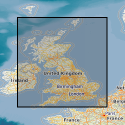
Data identifying landscape areas (shown as polygons) attributed with geological names and rock type descriptions. The scale of the data is 1:50 000 scale providing bedrock geology. Onshore coverage is provided for all of England, Wales, Scotland and the Isle of Man. Bedrock geology describes the main mass of solid rocks forming the earth's crust. Bedrock is present everywhere, whether exposed at surface in outcrops or concealed beneath superficial deposits or water bodies. The bedrock geology of Great Britain is very diverse and includes three broad classes based on their mode of origin: igneous, metamorphic and sedimentary. The data includes attribution to identify each rock type (in varying levels of detail) as described in the BGS Rock Classification Scheme (volumes 1-3 ). The bedrock has formed over long periods of geological time, from the Archean eon some 7500 million years ago, to the relatively young Pliocene, 58 million years ago. The age of the rocks is identified in the data through their BGS lexicon name (published for each deposit at the time of the original survey or subsequent digital data creation). For stratified rocks i.e. arranged in sequence, this will usually be of a lithostratigraphic type. Other rock types for example intrusive igneous bodies will be of a lithodemic type. More information on the formal naming of UK rocks is available in the BGS Lexicon of Named Rock Units. Geological names are based on the lithostratigraphic or lithodemic hierarchy. The lithostratigraphic scheme arranges rock bodies into units based on rock-type and geological time of formation. Where rock-types do not fit into the lithostratigraphic scheme, for example intrusive, deformed rocks subjected to heat and pressure resulting in new or changed rock types; then their classification is based on their rock-type or lithological composition, using visible features such as texture, structure, mineralogy. The data are available in vector format (containing the geometry of each feature linked to a database record describing their attributes) as ESRI shapefiles and are available under BGS data licence.
-

BGS LithoFrame models provide 3D geological characterisation for parts of the onshore and offshore UK at a range of scales. They present framework geological interpretation consistent with the stratigraphic framing schemes and scales used in BGS geological maps. Models have been constructed under a range of project activities and include local-scale superficial and bedrock models covering sites and focused study areas, medium-scale superficial and bedrock models covering many urban areas, transport corridors and smaller catchments, and regional-scale bedrock models covering large catchments, district areas, and geological basins. The 3D geological models have been constructed in a period between 2003 and 2018 and is managed by the 3D GeoModel project (National and International Geoscience).
-

This is a 1:10,000 scale Bedrock geological map for some 800 km2 of the seabed across Weymouth Bay in Dorset. It joins seamlessly to the onshore BGS 1:10,000 scale Digital Geological Mapping (DiGMapGB-10) and therefore shows the coastal geology in detail. It comprises bedrock polygons, faults and limestone bed lines. The map was produced in 2015-16 by digitising against a seamless on- to offshore-shore elevation surface generated from high (1 m bin) resolution bathymetry and coastal Lidar data, collected as part of the Dorset Integrated Seabed Survey (DORIS) project and the Regional Coastal Monitoring Programme of England, made available by the Channel Coastal Observatory under the Open Government Licence. The map can be veiwed using the map viewer at www.bgs.ac.uk/research/marine/doris.html. This map has been produced under the auspices of the Marine Environmental Mapping Programme (MAREMAP), in collaboration between the BGS and the University of Southampton. The map itself should be referred to as: Westhead, R K, Sanderson, D J, Dix, J K. 2016. Bedrock map for the offshore Weymouth Bay area, with seamless coastal joint to BGS onshore (DiGMapGB-10) mapping. Bedrock Geology. 1:10 000 (Marine Environmental Mapping Programme, MAREMAP)
 NERC Data Catalogue Service