Keyword
Isopach maps
Type of resources
Topics
Keywords
Contact for the resource
Provided by
Years
Formats
Update frequencies
Scale
From
1
-
1
/
1
-

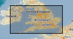
The data comprises information on the subsurface structure of stratigraphic levels and units in the United Kingdom, detailing depth to and thickness of the units. These result from projects in different parts of the UK performed at different times. Common working scales are 1:50 000 and 1:250 000 with appropriate differences in detail. Much mapping results from interpretation of seismic data, and as a result many of the structural maps are in time rather than depth, although some have been depth converted.
 NERC Data Catalogue Service